
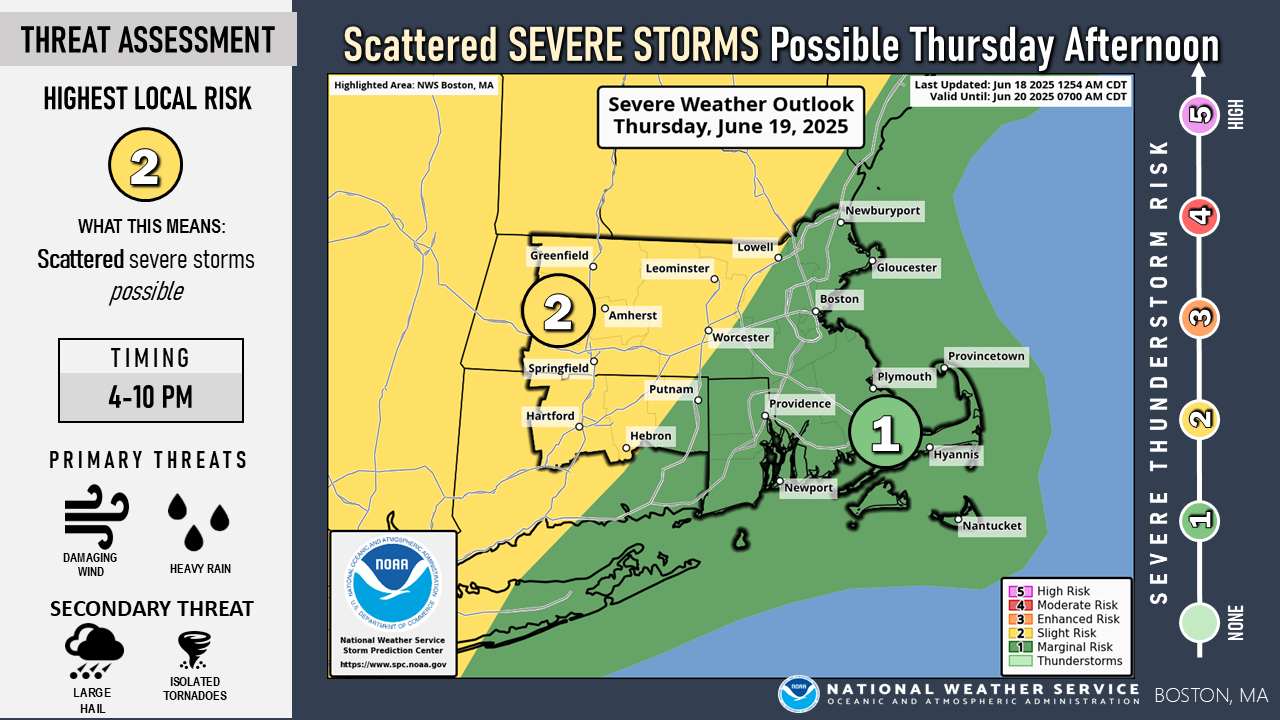
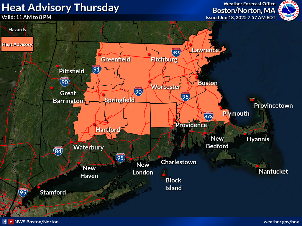
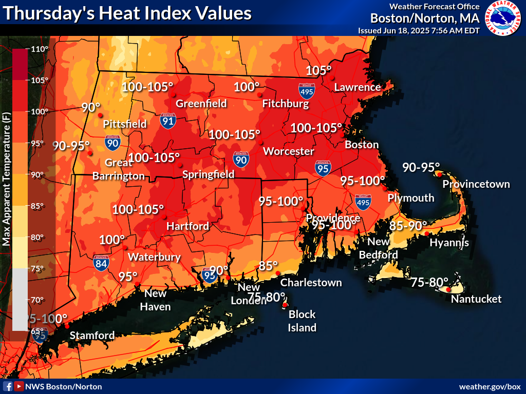
Good morning, We wanted to provide an update regarding the potential for scattered severe thunderstorms and hot, humid conditions on Thursday. Attached you will find our one-pager briefing and supplemental graphics. *Severe Thunderstorms:* The greatest risk for severe storms is between 4 PM and 10 PM, primarily across interior southern New England. The main threat is damaging straight-line wind gusts, with large hail and a brief tornado as a secondary threat. In addition, localized torrential downpours may result in street flooding, especially in urban areas. *Heat and Humidity:* Heat and humidity will peak during the early to mid-afternoon, with heat index values in the upper 90s to lower 100s. As a result, a Heat Advisory has been issued for northern Connecticut, northern Rhode Island, and much of Massachusetts, excluding the Berkshires, south coast, and Cape/Islands. The next forecast update will be issued by *3 PM this afternoon*. Please reach out if you have any questions or need further details. Meteorologists: Torry Dooley, Kyle Pederson, and Andrew Loconto If you have any questions or would like more information, please don't hesitate to contact us. You can reach us via: email: box.operations@noaa.gov phone: 508.622.3280 Slack/NWSChat 2.0 <https://nwschatws.slack.com/> (for approved partners) social media: Website <http://www.weather.gov/boston> | Facebook <http://www.facebook.com/NWSBoston> | Twitter <http://www.twitter.com/NWSBoston>