
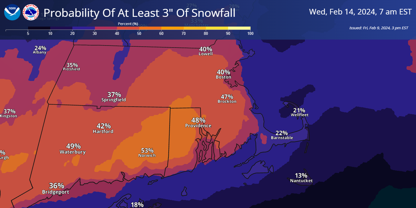
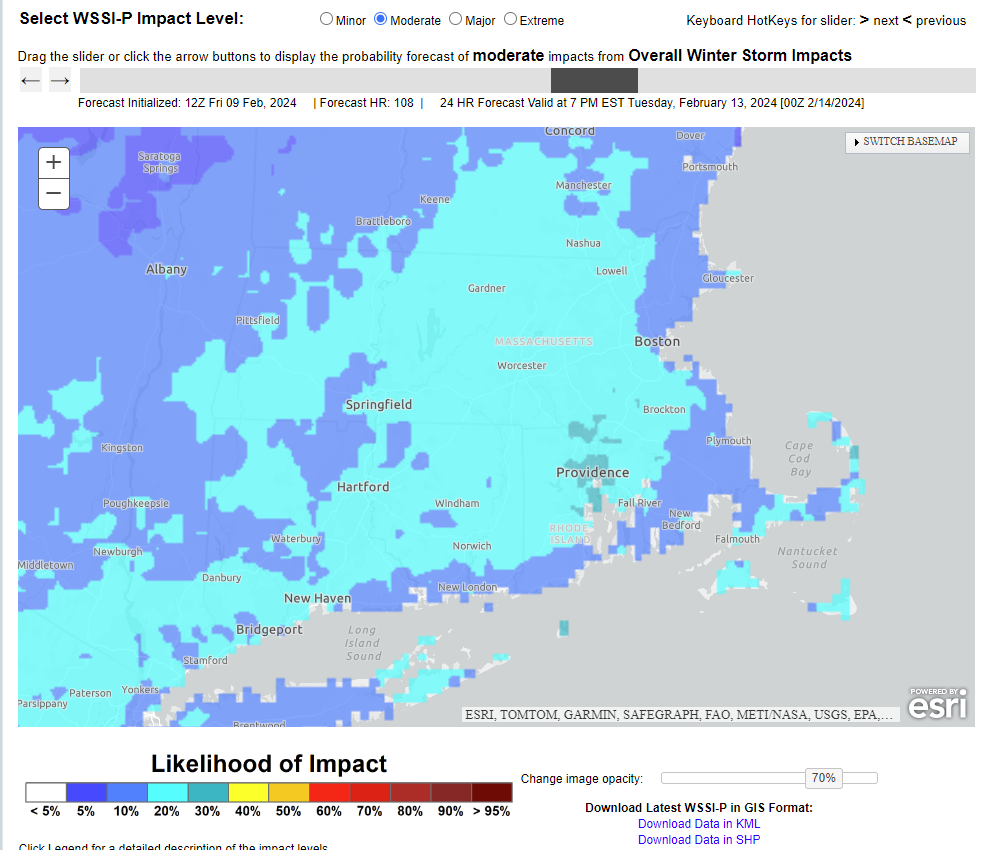
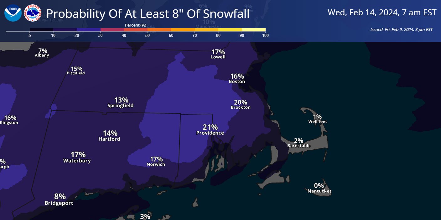
All, We wanted to provide you with our latest thoughts for a Winter Storm we expect to impact southern New England late Monday through Tuesday. There is still considerable uncertainty with the forecast track of the storm, so exactly what we get for snow and/or rain is still unknown. Please see the attached 1-Pager briefing which summarizes our current forecast. We expect to be working out the details over the weekend as we gain more clarity into how the storm will evolve. Also attached are 3 images: 1) The current probability of getting at least 3 inches of snow. 2) The current probability of getting at least 8 inches 3) The current probabilities of seeing moderate level impacts per the Probabilistic Winter Storm Index We encourage you to use these websites to access weather information over the weekend to see how the forecasts are evolving. Probabilistic Winter Storm Index <https://www.wpc.ncep.noaa.gov/wwd/wssi/prob_wssi.php> NWS Boston Winter Weather page <https://www.weather.gov/box/winter> NWS Boston Graphical Hazardous Weather Outlook <https://www.weather.gov/erh/ghwo?wfo=box> NWS Boston Coastal Flood Forecast <https://www.weather.gov/erh/coastalflood?wfo=BOX&zoomLevel=8¢erLat=42.17404¢erLng=-71.49837&overlays=0101000000000> Andy Nash & Kevin Cadima If you have any questions or would like more information, please don't hesitate to contact us. You can reach us via: email: box.operations@noaa.gov phone: 508.622.3280 Slack/NWSChat 2.0 <https://nwschatws.slack.com/> (for approved partners) social media: Website <http://www.weather.gov/boston> | Facebook <http://www.facebook.com/NWSBoston> | Twitter <http://www.twitter.com/NWSBoston>