
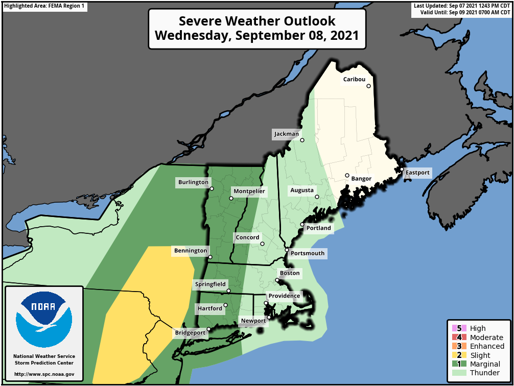
Good afternoon everyone, Attached is our latest weather briefing regarding the potential for strong to severe thunderstorms Wednesday night into Thursday. Concerns remain the same, a few storms may produce strong to damaging winds along with heavy rain and localized flooding. *What has changed - * *1) Risk level has increased to a slight risk just west of New England into eastern NY (see attached graphic)* *2) Increasing concern for two rounds of strong to severe thunderstorms, first round Wed night into Thu morning, then a second round Thu afternoon across RI and eastern MA.* An additional concern we have is later in the week and into the weekend, when large swells from Hurricane Larry arrive into the MA and RI waters Thursday, peak Friday and then linger into Saturday. These large swells will result in very rough surf and dangerous rip currents, especially at southeast facing ocean beaches for the entire coastline of MA and RI. Now that most beaches are unguarded, these conditions become even more dangerous. In addition, we discourage people from viewing the large surf on rocks and jetties, which can be very dangerous with large breaking waves. Frank Nocera & Nicole Belk If you have any questions or would like more information, don't hesitate to contact us via this email address, on NWSChat <https://nwschat.weather.gov/>, or at the following: National Weather Service Boston/Norton, MA 46 Commerce Way Norton, MA 02766 508.622.3280 Website <http://www.weather.gov/boston> | Facebook <http://www.facebook.com/NWSBoston> | Twitter <http://www.twitter.com/NWSBoston>