
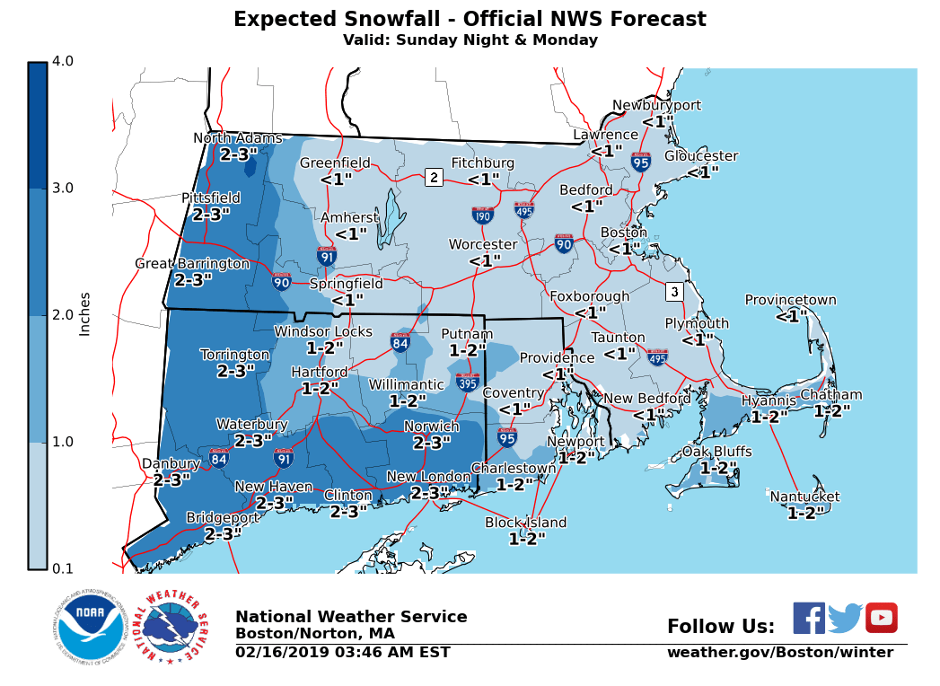
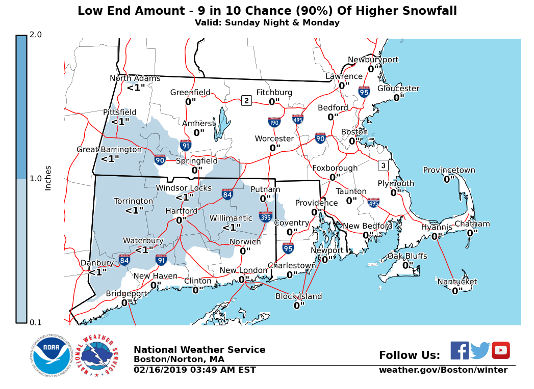
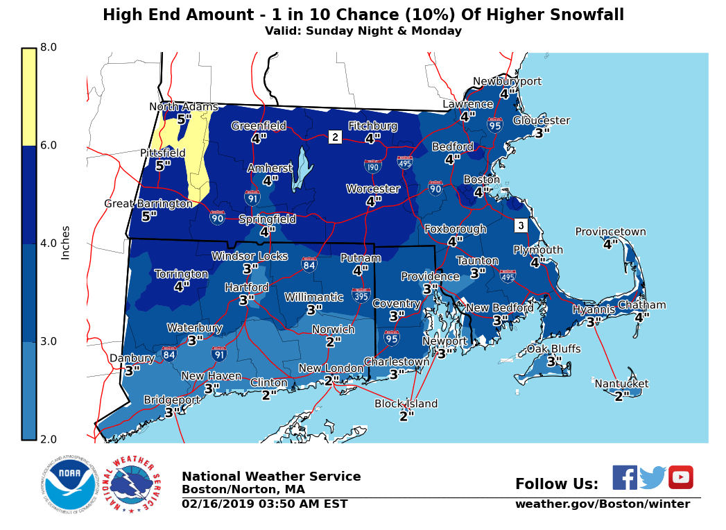
Good morning everyone, There is a low to moderate risk of accumulating snow Sunday night into Monday. Here are the details ... *What / Where / When ... * Snow, mainly light is expected Sunday night into Monday across all of MA, RI and CT. *Uncertainty ...* Current indications is for mainly light snow as this weather system weakens as it tracks across the region. The most likely scenario is for snow accumulations to range from a coating to two inches. If the system weakens more rapidly then expected less snow is possible. Conversely, if the system weakens slower as it approaches the region more snow is possible. Three graphics are attached to illustrate these different possible scenarios. This event is still more than 48 hrs away, so changes to the forecast are likely. Thus stay tuned to these updated email weather briefings. *Impacts ... * Despite minor snow accumulations expected, roads may still become snow covered late Sunday night into Monday resulting in slippery travel. With Monday a holiday travel volume may be less than normal, possibly reducing travel impacts. Nevertheless, it doesn't take much snow for slippery travel to develop. Meteorologist - Frank Nocera If you have any questions or would like more information, don't hesitate to contact us via this email address, on NWSChat <https://nwschat.weather.gov/>, or at the following: National Weather Service Boston/Norton, MA 46 Commerce Way Norton, MA 02766 508.622.3280 Website <http://www.weather.gov/boston> | Facebook <http://www.facebook.com/NWSBoston> | Twitter <http://www.twitter.com/NWSBoston>