
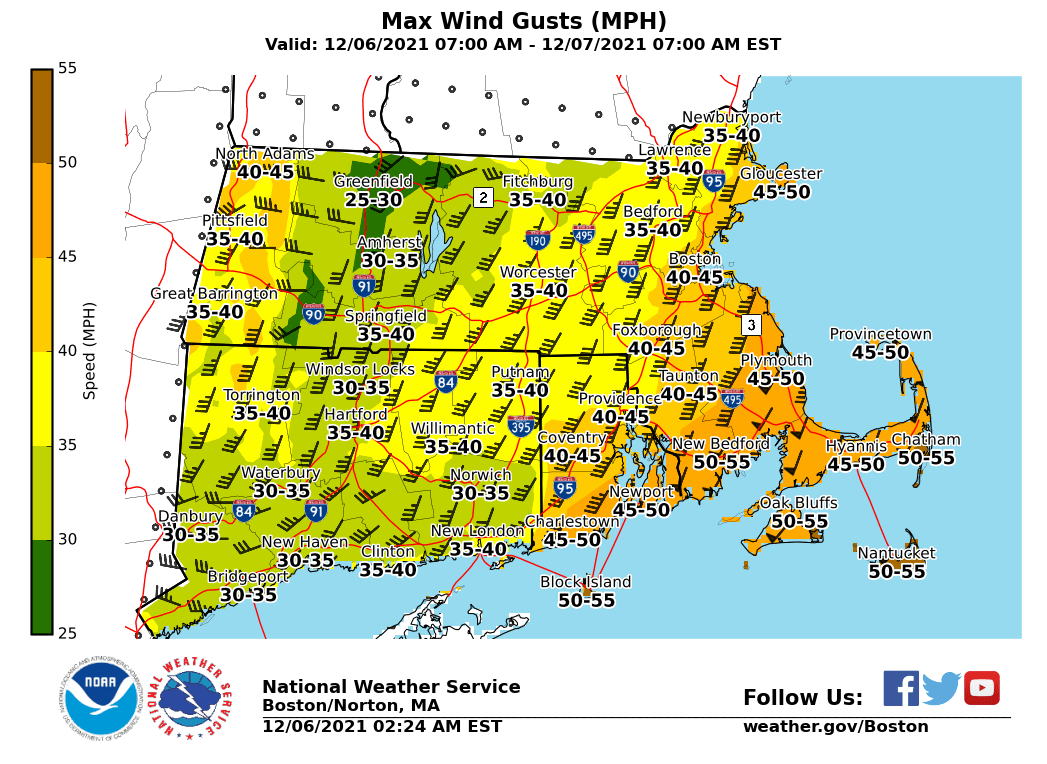
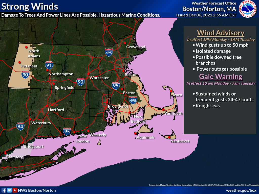
Good Morning, Strong winds are expected to impact southern New England this afternoon and tonight. The strongest gusts may cause downed branches and a few power outages. Maximum wind gusts 40-50 mph are expected, centered across Cape Cod, Coastal Rhode Island, southeast Massachusetts, the Islands, and portions of Berkshire county. A high wind advisory will be in place from 1 PM this afternoon through 1 AM Tuesday. A gale warning will also be in effect from late Monday morning through Tuesday morning. Please find more information in the attached one pager. This will be likely be the last briefing regarding the high wind potential for tonight unless a significant change arises. We will be sending additional briefings regarding the potential for accumulating snowfall this Wednesday. If you have any questions or would like more information, don't hesitate to contact us via this email address, on NWSChat <https://nwschat.weather.gov/>, or at the following: Thank you, Rob Megnia and Matthew Belk National Weather Service Boston/Norton, MA 46 Commerce Way Norton, MA 02766 508.622.3280 Website <http://www.weather.gov/boston> | Facebook <http://www.facebook.com/NWSBoston> | Twitter <http://www.twitter.com/NWSBoston>