
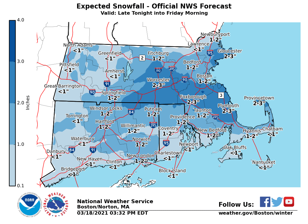
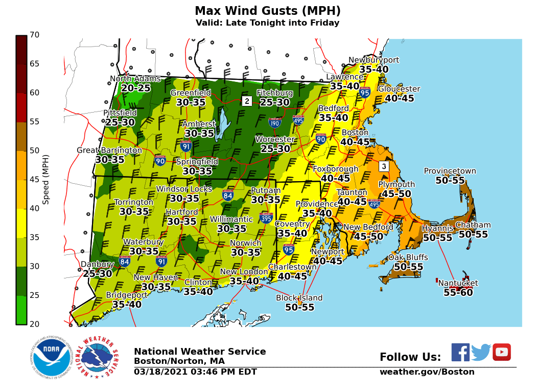
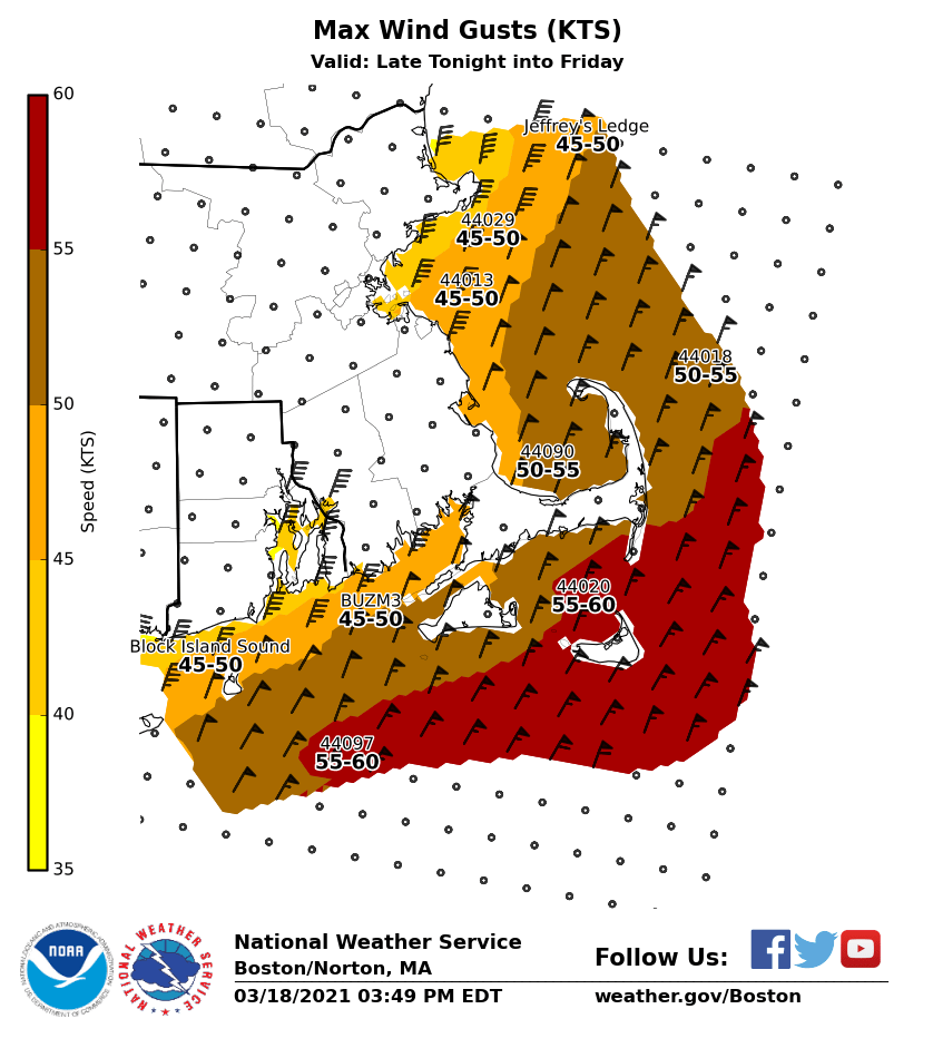
Good afternoon, Please see the attached one-page briefing and images which provide information on rain changing to snow and strong winds later tonight into Friday morning. We have not made significant changes since the last briefing with all headlines remaining the same. Regarding strong winds, we are still expecting a period of 40 to 50 mph gusts over the Cape and Islands, except for 45 to 55 mph gusts possible over Nantucket. Regarding snowfall, the amounts have been reduced slightly, especially over Western MA and the CT River valley. Overall, we are still expecting totals of 1-2 inches overnight, with isolated 3 inches possible. The main impact from the snow is the possibility of briefly snow covered roads, especially on secondary roadways during the heavier snowfall rates. Thanks, Rodney Chai and Bill Babcock If you have any questions or would like more information, don't hesitate to contact us via this email address, on NWSChat <https://nwschat.weather.gov/>, or at the following: National Weather Service Boston/Norton, MA 46 Commerce Way Norton, MA 02766 508.622.3280 Website <http://www.weather.gov/boston> | Facebook <http://www.facebook.com/NWSBoston> | Twitter <http://www.twitter.com/NWSBoston>