
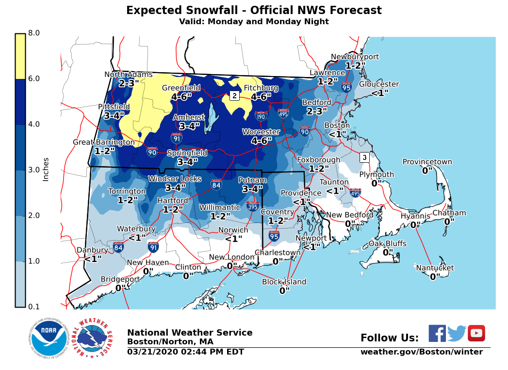
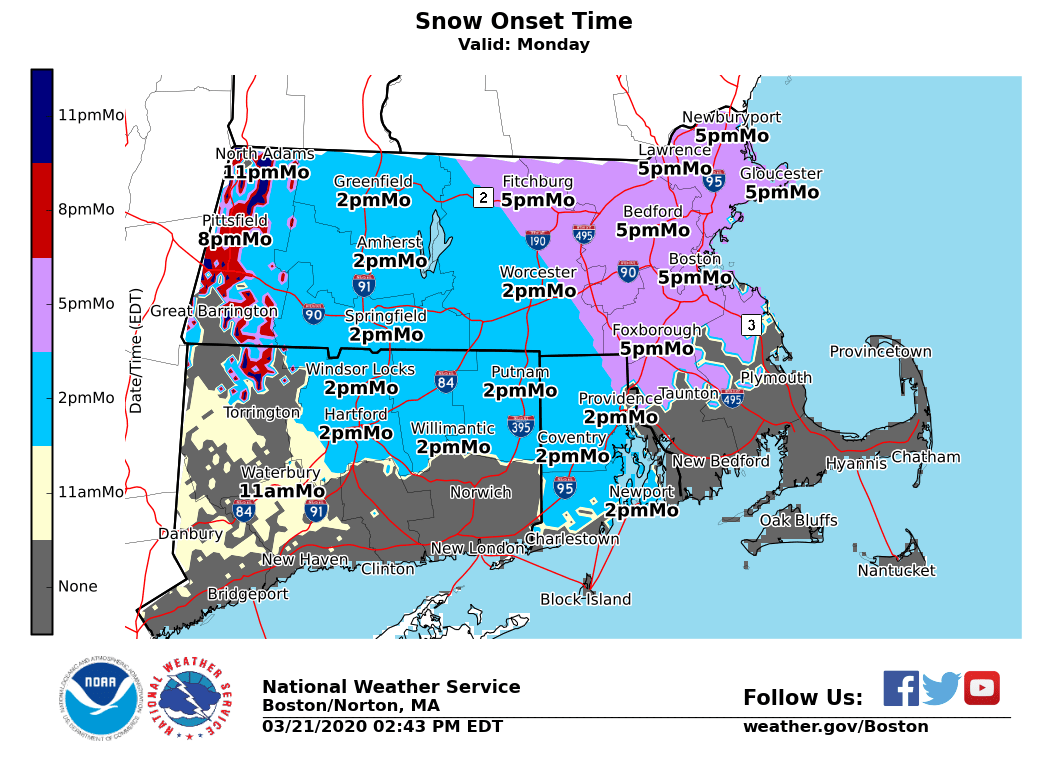
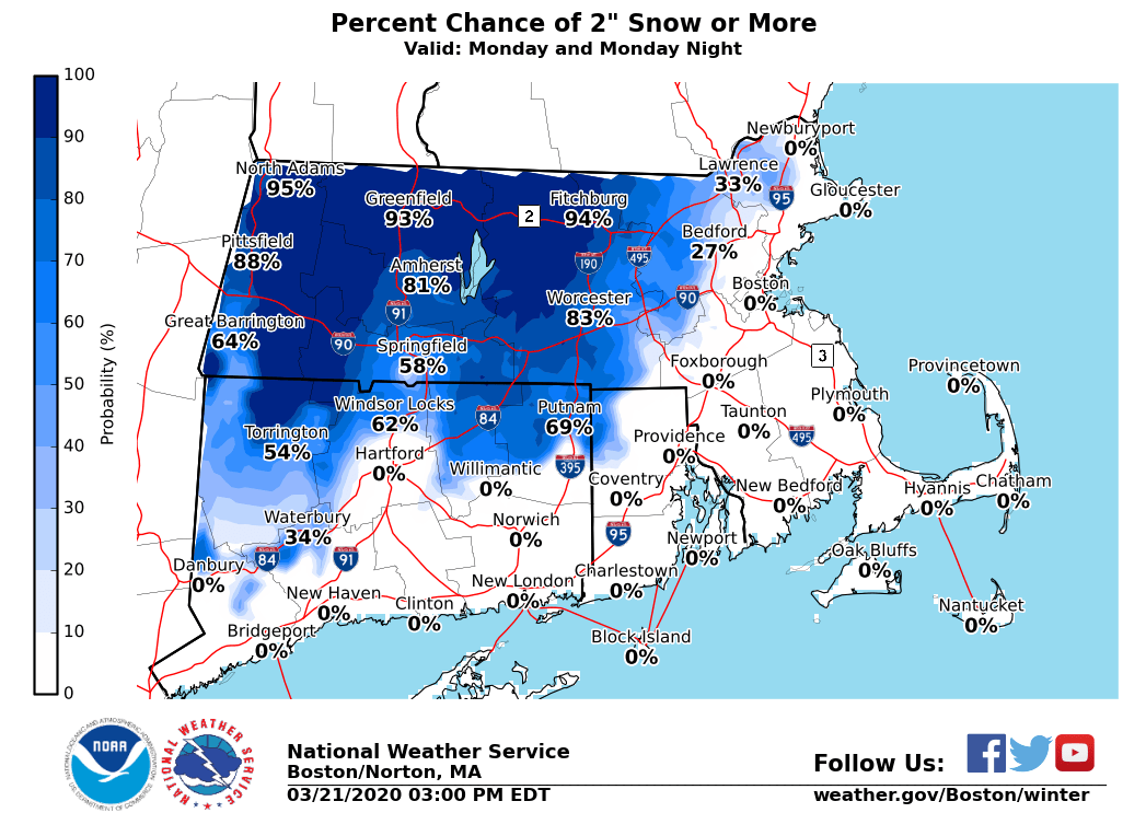
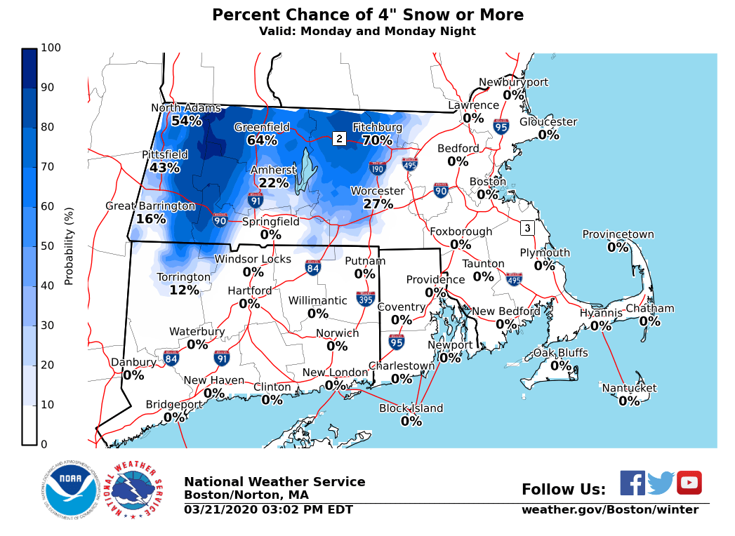
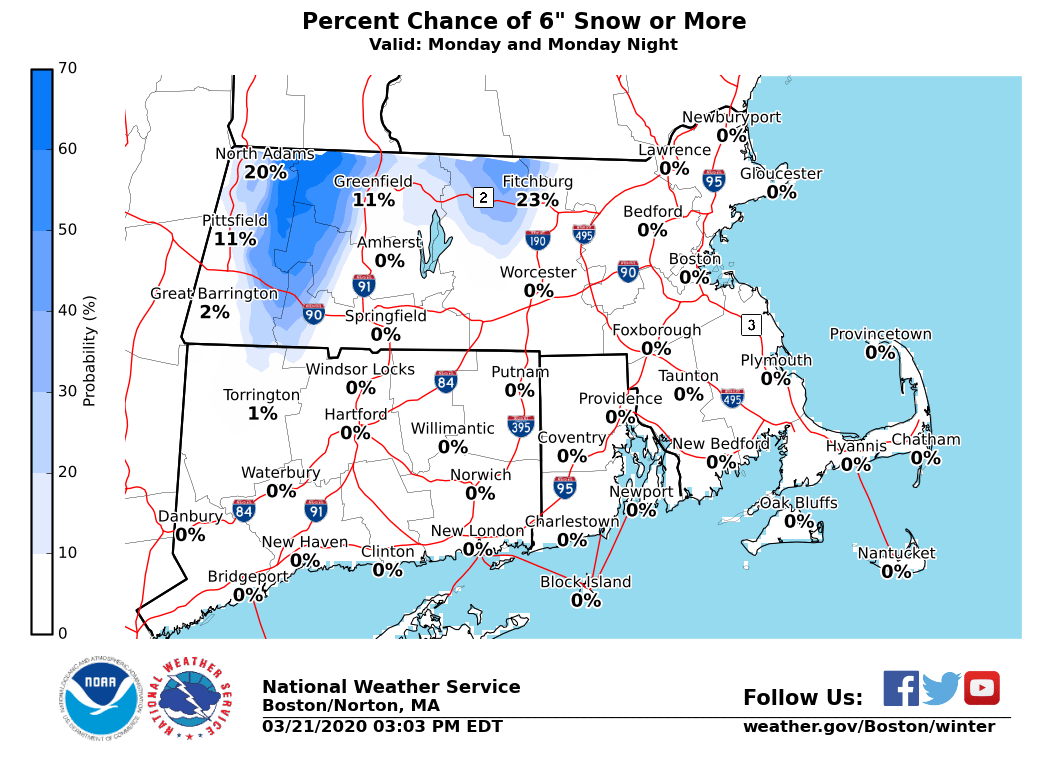
Good afternoon everyone, A coastal storm will pass southeast of New England Late Monday into Tuesday, initially bringing snow to much of the area Monday afternoon before a change to rain Monday night. The key takeaway is this is expected to be a minor snowfall event, with the exception of the higher elevations of western and central Massachusetts, where as much as 6 inches of snow is possible. Please see the attached graphics which include: - NWS Official Snowfall Forecast - Approximate onset time of accumulating snow (note areas in gray will have rain) - Chances of receiving 2 inches, 4 inches, or 6 inches or more of snow. Here are the details: *What/Where/When:* - Snow develops across much of southern New England Monday afternoon, except near the South Coast, Cape Cod, and the Islands where mainly rain is expected. - Snow should be briefly heavy late Monday afternoon and early Monday evening before changing to rain from south to north. Only the higher elevations of northern Worcester County and near the Berkshires are expected to remain all snow. - Accumulations of a slushy inch or two are expected in the Providence and Boston areas, 2-4" in the Hartford/Springfield area and near the I-495 corridor in northeast Massachusetts, and 3-6" in the higher elevations near the Berkshires and in northern Worcester County, where a few locations could see as much as 7". - The consistency of the snow will be heavy and wet in all areas. *Uncertainty:* - If the coastal storm passes farther offshore, snowfall totals will be much less, especially across the interior. - Conversely, if the storm tracks closer to southern New England, there would be less snow across most of the region, since the higher accumulations would shift to the northwest of Massachusetts. *Headlines:* - Right now due to uncertainty in the storm's track, we are not planning to issue any Winter Weather Advisories at this time. However, winter weather headlines may be issued in later forecasts once the track of the storm becomes more certain. If you have any questions or would like more information, don't hesitate to contact us via this email address, by phone, or on NWSChat <https://nwschat.weather.gov/>. Thanks, Joe DelliCarpini and Andrew Loconto National Weather Service Boston/Norton, MA 46 Commerce Way Norton, MA 02766 508.622.3280 Website <http://www.weather.gov/boston> | Facebook <http://www.facebook.com/NWSBoston> | Twitter <http://www.twitter.com/NWSBoston>