
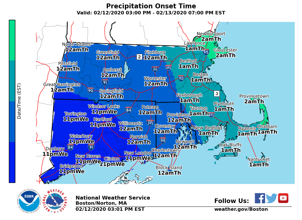
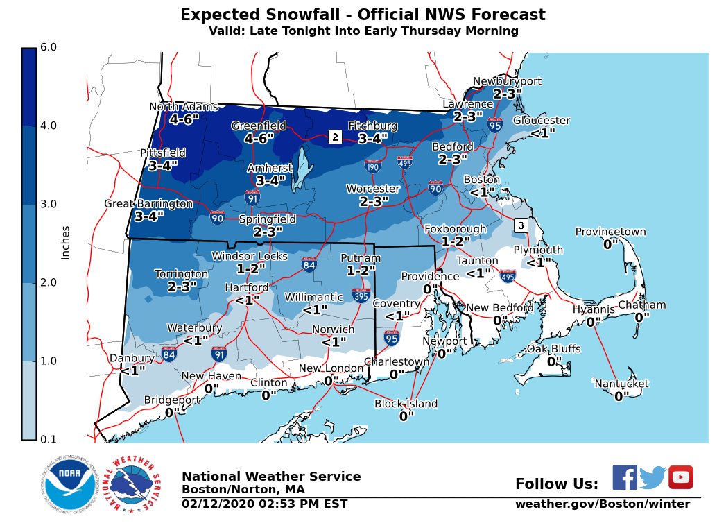
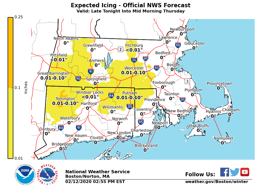
Good afternoon everyone No significant changes were made to the previous forecast. We have attached a few images showing the expected start time of the snow as well as the accumulations. An outline follows in the email below. *WHAT/WHERE/WHEN:* - Snow develops from west to east between 11 PM and 2 AM Thursday. - Areas south of the Massachusetts Turnpike will change to mainly rain by 5-6 AM and to the New Hampshire border by 7-8 AM. A brief period of sleet may occur during the transition. - Pockets of light freezing rain may persist until 9 or 10 AM, but mainly confined to the higher terrain of the Worcester Hills and Berkshires. *POTENTIAL IMPACTS/ACCUMULATIONS:* *- *Snow will only last a few hours in most locations, but may fall moderate to heavy for a very short time. Therefore, roads may quickly become snow covered along with reduced visibility. - A quick 1 to 2 inches of snow are possible for most of the region away from the south coast and Cape Cod. A swath of 2-5 inches of snow is possible from near Route 2 in Massachusetts to the New Hampshire border. -* The greatest impacts to the Thursday morning rush hour are expected north of the Massachusetts Turnpike and especially north of Route 2. There is where snow will still be falling at 5 or 6 AM. * *- *Up to one tenth of an inch of ice accretion will be possible mainly across the higher elevations of the Worcester Hills and Berkshires. Little impact expected though on roads with temperatures near 32 and falling on top of the earlier snow. Please let us know if you have any questions or concerns! Thank You Meteorologist: Hayden Frank If you have any questions or would like more information, don't hesitate to contact us via this email address, on NWSChat <https://nwschat.weather.gov/>, or at the following: National Weather Service Boston/Norton, MA 46 Commerce Way Norton, MA 02766 508.622.3280 Website <http://www.weather.gov/boston> | Facebook <http://www.facebook.com/NWSBoston> | Twitter <http://www.twitter.com/NWSBoston>