
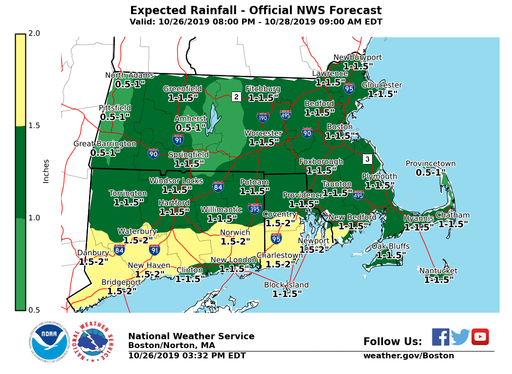
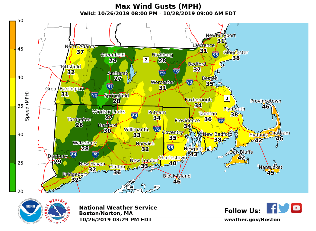
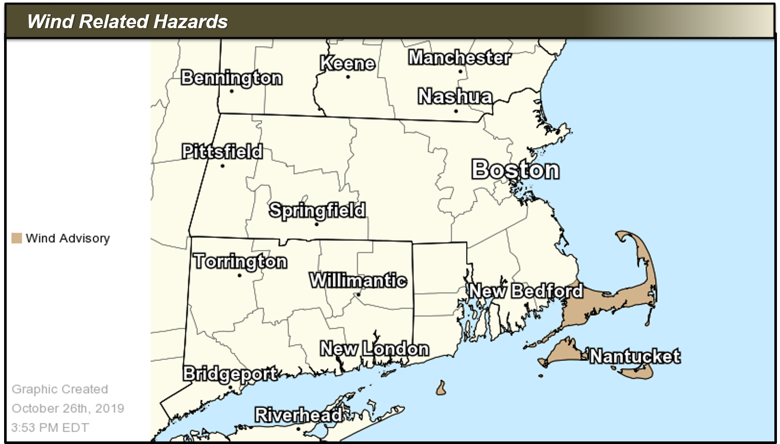
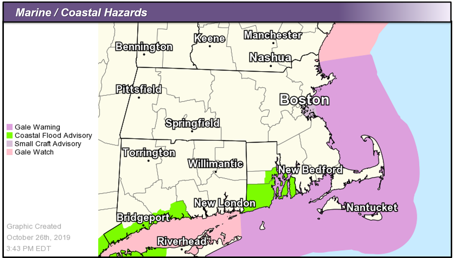
Good afternoon everyone, Low pressure is expected to move northeast from the northern mid-Atlantic/lower Hudson River Valley on Sunday. This will bring about a period of steady, at times heavy rain areawide Sunday afternoon into evening, and a period of gusty winds for southeast MA, Block Island and the outer waters. Minor coastal flooding is also expected for coastal RI mainly Sunday afternoon into the evening. Into Monday and Tuesday, a period of prolonged onshore winds combined with high astronomical tides may bring a threat of minor coastal flooding for eastern MA. *Changes with this update:* - *Wind Advisory Issued*: For Cape Cod and the Islands in MA and for Block Island in RI. In effect from 2 PM to 10 PM Sunday. - *Coastal Flood Advisory Issued:* For Eastern Kent, Bristol, Washington and Newport Counties in RI. In effect from 4 PM to 10 PM Sunday. - *Gale Warnings/Small Craft Advisories Issued*: Gale Warnings for all coastal and offshore waters, except for Small Craft Advisories Boston Harbor. These begin Sunday afternoon. *Details:* *Rainfall:* - *Timing:* Light rain begins in western MA/northern CT overnight tonight. Period of heaviest rains is midday to late-evening Sunday (before midnight). - *Amounts:* Between a half to 1.5 inches, highest southern counties. - *Impacts:* Minor urban/poor drainage flooding possible from clogged storm drains. - *Uncertainty:* Rumbles of thunder may lead to locally higher rainfall amounts, especially south of I-90. Isolated/limited coverage of poor drainage flooding. *Winds:* - *Timing:* Gusts increase early Sunday afternoon for the Cape and Islands and Block Island; period of strongest gusts between 4-9 PM. - *Peak Gusts:* Up to 50 mph. - *Impacts:* Tree limbs could be blown down and result in a few power outages. - *Uncertainty*: Strongest winds will accompany rain, which could produce pockets of stronger winds to transfer to the surface. This potential may be greater if thunder materializes. *Coastal Flooding:* - - *Timing:* 4 PM to 10 PM Sunday. - *Impacts:* Vulnerable shoreline locations in Newport, Portsmouth and Middletown may experience minor coastal flooding. This includes flooding of beach parking lots and parts of Hazard Road in Newport. - *Uncertainty:* Minor splashover is possible early Sunday morning with high tide, though impacts will be little if any. ***Note*: A prolonged period of onshore flow Monday into Tuesday in conjunction with high astronomical tides may cause minor coastal flooding into eastern Massachusetts, including Boston Harbor. Coastal Flood Advisories may be needed. Please find graphics attached with the forecast rainfall, maximum wind gusts in miles per hour, and existing Wind and Marine/Coastal Flood Headlines in effect as of this afternoon's forecast. Meteorologist: Andrew Loconto If you have any questions or would like more information, don't hesitate to contact us via this email address, on NWSChat <https://nwschat.weather.gov/>, or at the following: National Weather Service Boston/Norton, MA 46 Commerce Way Norton, MA 02766 508.622.3280 Website <http://www.weather.gov/boston> | Facebook <http://www.facebook.com/NWSBoston> | Twitter <http://www.twitter.com/NWSBoston>