
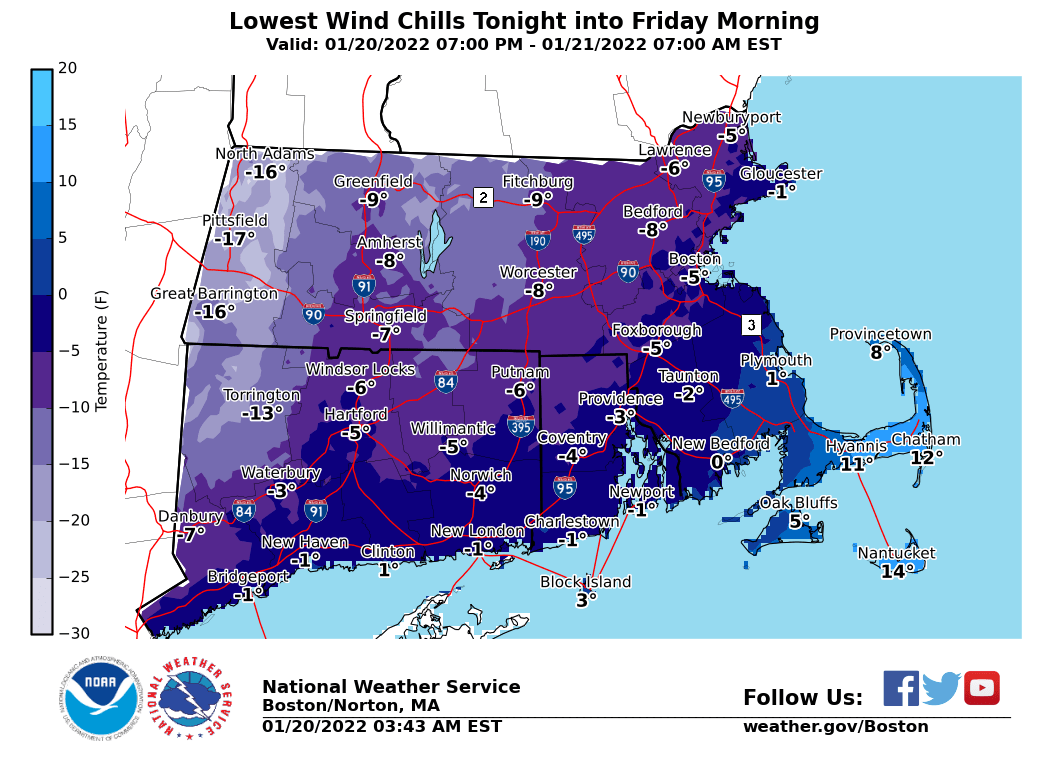
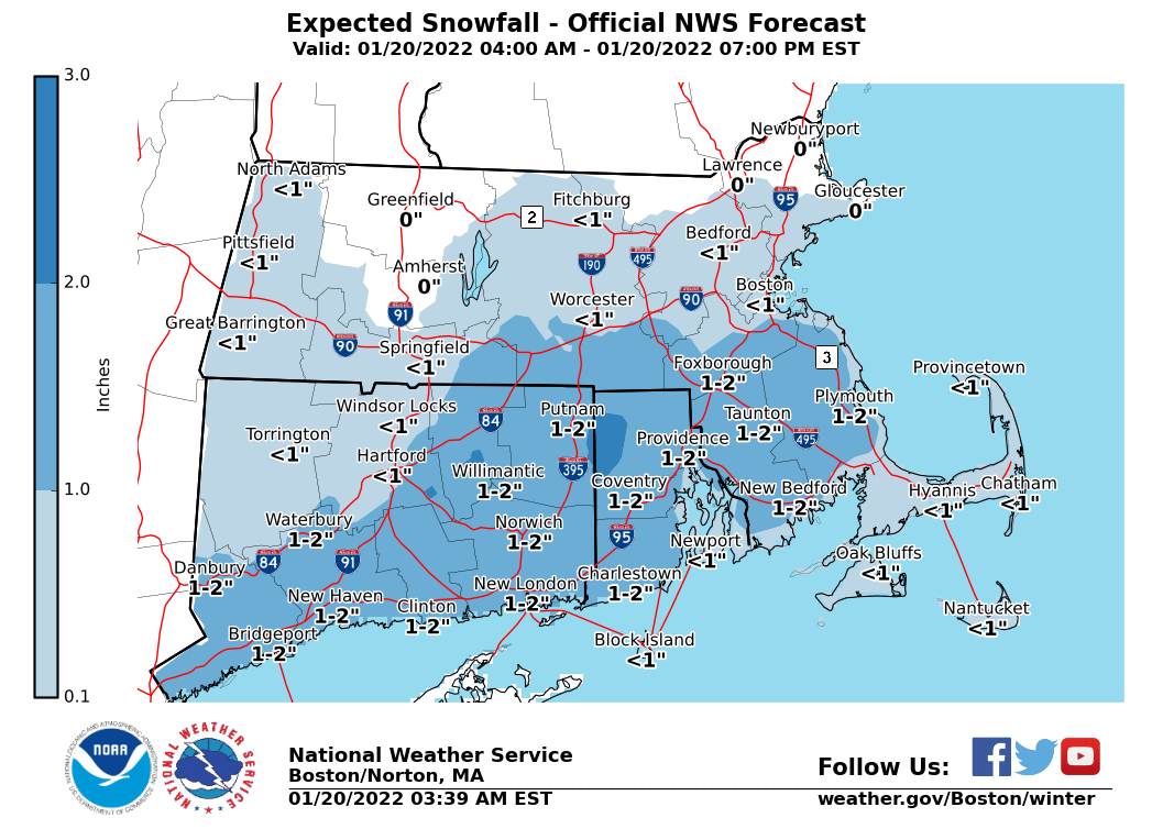
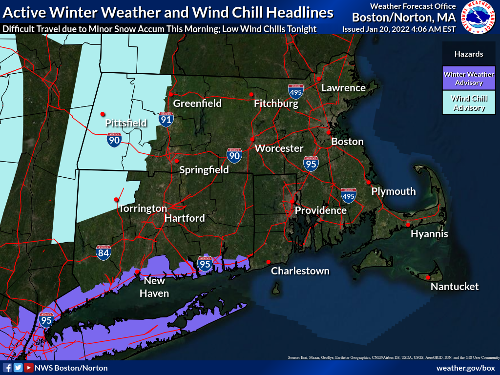
Good morning, Please find attached an updated one-page briefing on the minor accumulating snow for this morning and also regarding low wind chills tonight into early Friday morning. Attached supporting graphics include: - Active winter weather and wind chill headlines. - Updated Snow Accumulations for this morning's snow event. - Lowest Wind Chill Temperatures for Tonight into Early Friday morning. With snow expected to end by the afternoon, *this will be the least briefing pertaining to the minor accumulating snow event unless there are significant changes*. Expect an updated briefing on the wind chill hazard *by 6 PM Thursday*. Thank You! Meteorologists: Andrew Loconto and Hayden Frank If you have any questions or would like more information, don't hesitate to contact us via this email address, on NWSChat <https://nwschat.weather.gov/>, or at the following: National Weather Service Boston/Norton, MA 46 Commerce Way Norton, MA 02766 508.622.3280 Website <http://www.weather.gov/boston> | Facebook <http://www.facebook.com/NWSBoston> | Twitter <http://www.twitter.com/NWSBoston>