
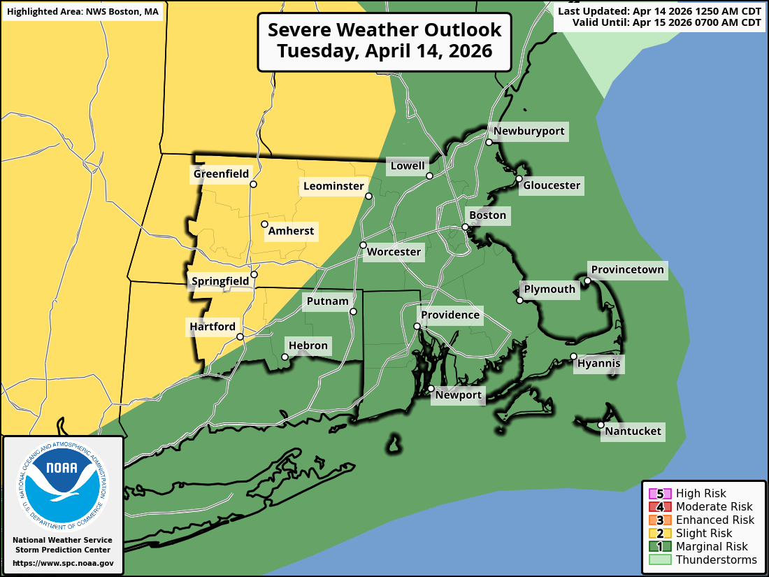
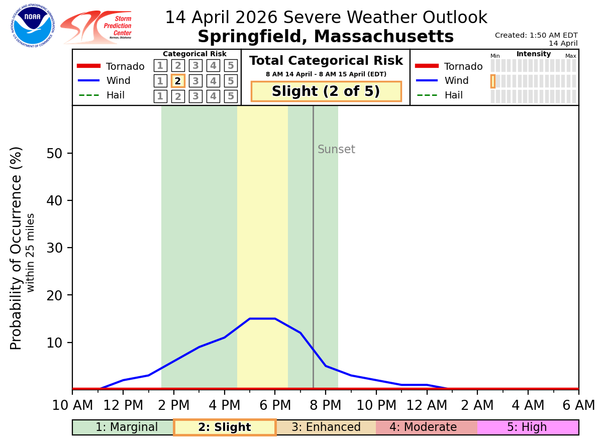
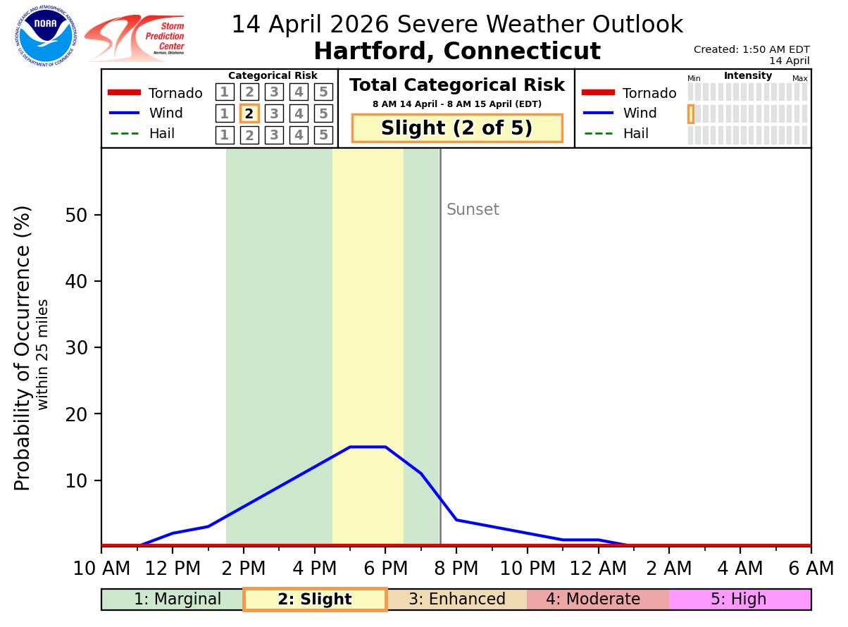
Good morning everyone, Strong to possibly severe thunderstorms are possible late this afternoon and early evening across northwest portions of CT and MA, including the greater Hartford and Springfield areas. The attached severe weather outlook indicates that the previously issued marginal risk (level 1 of 5) has been increased to a slight risk (level 2 of 5), given recent higher trends for strong to severe storms. Timing: The attached timing graphics for Hartford and Springfield indicate thunderstorms will occur between 2 PM and 8 PM today, with the highest probabilities between 4 PM and 7 PM. Impacts: The attached timing graphics also indicate the main thunderstorm hazard is strong to damaging winds, which may result in down trees and powerlines. Power outages are possible in northwest CT and MA. NWS Boston/Norton If you have any questions or would like more information, please don't hesitate to contact us. You can reach us via: email: box.operations@noaa.gov phone: 508.622.3280 Slack/NWSChat 2.0 <https://nwschatws.slack.com/> (for approved partners) social media: Website <http://www.weather.gov/boston> | Facebook <http://www.facebook.com/NWSBoston> | Twitter <http://www.twitter.com/NWSBoston>