
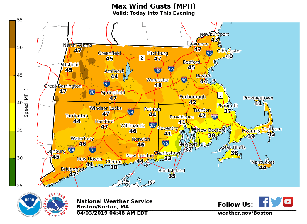
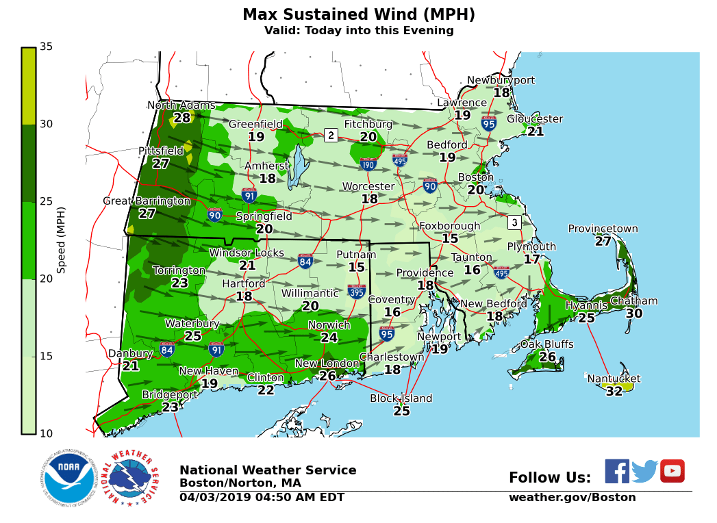
Good morning. A strong coastal storm is passing well offshore of Nantucket. This spread rain across Eastern Massachusetts and Rhode Island, while the Central Hills (mainly Worcester County) saw the rain change to snow. - *Strong to damaging winds ... * - North-Northeast clipping southeast New England with gusts up as high as 50 mph, especially for Nantucket. - Westerly winds increase this afternoon and evening with gusts as high as 55 mph, especially across the high terrain of Massachusetts. - Wind Advisories continue over Nantucket until 1 PM and over Massachusetts along and north of the Mass Pike from 2 pm to 9 pm. *The Wind Advisory has been EXPANDED* to include Hartford, Tolland, Windham Counties in Northern Connecticut...Providence County in Northern Rhode Island, and Northern Bristol County/Western Plymouth County in Southeast Massachusetts. - *Wet snow ... * - We expect wet snow will fall over the Central Hills of northeast CT, northwest RI, and central MA. - Greatest accumulations are likely over the higher elevations in and around the Worcester-metro area and points northward towards the border - A Winter Weather Advisory continues for Worcester and northern Middlesex County MA through 8 AM for accumulation from a coating to around an inch. - This may bring slippery travel during the morning rush hour. - Most of the snow is likely to melt and disappear by 10 am. If you have any questions or would like more information, don't hesitate to contact us via this email address, on NWSChat <https://nwschat.weather.gov/>, or at the following: National Weather Service Boston/Norton, MA 46 Commerce Way Norton, MA 02766 508.622.3280 Website <http://www.weather.gov/boston> | Facebook <http://www.facebook.com/NWSBoston> | Twitter <http://www.twitter.com/NWSBoston>