
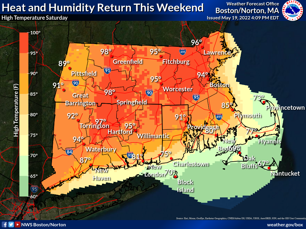
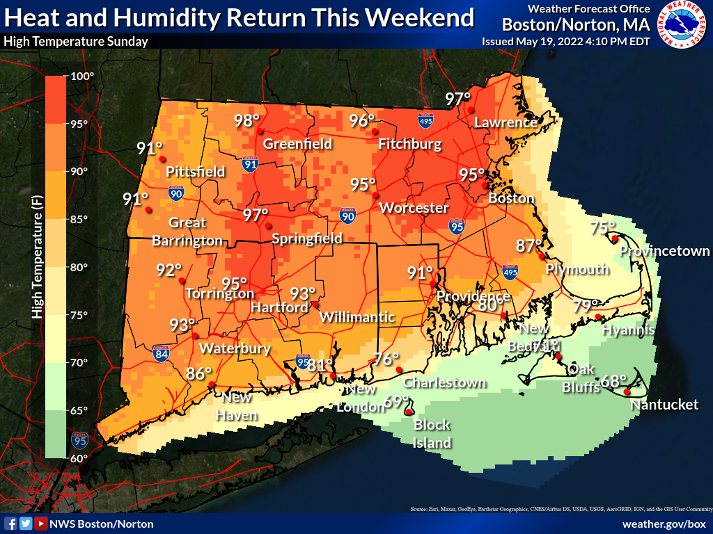
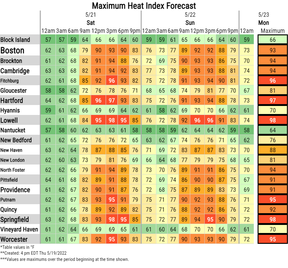
Good afternoon, Please find attached an updated one-page briefing and supporting graphics regarding the first occurrence of summer heat and humidity expected away from the coastline Saturday and Sunday. Forecast remains unchanged from the briefing sent Thursday morning. Heat indices are forecast to reach into the mid to upper 90s, with a lower chance for values at or over 100 degrees. In addition, little relief at night, especially urban areas with lows Saturday night not falling below 70F. Heat-related headlines will likely be needed for Saturday and Sunday. Expect the next briefing to be sent by 6 AM Friday. Thank You! Meteorologists: Andrew Loconto and Bill Leatham If you have any questions or would like more information, don't hesitate to contact us via this email address, on NWSChat <https://nwschat.weather.gov/>, or at the following: National Weather Service Boston/Norton, MA 46 Commerce Way Norton, MA 02766 508.622.3280 Website <http://www.weather.gov/boston> | Facebook <http://www.facebook.com/NWSBoston> | Twitter <http://www.twitter.com/NWSBoston>