
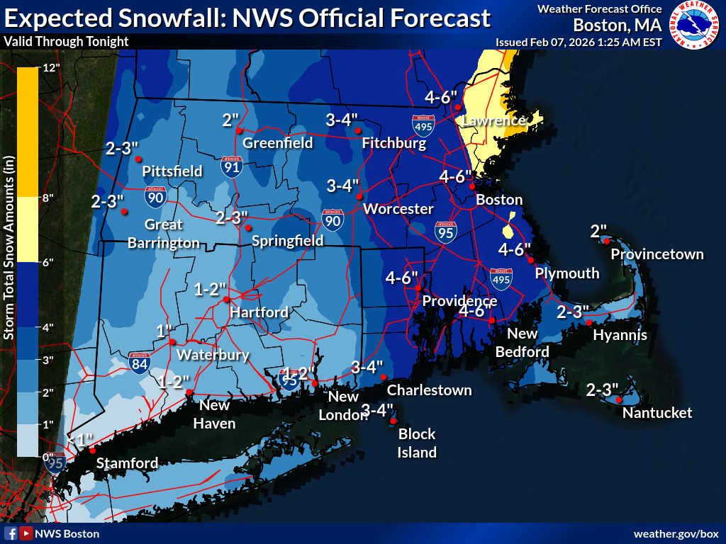
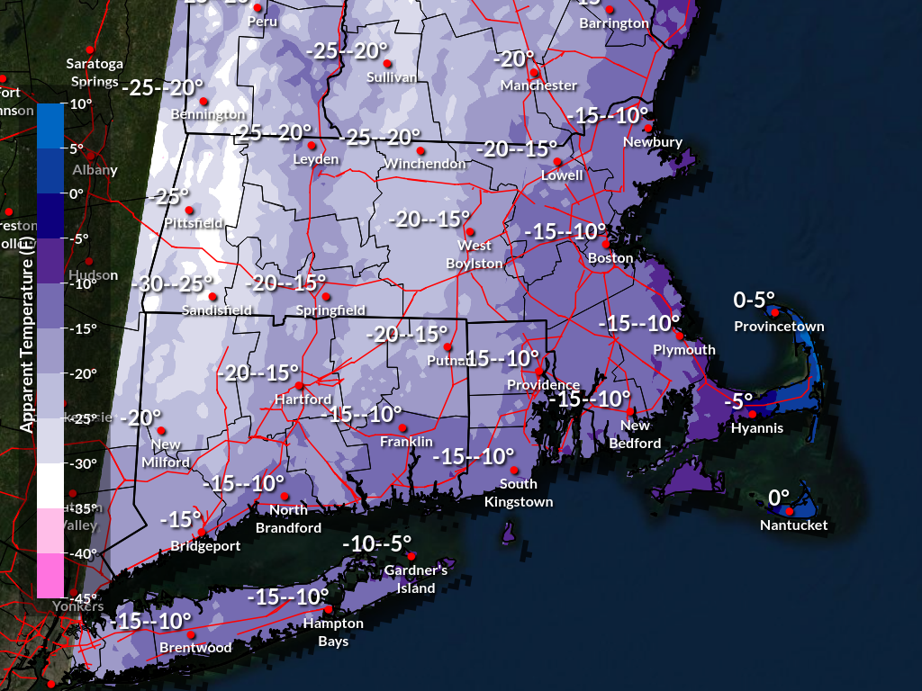
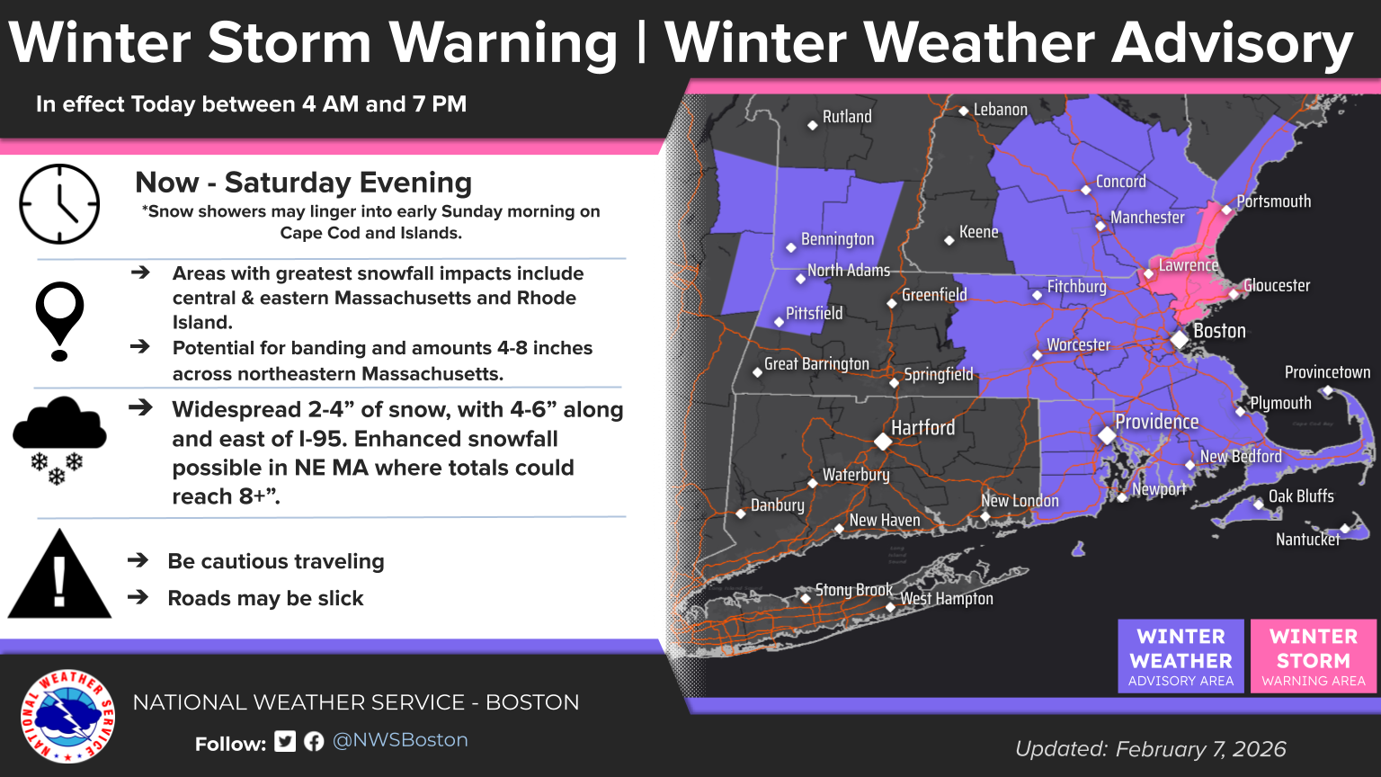
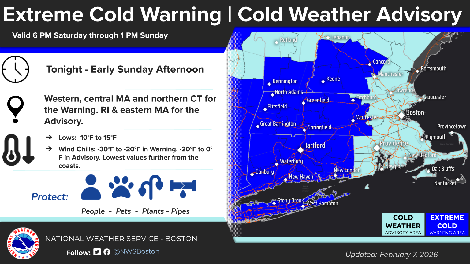
Good morning, Attached are two separate one-page briefings: - The first focuses on the dangerous cold tonight into Sunday morning - The second details snowfall today into this evening Changes since the last briefing: - Winter Storm Watch for Essex county was upgraded to a Winter Storm Warning. There is not much change to the snowfall forecast with generally 3 to 6 inches for the advisory area across central and eastern MA into Rhode Island, with locally up to 8 inches in northeast MA. The biggest challenge is pinpointing where the heavier snow bands will set up. Confidence is moderate and the axis of heavy snowfall could still shift. There have been no changes to the forecast for the extreme cold tonight into Sunday, in which we maintain high confidence. We have also attached additional images showing minimum wind chill values, expected snowfall totals, and current advisories, watches, and warnings. Thank you, Kevin Cadima and Candice Hrencecin If you have any questions or would like more information, please don't hesitate to contact us. You can reach us via: email: box.operations@noaa.gov phone: 508.622.3280 Slack/NWSChat 2.0 <https://nwschatws.slack.com/> (for approved partners) social media: Website <http://www.weather.gov/boston> | Facebook <http://www.facebook.com/NWSBoston> | Twitter <http://www.twitter.com/NWSBoston>