
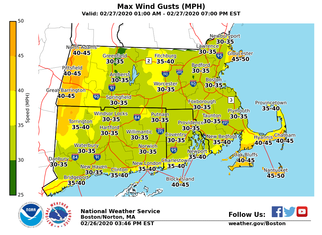
Good evening, Sent the previous email a bit too quickly, but we are expecting some patchy dense fog to impact the Route 3 corridor for this evenings commute. This includes the Greater Boston Area. Below is an updated weather briefing for a wind event that will impact coastal Cape Ann and Northern Berkshire County late tonight into Thursday morning. We also expect strong winds to develop across Cape Cod and the Islands late Thursday morning and continue through the afternoon. Details: *Wind Advisories* in effect for: - Eastern Essex County from 3AM to 9 AM Thursday - Northern Berkshire County from 10 PM tonight until 7 AM Thursday - Barnstable, Dukes and Nantucket Counties in MA from 10 AM until 4 PM Thursday - Block Island from 10 AM until 4 PM Thursday *What...*sustained winds of 20 to 35 mph with gusts up to 50 mph. *When...*Strongest wind gusts late tonight into early Thursday morning across Northern Berkshire County and Coastal Essex County/Cape Ann region. Cape Cod and the Islands will see the strongest gusts late Thursday morning into the afternoon. *Impacts...*Unsecured objects such as trash cans may be blown around. Tree limbs may be blown down that may cause localized damage. A few power outages are also possible. *Additional Information*...Elsewhere it will be windy but below wind advisory criteria late tonight and on Thursday. Attached is a map with the highest wind gusts expected tonight through Thursday. Thank you, Meteorologist: Bill Leatham If you have any questions or would like more information, don't hesitate to contact us via this email address, on NWSChat <https://nwschat.weather.gov/>, or at the following: National Weather Service Boston/Norton, MA 46 Commerce Way Norton, MA 02766 508.622.3280 Website <http://www.weather.gov/boston> | Facebook <http://www.facebook.com/NWSBoston> | Twitter <http://www.twitter.com/NWSBoston>