
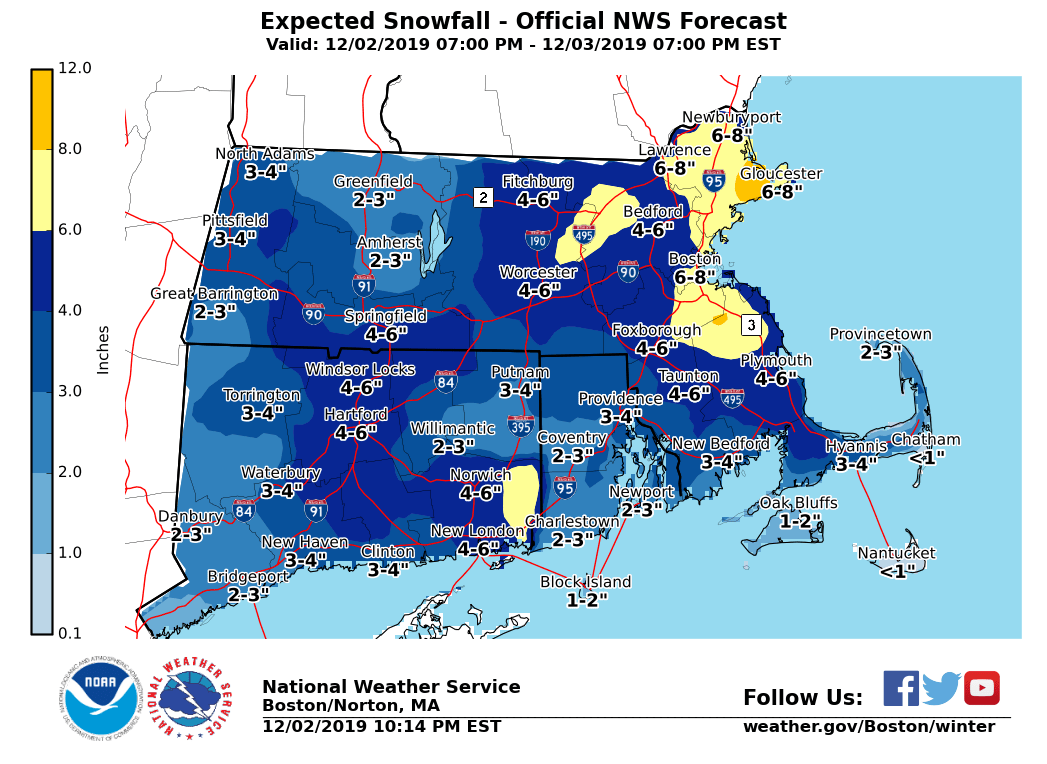
...previously wasn't sent from the BOX.Operations account -- sorry!... Good evening everyone, Just a quick update... No changes to warnings. We have lowered expected snowfall totals just a tad based on some of the latest model information. Still have high confidence of 4 inches in eastern MA with areas of 6 to 8 inches possible. A slight shift to the west of the track of the storm could mean higher totals and a slight shift more offshore would mean lower totals. During the past two hours, four inches have fallen in a very heavy band over Windsor Locks, CT. The potential for similar banding exists toward daybreak in eastern MA. If a heavy band were to occur there, it would most likely be between 4 AM and 10 AM. Please see attached snow total graphic, from 7 PM this evening to 7 PM tomorrow evening. -- Glenn Field Warning Coordination Meteorologist NWS - Boston/Norton, MA If you have any questions or would like more information, don't hesitate to contact us via this email address, on NWSChat <https://nwschat.weather.gov/>, or at the following: National Weather Service Boston/Norton, MA 46 Commerce Way Norton, MA 02766 508.622.3280 Website <http://www.weather.gov/boston> | Facebook <http://www.facebook.com/NWSBoston> | Twitter <http://www.twitter.com/NWSBoston>