
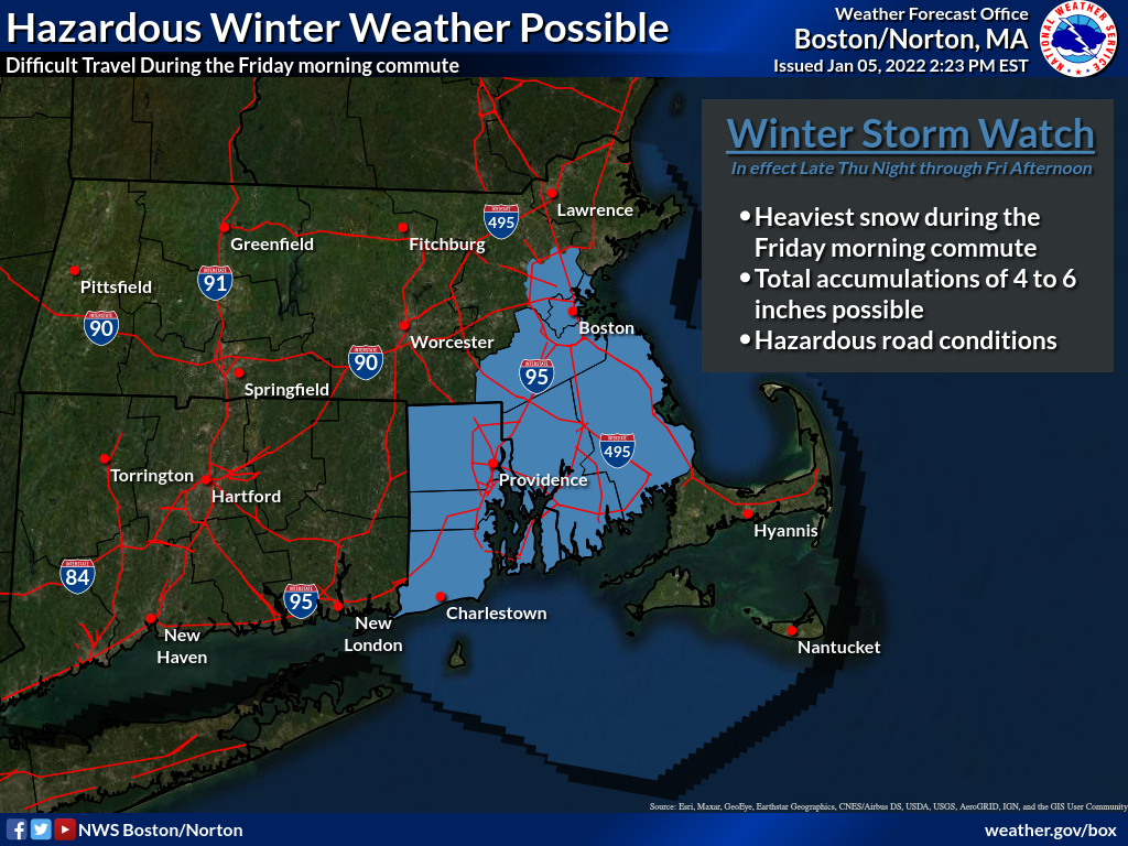
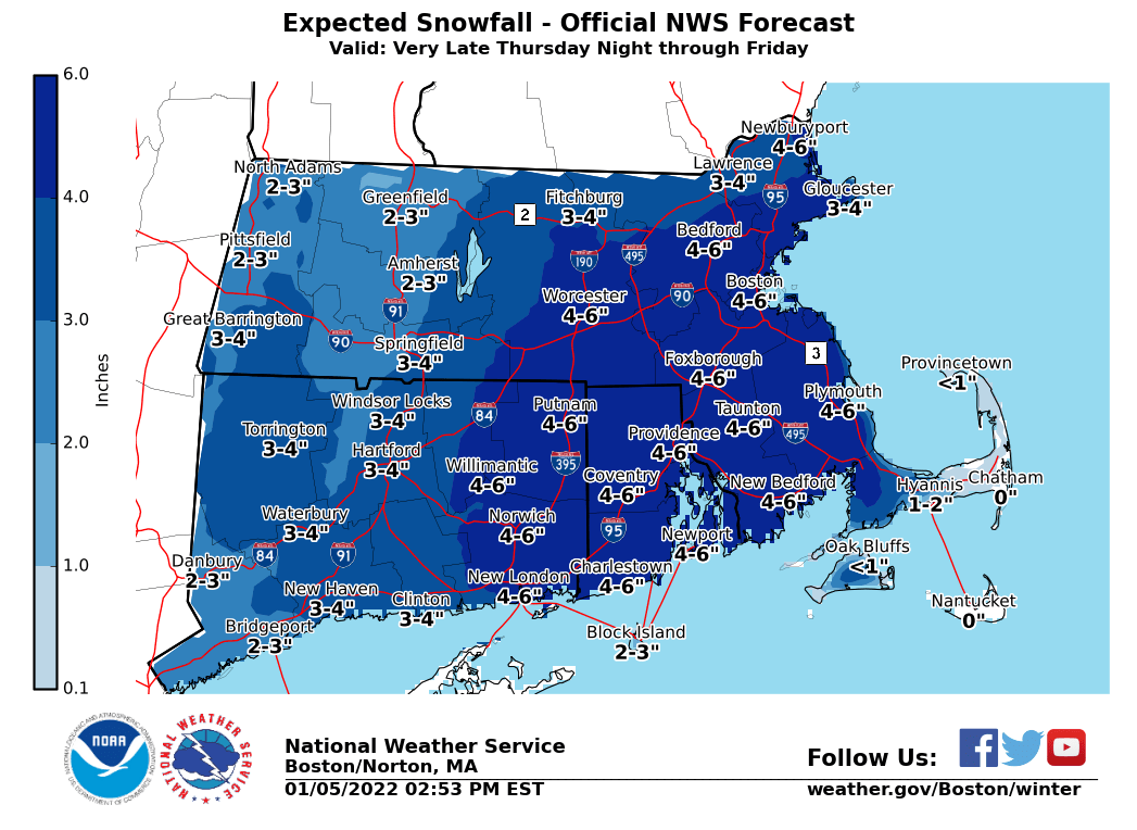
Good Afternoon, Attached is an updated briefing regarding the potential winter storm late Thursday night into Friday. The most substantial change compared to our earlier briefing is the issuance of a Winter Storm Watch for all of Rhode Island (with the exception of Block Island), and Bristol, Plymouth, Suffolk, Norfolk, and SE Middlesex counties in Massachusetts. The potential for heaviest snowfall rates, greater than 1" per hour, looks to be centered in these areas, primarily along and east of the I-95 corridor. A snowfall map has also been attached for your convenience. Widespread 4-6" snow totals are expected across SE MA and RI. Localized higher amounts are possible. If you have any questions or would like more information, don't hesitate to contact us via this email address, on NWSChat <https://nwschat.weather.gov/>, or at the following: Kristie Smith, Bill Leatham, and Andrew Loconto National Weather Service Boston/Norton, MA 46 Commerce Way Norton, MA 02766 508.622.3280 Website <http://www.weather.gov/boston> | Facebook <http://www.facebook.com/NWSBoston> | Twitter <http://www.twitter.com/NWSBoston>