
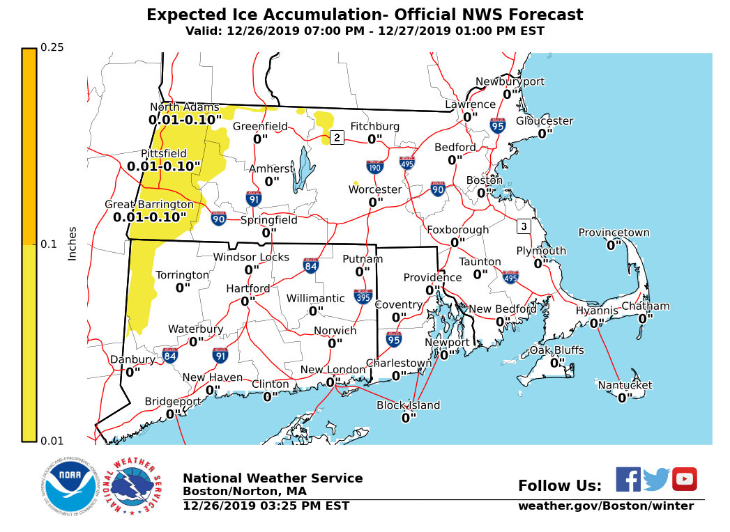
Good afternoon, We still expect the threat of spotty light freezing rain and/or sleet across portions of western and northern MA after midnight through the Friday morning commute. Winter Weather Advisories may be issued with later forecasts if confidence grows in the threat of more widespread freezing rain. A Special Weather Statement has been issued to highlight the greatest concerns. Attached is the latest thinking on precipitation types, as well as ice accretion. *Locations:* The higher terrain towards the Berkshires, as well as northern MA generally along and north of Route 2. *When:* Between midnight and 9 AM Friday *What:* Light ice accumulations up to a few hundredths of an inch. Negligible sleet accumulations. *Impacts:* Untreated surfaces may become slippery and lead to travel difficulties for the Friday morning commute. *Confidence:* Moderate to high on precipitation types, closer to moderate on expected ice accumulations. Though the area threatened by freezing rain is fairly broad, freezing rain in any area may prove quite light and spotty in nature. This is likely to significantly limit ice amounts and coverage. Please let us know if you require additional information. Matthew Belk If you have any questions or would like more information, don't hesitate to contact us via this email address, on NWSChat <https://nwschat.weather.gov/>, or at the following: National Weather Service Boston/Norton, MA 46 Commerce Way Norton, MA 02766 508.622.3280 Website <http://www.weather.gov/boston> | Facebook <http://www.facebook.com/NWSBoston> | Twitter <http://www.twitter.com/NWSBoston>