
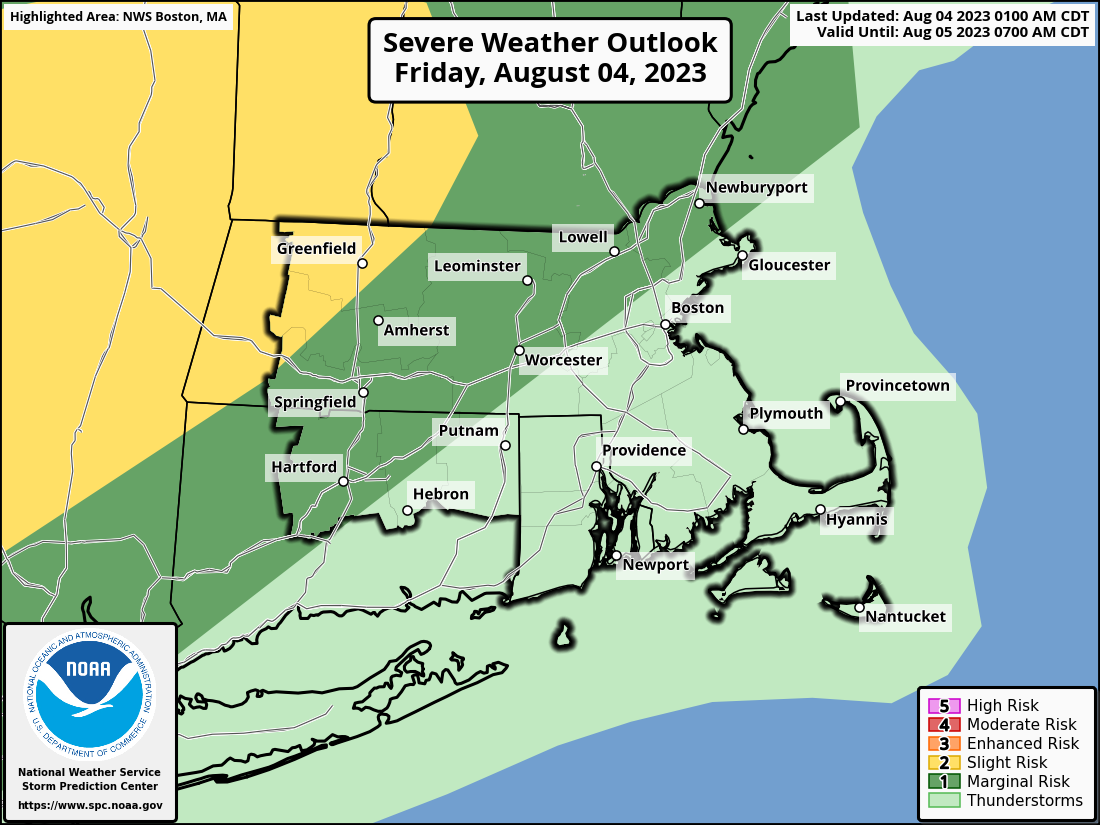
Good morning everyone, Just a quick update about the weather forecast. We haven't made many changes, but we want to remind you that there's a chance of locally strong to severe thunderstorms this afternoon and evening. The main risks are heavy rainfall that could lead to localized flooding, damaging straight-line winds, and hail, with greatest risk west and northwest of I-95. The storms will move from west to east between 3 pm and 10 pm, and showers will continue into the overnight hours. However, the severe weather threat should be over by 10 pm. If you have any questions or concerns, please don't hesitate to contact us. Best regards, Hayden Frank and Torry Dooley If you have any questions or would like more information, don't hesitate to contact us via this email address, on NWSChat <https://nwschat.weather.gov/>, or at the following: National Weather Service Boston/Norton, MA 46 Commerce Way Norton, MA 02766 508.622.3280 Website <http://www.weather.gov/boston> | Facebook <http://www.facebook.com/NWSBoston> | Twitter <http://www.twitter.com/NWSBoston>