
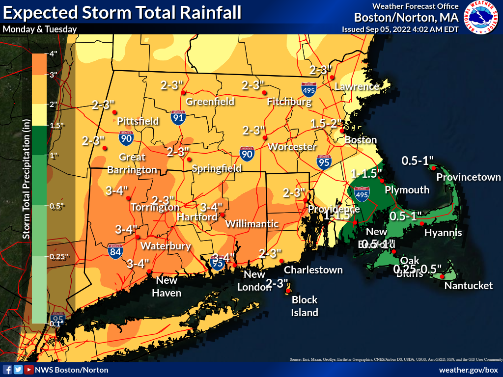
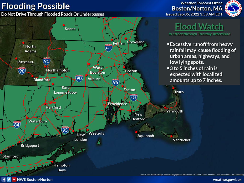
Good morning, Areas of very heavy rain have begun early Monday morning across northeast MA, with a flash flood warning already issued. A flood watch is in effect for most of MA, RI & CT, as the threat for flash flooding will overspread this area later this morning into the afternoon, and continue through about 5 pm Tuesday. Rainfall totals of 2 to 4 inches will be common across the region, but isolated amounts of 5-7 inches is possible in spots, although there is uncertainty on the exact area of heaviest rainfall and associated flash flooding. Another updated email briefing will follow around 4 pm Monday. Attached are additional details. Let us know if you have any questions or comments. Frank Nocera & Bryce Williams If you have any questions or would like more information, don't hesitate to contact us via this email address, on NWSChat <https://nwschat.weather.gov/>, or at the following: National Weather Service Boston/Norton, MA 46 Commerce Way Norton, MA 02766 508.622.3280 Website <http://www.weather.gov/boston> | Facebook <http://www.facebook.com/NWSBoston> | Twitter <http://www.twitter.com/NWSBoston>