
Good morning, We apologize for the second email. We omitted Bristol County RI and Block Island from the previous Winter Weather Advisory graphic. The attached image will fix that error. No other changes to the forecast have been made. Matthew Belk If you have any questions or would like more information, don't hesitate to contact us via this email address, on NWSChat <https://nwschat.weather.gov/>, or at the following: National Weather Service Boston/Norton, MA 46 Commerce Way Norton, MA 02766 508.622.3280 Website <http://www.weather.gov/boston> | Facebook <http://www.facebook.com/NWSBoston> | Twitter <http://www.twitter.com/NWSBoston> On Sun, Feb 13, 2022 at 4:29 AM BOX Operations - NOAA Service Account < box.operations@noaa.gov> wrote:
Good morning,
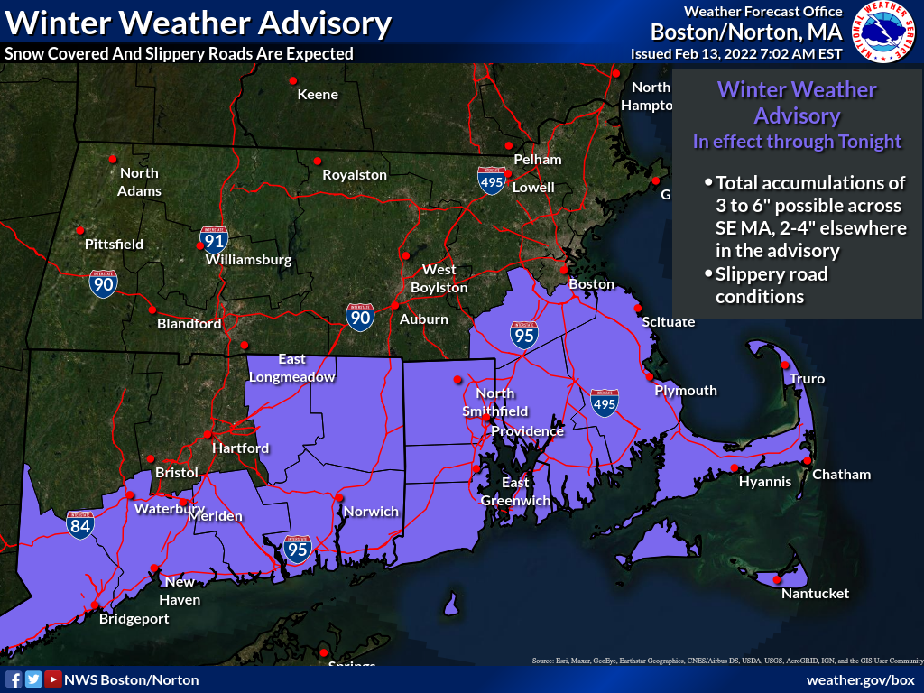
*Winter Weather Advisories were expanded this morning. They now cover much of RI and CT, as well as more of eastern MA.* A closer pass of the offshore low pressure will lead to slightly more precipitation. Still expecting the snowfall to be of the normal to fluffy variety.
Attached is the latest one-page briefing regarding the accumulating snow expected across southern New England into Monday. We have also attached the Winter Weather Advisory, Storm Total Snowfall, and expected onset and ending times graphics.
Meteorologists Rob Megnia and Matthew Belk
If you have any questions or would like more information, don't hesitate to contact us via this email address, on NWSChat <https://nwschat.weather.gov/>, or at the following:
National Weather Service Boston/Norton, MA 46 Commerce Way Norton, MA 02766 508.622.3280 Website <http://www.weather.gov/boston> | Facebook <http://www.facebook.com/NWSBoston> | Twitter <http://www.twitter.com/NWSBoston>