
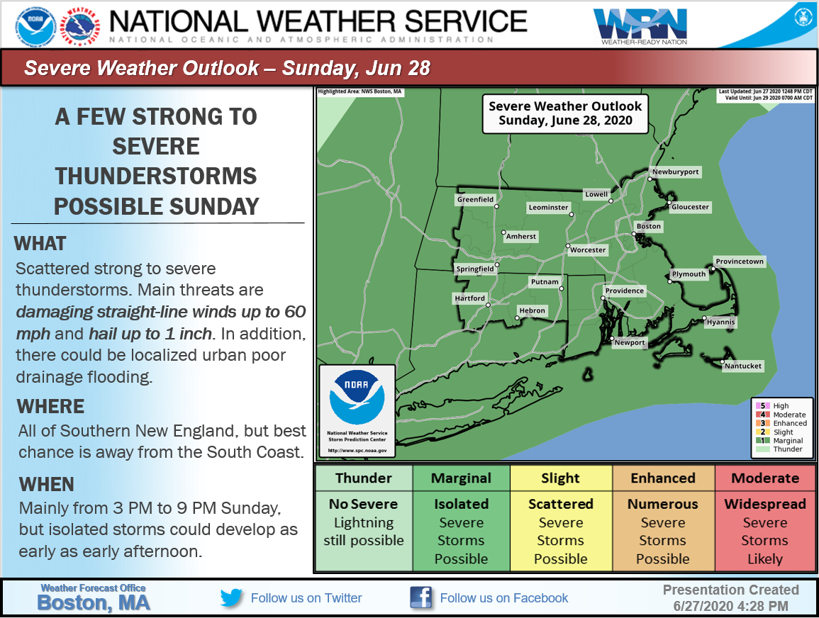
Good afternoon, We are still anticipating the threat of scattered strong to severe thunderstorms across portions of Southern New England on Sunday. *Changes since the previous update* No changes since the previous update. The Storm Prediction Center (SPC) continues to maintain a marginal severe threat for all of Southern New England. The breakdown in timing, locations and confidence are below: *Timing*: 3-9 PM, but isolated storms possible as early as early afternoon. *Locations*: Possible anywhere across Southern New England, but the best chance is away from the immediate South Coast as well as the Cape and Islands. *Severe Thunderstorm Threats:* Primary threat is damaging straight-line wind up to 60 mph with hail up to 1" in diameter being a secondary concern. In addition, due to the stationary nature of storms, there could be localized urban poor drainage flooding where downpours develop. *Confidence: *Moderate. Isolated strong/severe storms could be possible before noon contingent on cold front and/or sea breeze development/timing. Please see the attached graphic for additional details. Thank you, Meteorologists Rodney Chai and Andrew Loconto If you have any questions or would like more information, don't hesitate to contact us via this email address, on NWSChat <https://nwschat.weather.gov/>, or at the following: National Weather Service Boston/Norton, MA 46 Commerce Way Norton, MA 02766 508.622.3280 Website <http://www.weather.gov/boston> | Facebook <http://www.facebook.com/NWSBoston> | Twitter <http://www.twitter.com/NWSBoston>