
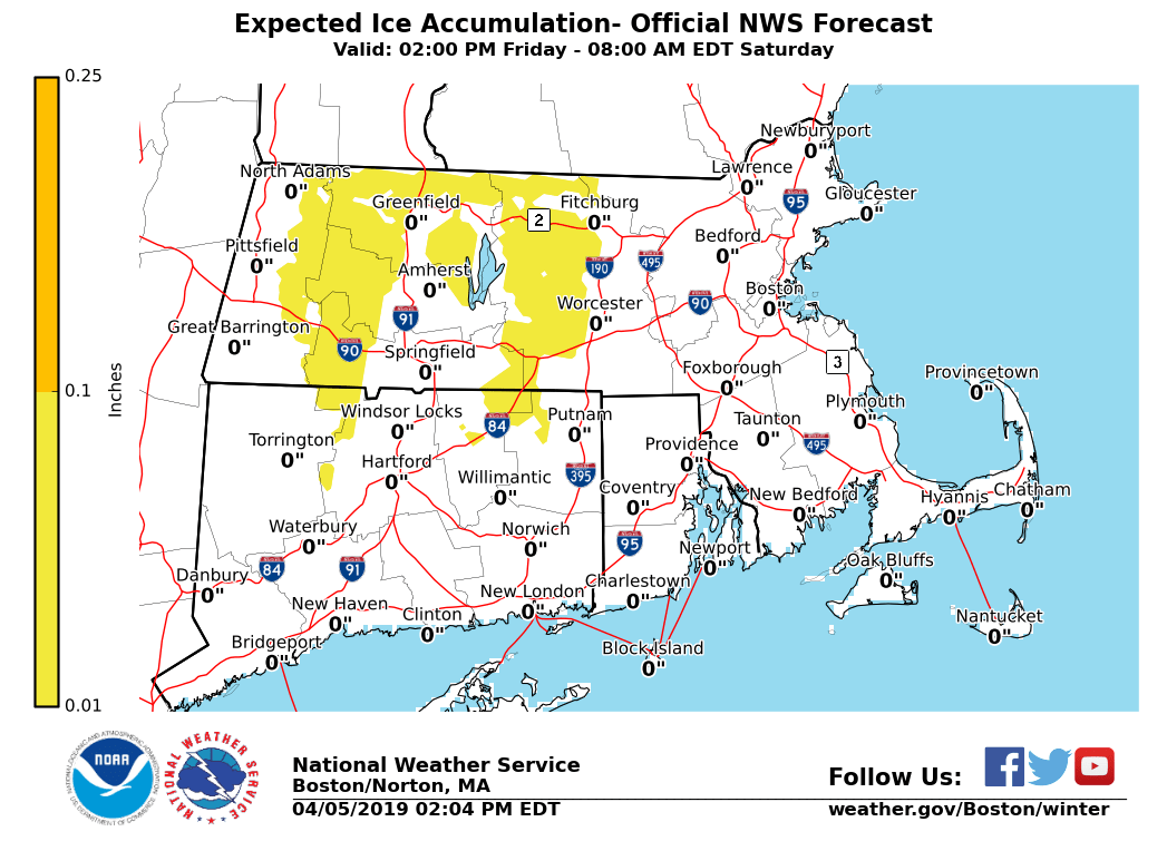
Good afternoon, all: *What Remains the Same*: - Winter Weather Advisory for the Berkshires, including the east slopes - Snow and sleet accumulation before a transition to freezing rain, then rain - A few inches of snow and sleet may accumulate before the transition to freezing rain and rain - - up to a few hundredths inch of ice accretion is possible *What Will Be Changing:* - Special Weather Statement will be issued for the threat of freezing rain - Not as confident freezing rain will be widespread - Risk of freezing rain across central and western Massachusetts, as well as northern Connecticut - Especially at elevations of 1,000 ft or higher - Up to a few hundredths inch of ice accretion is possible A preliminary ice accumulation map is attached. Another update will be sent this afternoon if there are significant changes. Matthew Belk If you have any questions or would like more information, don't hesitate to contact us via this email address, on NWSChat <https://nwschat.weather.gov/>, or at the following: National Weather Service Boston/Norton, MA 46 Commerce Way Norton, MA 02766 508.622.3280 Website <http://www.weather.gov/boston> | Facebook <http://www.facebook.com/NWSBoston> | Twitter <http://www.twitter.com/NWSBoston>