
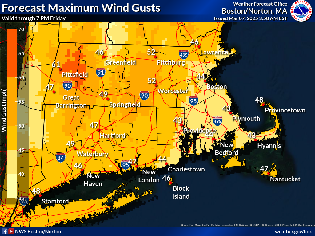
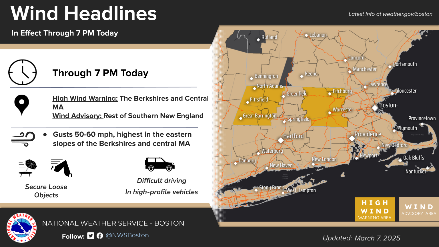
Good morning, Following is an updated weather briefing and situation update regarding the ongoing strong wind event currently affecting Southern New England, expected to continue through this afternoon. *Changes Since Last Briefing:* The High Wind Warning has been expanded into the remainder of Berkshire County in Massachusetts. *Situation Update: *While gusts during the night have been rather commonly in the 40-45 mph range for most of CT, MA and RI, recent gusts at Worcester Airport were as high as 58 mph, and 65 mph at Pittsfield. Wind gusts will continue to increase this morning into the 50-60 mph range and be capable of causing instances of damage thru the mid-afternoon hours. Wind gusts will begin to ease into the 25-40 mph range after sundown into tonight, but a second increase in gusts back to the 40-50 mph range is possible on Saturday. These details are included in the attached one-page briefing packet. *Next Briefing:* Expect this to be the final briefing, with wind gusts forecast to decrease by later this afternoon. However if forecast wind gusts for Saturday were to prompt the need for additional wind headlines, we would then send another briefing by 600 PM today. Thank You! Meteorologist: Andrew Loconto If you have any questions or would like more information, please don't hesitate to contact us. You can reach us via: email: box.operations@noaa.gov phone: 508.622.3280 Slack/NWSChat 2.0 <https://nwschatws.slack.com/> (for approved partners) social media: Website <http://www.weather.gov/boston> | Facebook <http://www.facebook.com/NWSBoston> | Twitter <http://www.twitter.com/NWSBoston>