
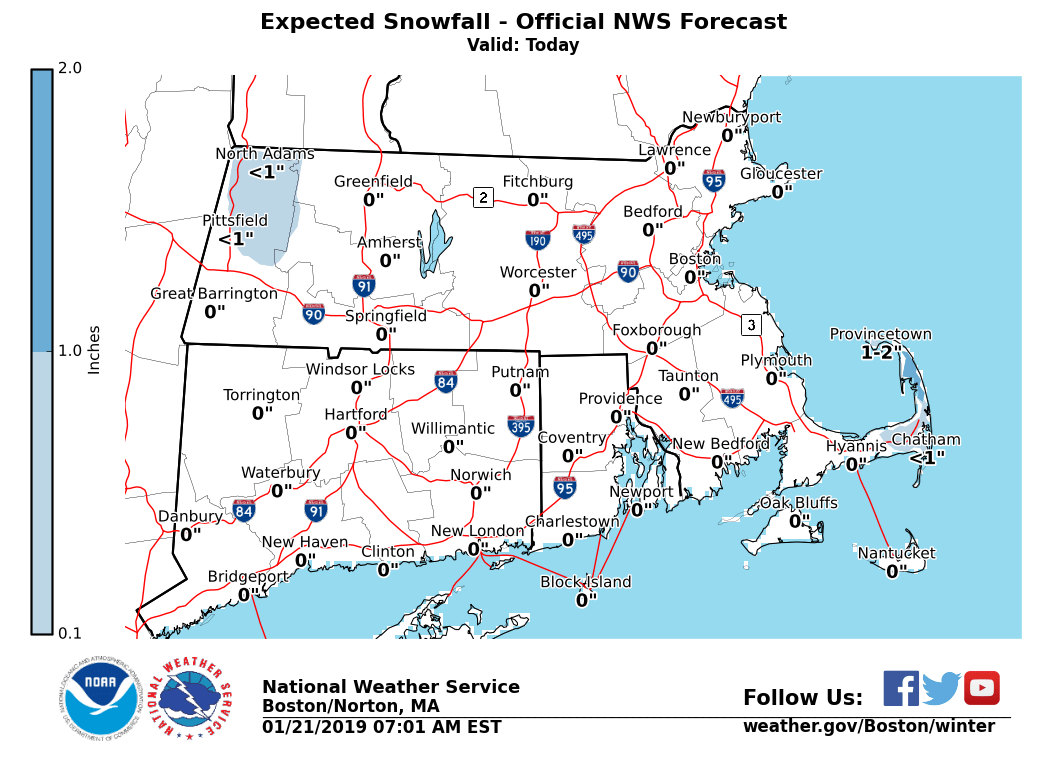
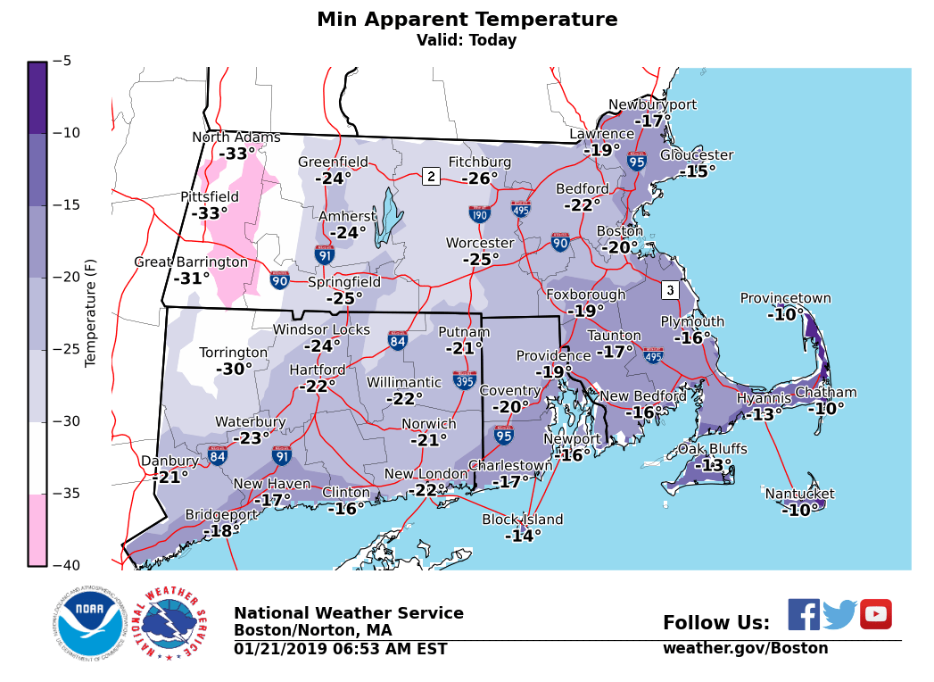
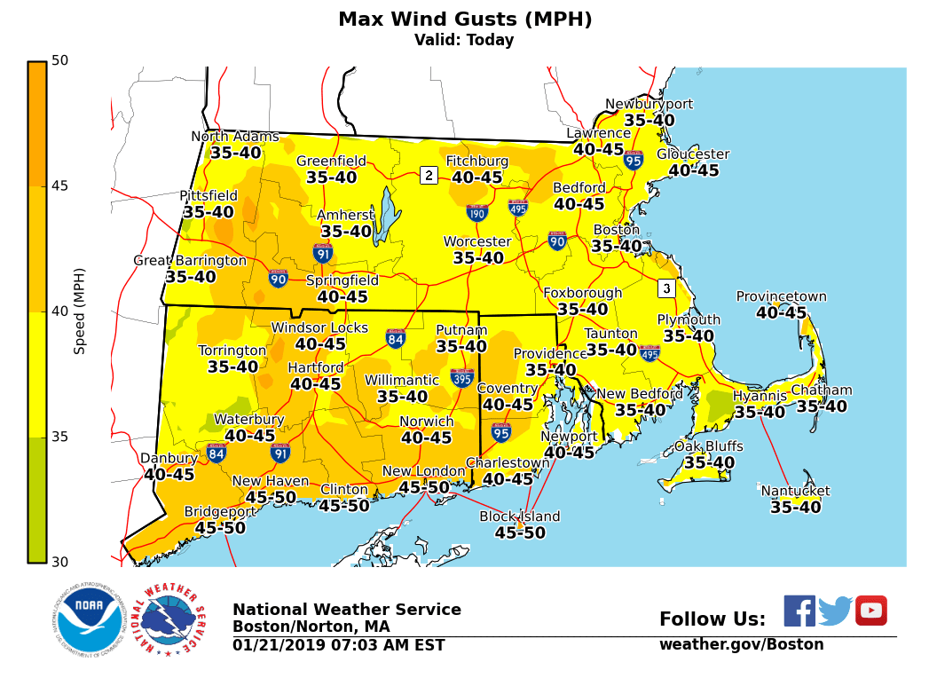
Good morning everyone, No major changes to previously issued weather headlines. Attached is our updated briefing into Tuesday. *What / Where / When ...* - Lingering winter weather - Ocean-effect snow possible across the outer Cape - Generally less than 1 inch of accumulation, perhaps up to 2 inches in spots - Bitterly Cold Wind Chills - Bitterly cold wind chills of -15 to -35°F this morning. - Bitter cold will continue through Tuesday morning with wind chills around -10 to -15°F - Wind Chill headlines through today - Potential Downed Limbs, Isolated Power Outages - Gusty winds may result in downed limbs and/or isolated power outages across areas N&W of the Hartford to Boston corridor where observed heavier amounts of snow and ice remain on trees and power lines - Moderate to Heavy Freezing Spray - Gale Warnings on all waters through tonight (may need to be extended later into Tuesday) - Moderate to locally heavy freezing spray through tonight - Minor Coastal Flooding - East-coastal MA this morning - Isolated pockets of minor flooding along the coast for typically prone locations, especially Boston Harbor south to Cape Cod Bay, as well as northern Nantucket - Mainly due to lingering swell and high astronomical tides If you have any questions or would like more information, don't hesitate to contact us via this email address, on NWSChat <https://nwschat.weather.gov/>, or at the following: Matthew Belk National Weather Service Boston/Norton, MA 46 Commerce Way Norton, MA 02766 508.622.3280 Website <http://www.weather.gov/boston> | Facebook <http://www.facebook.com/NWSBoston> | Twitter <http://www.twitter.com/NWSBoston>