
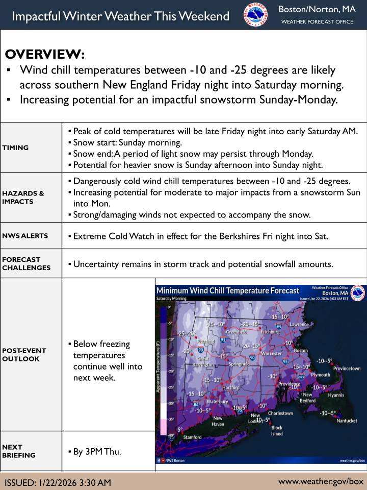
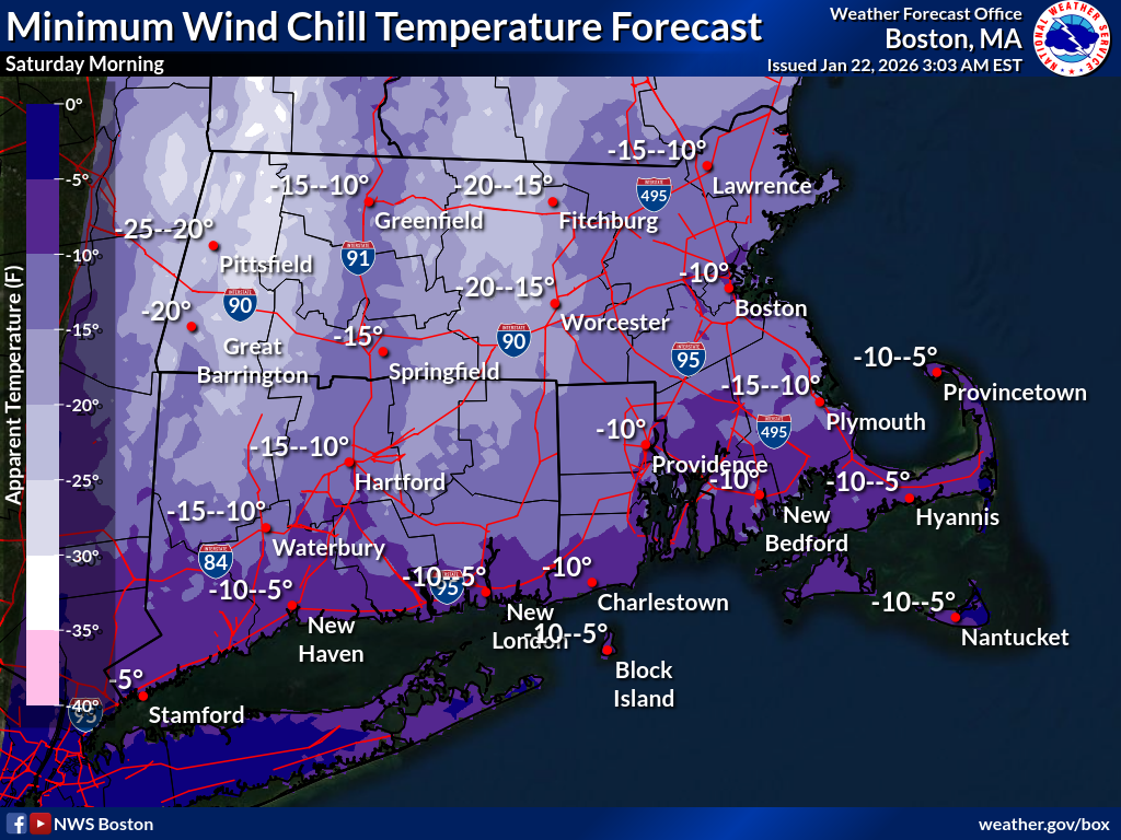
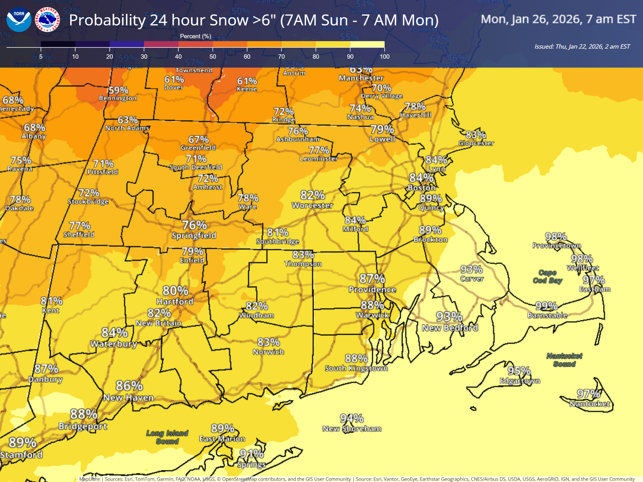
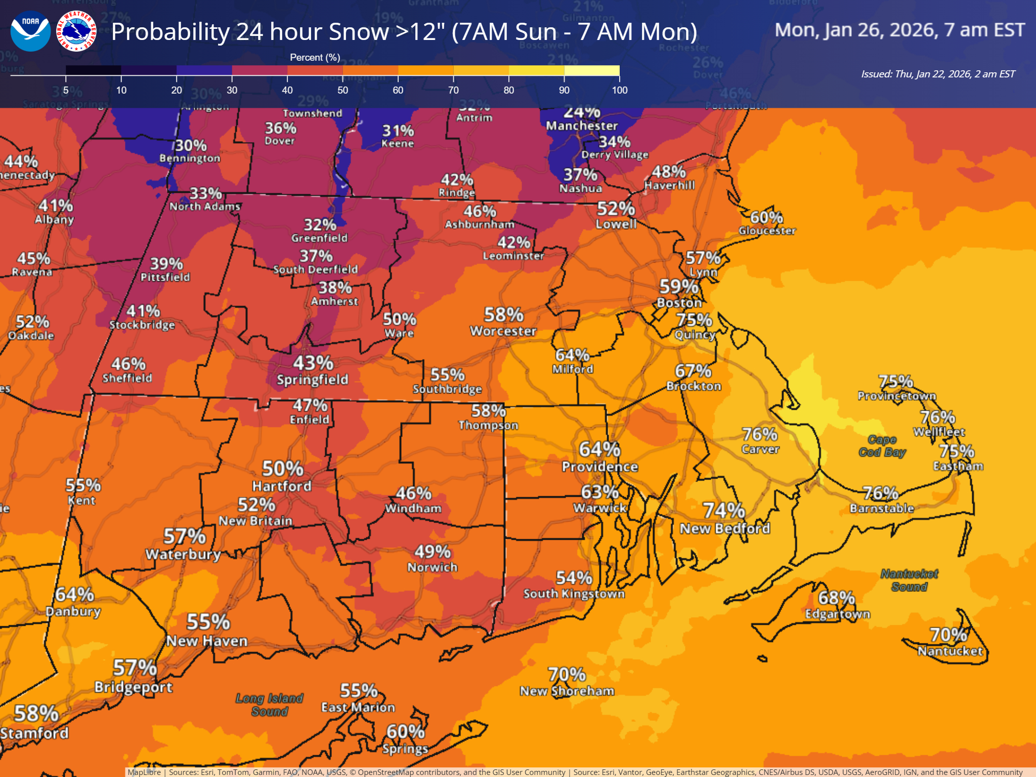
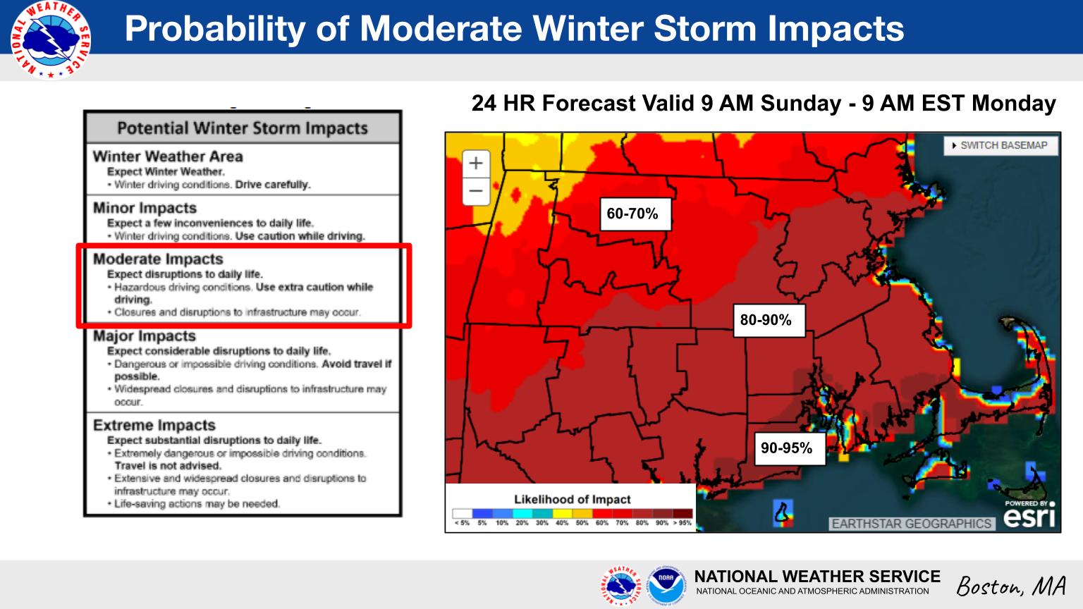
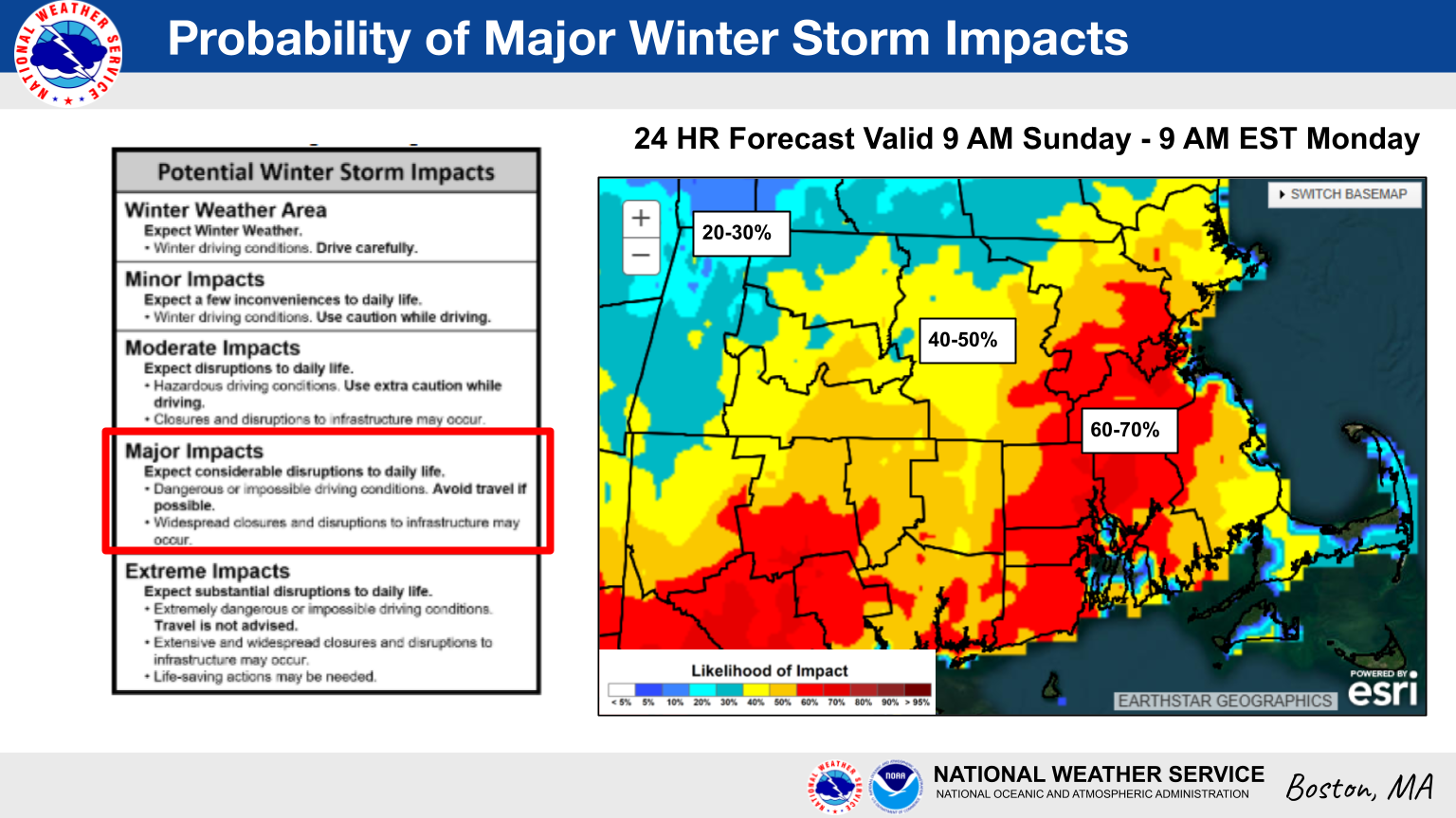
Good morning everyone, You'll find attached this morning's updated briefing graphics regarding 1) dangerous cold Friday night/Saturday morning and 2) a snowstorm expected Sunday into Monday. *Here are the main changes since the last briefing:* - An Extreme Cold Watch is in effect for the Berkshires for wind chill temperatures as low as -25 degrees Friday night into Saturday morning. - Probabilities of 6+ inches of snow have increased, as have probabilities of a moderate impact from said snow. While we remain 3 days out from the start of this storm which is too soon to settle on how exactly this will play out, confidence is increasing that an impactful snowstorm will impact the region. We'll provide an updated briefing no later than 3 PM today. Don't hesitate to reach out with any questions in the meantime. Thank you, Bryce Williams email: box.operations@noaa.gov phone: 508.622.3280 Slack/NWSChat 2.0 <https://nwschatws.slack.com/> (for approved partners) social media: Website <http://www.weather.gov/boston> | Facebook <http://www.facebook.com/NWSBoston> | Twitter <http://www.twitter.com/NWSBoston>