
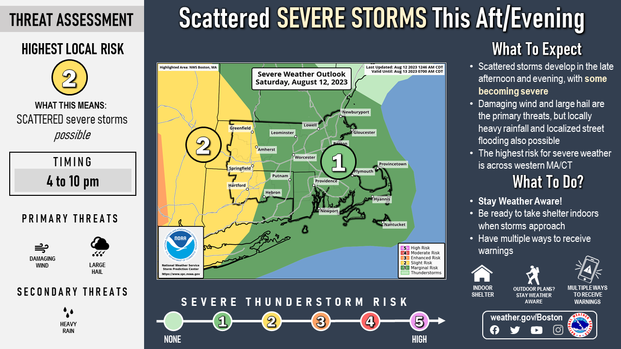
Good morning, There is not much change to the forecast regarding the severe weather potential today. Scattered storms are expected to develop later this afternoon and evening, and some storms may become severe. The primary threat is damaging wind and large hail, but locally heavy rainfall leading to street flooding is also possible. While severe storms are possible across all of SNE, the highest risk is across western MA/CT. Another round of a few strong to possibly severe storms are expected Sunday, with the greatest risk across eastern MA and Rhode Island. Please keep in touch with the latest forecasts and possible watches and warnings later this afternoon and tonight. Thank you. Kevin Cadima and Rob Megnia If you have any questions or would like more information, please don't hesitate to contact us. You can reach us via: email: box.operations@noaa.gov phone: 508.622.3280 Slack/NWSChat 2.0 <https://nwschatws.slack.com/> (for approved partners) social media: Website <http://www.weather.gov/boston> | Facebook <http://www.facebook.com/NWSBoston> | Twitter <http://www.twitter.com/NWSBoston>