
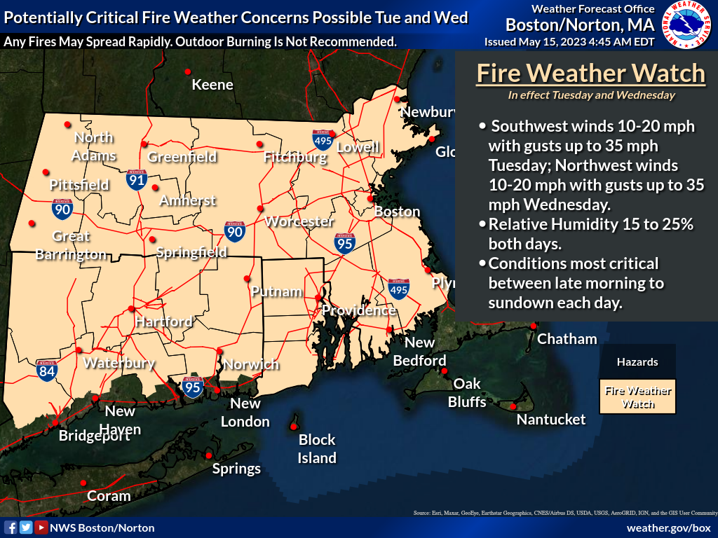
Good morning, Southern New England has not seen appreciable rainfall for the last several days. Full sunshine, gusty conditions and a dry air mass combined with the recent lack of rain will raise the risk for brushfires on Tuesday and Wednesday, with the most critical conditions expected between late morning to sundown each day. After coordination with state forestry officials, a Fire Weather Watch has been issued for Tuesday and Wednesday for portions of Southern New England. Following attached graphic is the Fire Weather Watch area for greater awareness. An update to this briefing will be issued when there are anticipated changes to the Fire Weather Watch, either to Warnings or Statements. Expect this update no later than Tuesday morning, or sooner if warranted. Thank You! Meteorologists: Andrew Loconto and Matt Belk If you have any questions or would like more information, don't hesitate to contact us via this email address, on NWSChat <https://nwschat.weather.gov/>, or at the following: National Weather Service Boston/Norton, MA 46 Commerce Way Norton, MA 02766 508.622.3280 Website <http://www.weather.gov/boston> | Facebook <http://www.facebook.com/NWSBoston> | Twitter <http://www.twitter.com/NWSBoston>