
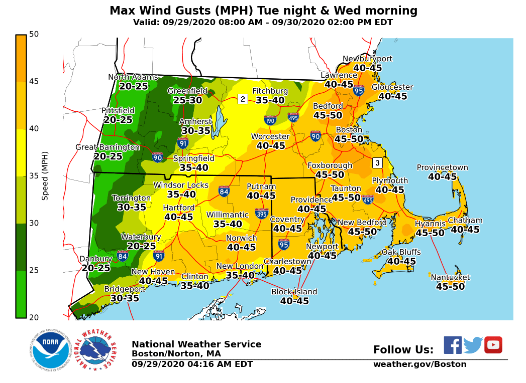
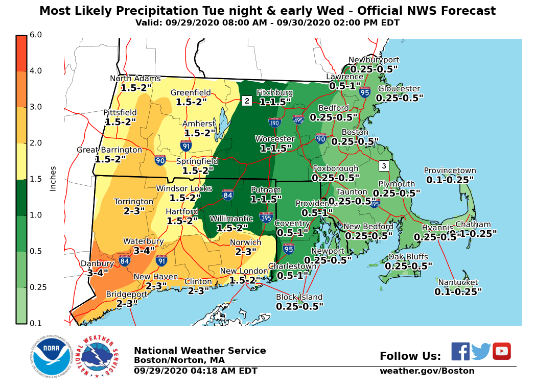
Good morning everyone, A period of strong to perhaps damaging winds may impact the region late tonight into early Wednesday morning along with heavy downpours. Here are the details... *What ... *Wind Advisory in effect for possible isolated wind damage *Where ... *portions of northern Connecticut, all of Rhode Island including the city of Providence and all of eastern Massachusetts including Cape Cod and the Islands along with the city of Boston. *When ... *2 am to 10 am Wednesday for the strongest winds *Impacts ... *strong winds with gusts up to 50 mph combined with trees remaining fully leaved and heavy downpours may result in isolated wind damage and power outages *Forecast Confidence ... *there remains some uncertainty on the magnitude and areal coverage of the winds. We should have more information regarding these details later today. Attached are two forecast graphics - 1) most likely maximum wind gusts and 2) most likely rainfall. These images will be updated by 5 pm today. Frank Nocera & Rodney Chai If you have any questions or would like more information, don't hesitate to contact us via this email address, on NWSChat <https://nwschat.weather.gov/>, or at the following: National Weather Service Boston/Norton, MA 46 Commerce Way Norton, MA 02766 508.622.3280 Website <http://www.weather.gov/boston> | Facebook <http://www.facebook.com/NWSBoston> | Twitter <http://www.twitter.com/NWSBoston>