
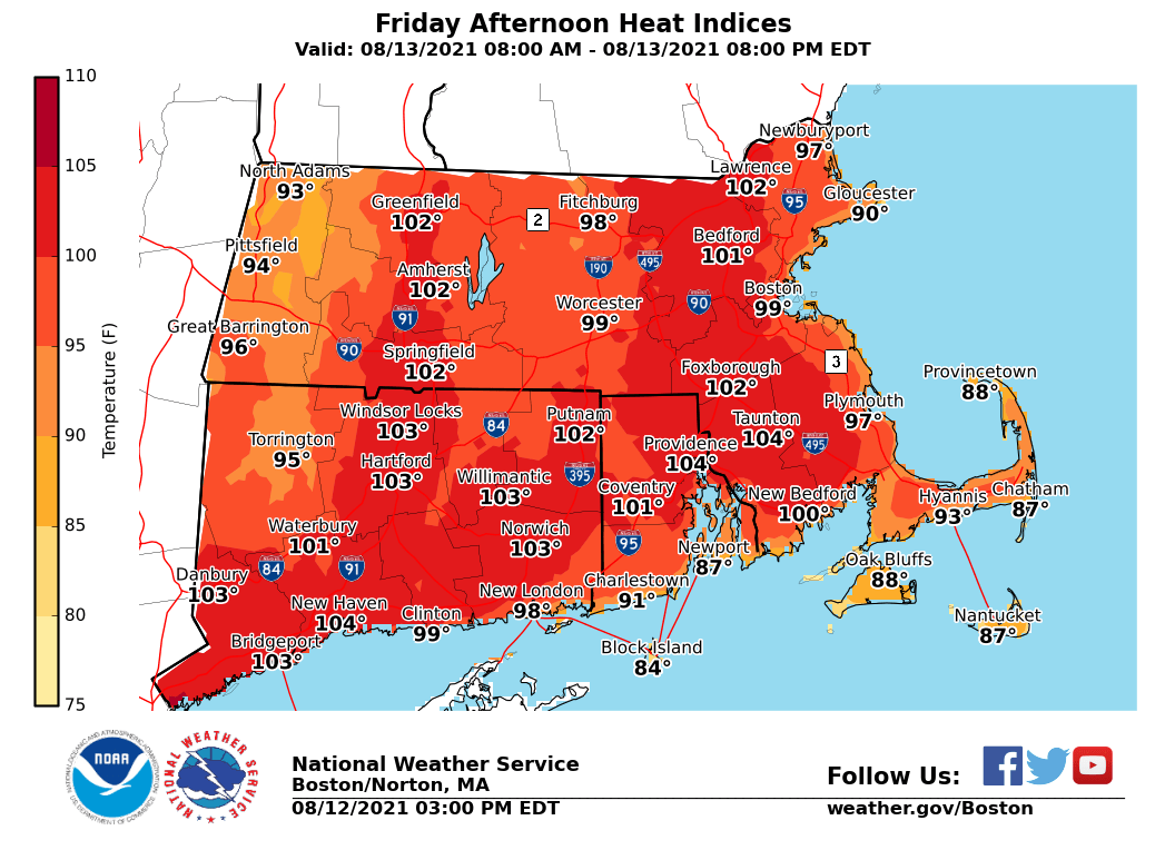
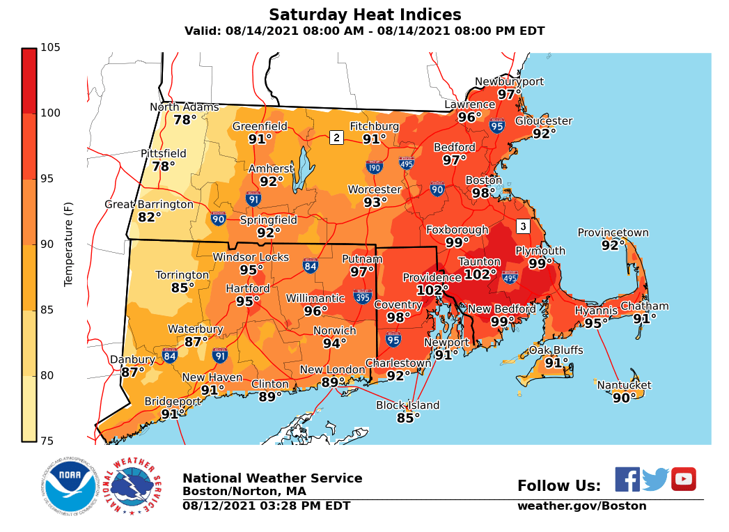
Good afternoon everyone This is an updated briefing on the Heat and Humidity through Saturday. Overall, the only real change to the forecast was to convert the Excessive Heat Watch to a Heat Advisory on Friday. The Heat Advisory was also expanded to include Cape Cod. *This Evening...* *- The potential for scattered strong to severe thunderstorms this evening.* - Greatest risk for severe weather this evening is northwest of I-95 & especially in western MA. - It is possible a Severe Thunderstorm Watch is issued for portions of the region. - Main threat begin localized damaging winds and brief heavy rain/localized street flooding through about midnight. Friday... - The Excessive Heat Watch has been converted to a Heat Advisory for Friday. - Heat Indices between 98 and 104 degrees on Friday. - A few strong thunderstorms are possible late Friday afternoon and evening, but the overall threat looks less than this evening with the focus across western MA and CT. Saturday... - One more day of heat and humidity is on tap for Saturday. - Heat Advisories may be needed for parts of the area especially CT/RI/SE MA. Heat Indices of 95-100+ possible. - A few strong to severe thunderstorms are possible Saturday afternoon and evening with the best chance towards the I-95 corridor and south of the MA Turnpike. A one-pager briefing has been attached for Friday and Saturday. We have also included the expected Heat Indices for both days. If you have any questions or would like more information, don't hesitate to contact us via this email address, on NWSChat <https://nwschat.weather.gov/>, or at the following: National Weather Service Boston/Norton, MA 46 Commerce Way Norton, MA 02766 508.622.3280 Website <http://www.weather.gov/boston> | Facebook <http://www.facebook.com/NWSBoston> | Twitter <http://www.twitter.com/NWSBoston>