
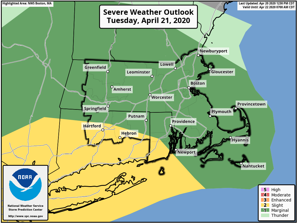
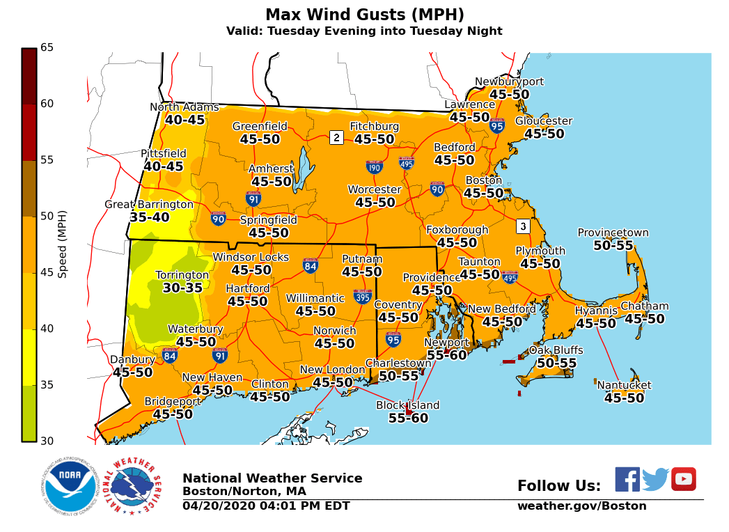
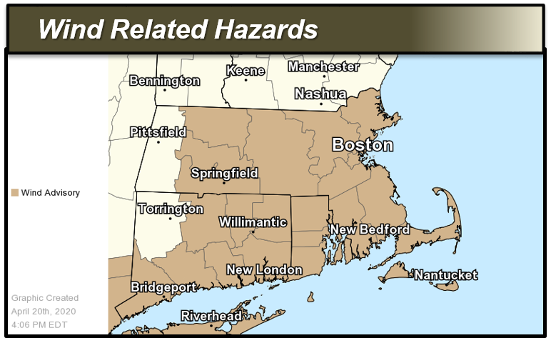
Good afternoon, A strong cold front will bring scattered heavy showers and thunderstorms Tuesday afternoon and strong gusty winds Tuesday into Wednesday. A Wind Advisory has been issued. Details below: *Headlines:* - *Wind Advisory: * For all of southern New England except for Berkshire County in Massachusetts and Litchfield County in Connecticut from 5 PM Tuesday through 3 AM Wednesday. *Details:* *Gusty Winds: Tuesday into Wednesday* - *Timing: *South winds through Tuesday afternoon. West-northwest winds Tuesday evening into Wednesday. Strongest winds expected Tuesday night into Wednesday, decreasing later Wednesday afternoon. - *Peak Wind Gusts: * - *Tuesday - Tuesday night: 3*5-50 mph. - *Impacts:* Scattered tree and powerline damage, especially Tuesday evening into Wednesday. - *Confidence*: Moderate to high on wind gust speeds, but there is some uncertainty as to how widespread wind gusts over 45 mph will be. *Thunderstorms - A Few Strong to Severe: Tuesday Afternoon into Early Evening* - *Timing: *Between 1 to 9 PM Tuesday. - *Thunderstorm Coverage:* Scattered. - *Threats:* Mainly heavy downpours, lightning, small hail, and gusty winds 35-50 mph. Low risk of severe storms that may produce hail up to 1" in diameter and wind gusts capable of causing sporadic tree and powerline damage. - *Confidence:* Higher confidence in the timing. Lower confidence on severe storm coverage. Storms may tend more in the "strong" category than severe, and not every town will see thunderstorms. Thanks Bryce Williams and Rodney Chai If you have any questions or would like more information, don't hesitate to contact us via this email address, on NWSChat <https://nwschat.weather.gov/>, or at the following: National Weather Service Boston/Norton, MA 46 Commerce Way Norton, MA 02766 508.622.3280 Website <http://www.weather.gov/boston> | Facebook <http://www.facebook.com/NWSBoston> | Twitter <http://www.twitter.com/NWSBoston>