
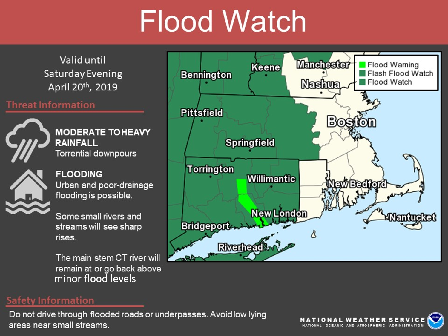
Good morning everyone, Widespread rain with embedded heavier showers continues this morning and through this evening. Total rainfall amounts of 1 to 2 inches is forecast. Details below: *What / Where / When * - Interior Flooding - With the possibility of urban and poor-drainage flooding, the FLOOD WATCH continues for western and central MA, all of CT where heaviest rainfall is forecast. - River Flooding - In addition to snow melt further upstream, heavy rainfall will exacerbate main stem flooding along the Connecticut River with some locations going back above minor flood levels. - It may also contribute to sharp rises for a few smaller streams throughout the area. - For more specific details, please see NWS river forecasts at: https://water.weather.gov/ahps2/index.php?wfo=box - Coastal Flooding - Only minimal tidal departures were noted during last evening's high tide along the south coast. We are not expecting much, if any, inundation issues today. Thank you Bryce Williams If you have any questions or would like more information, don't hesitate to contact us via this email address, on NWSChat <https://nwschat.weather.gov/>, or at the following: National Weather Service Boston/Norton, MA 46 Commerce Way Norton, MA 02766 508.622.3280 Website <http://www.weather.gov/boston> | Facebook <http://www.facebook.com/NWSBoston> | Twitter <http://www.twitter.com/NWSBoston>