
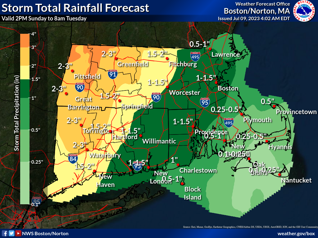
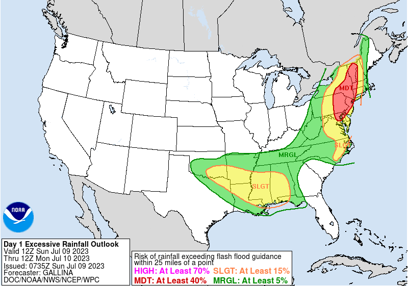
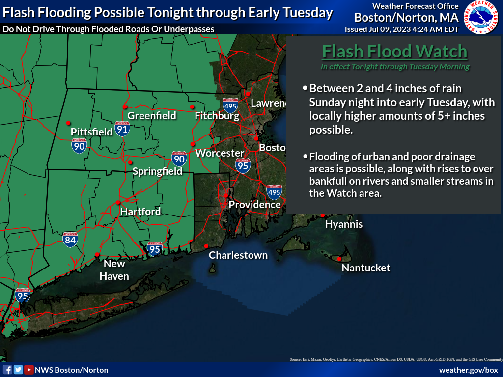
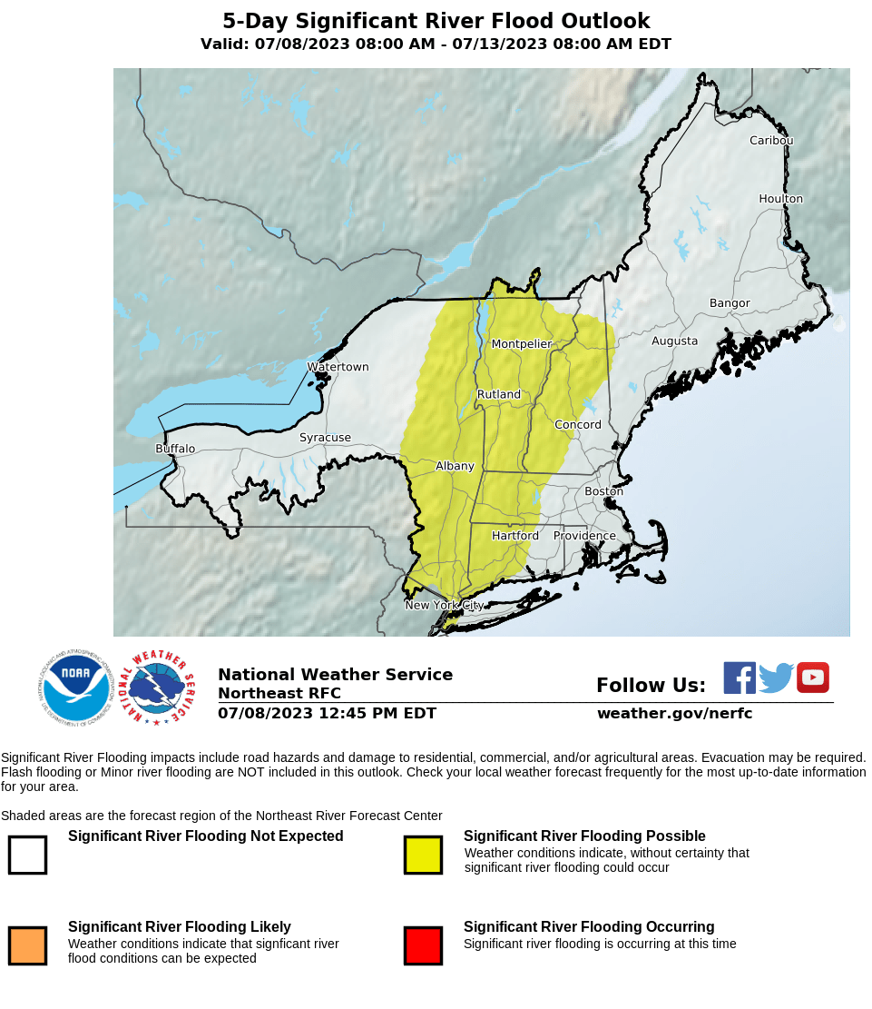
Good morning, Please find attached an updated one page briefing regarding expected periods of heavy rainfall beginning this afternoon and continuing through early Tuesday morning. Since yesterday's briefing *confidence has increased that the greatest threat for excessive rainfall will be across western MA/CT where widespread 2 to 4 inches of rainfall is forecast to fall between this afternoon and early Tuesday morning. Locally higher amounts of 5+ inches will be possible over this area as well. * There remains a moderate risk for excessive rainfall/flash flooding across western MA with the rest of southern New England in a slight risk category. No changes have been made to the existing flood watch. See the attached graphics for more details. We'll provide another update later this afternoon when new information becomes available. Thank you, Rob Megnia and Kevin Cadima If you have any questions or would like more information, don't hesitate to contact us via this email address, on NWSChat <https://nwschat.weather.gov/>, or at the following: National Weather Service Boston/Norton, MA 46 Commerce Way Norton, MA 02766 508.622.3280 Website <http://www.weather.gov/boston> | Facebook <http://www.facebook.com/NWSBoston> | Twitter <http://www.twitter.com/NWSBoston>