
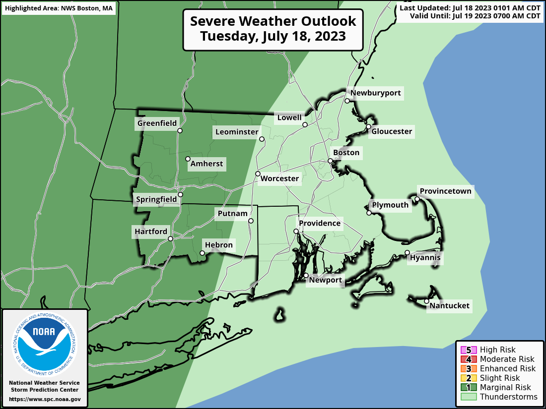
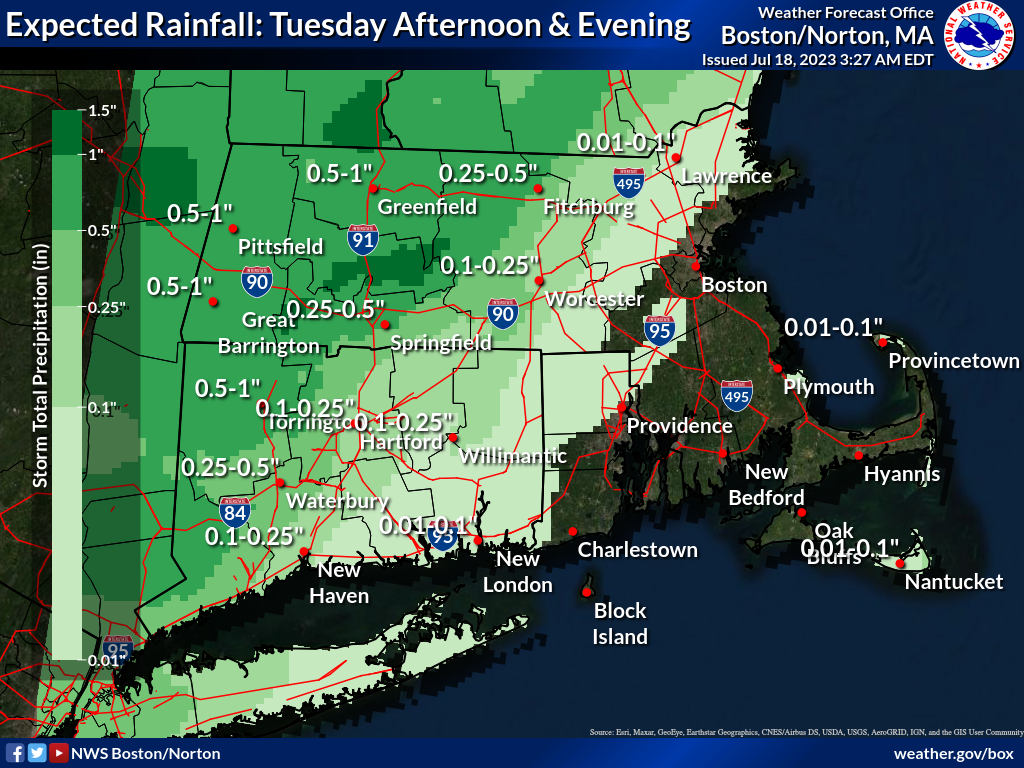
Good morning everyone, Attached is a one-pager briefing which provides information on the localized flash flood threat across western-central MA into northwest CT Tuesday afternoon and evening. There is also a low chance of severe thunderstorms across this region, with localized wind damage and hail being the main hazards. Farther east into RI and northeast MA, including the Providence to Boston corridor, dry weather may prevail today. We have also attached a Flood Watch graphic, latest rainfall forecast and severe weather outlook. If you have any questions or would like more information, don't hesitate to contact us via this email address, on NWSChat <https://nwschat.weather.gov/>, or at 508.622.3280. Frank Nocera & Matt Belk National Weather Service Boston/Norton, MA 46 Commerce Way Norton, MA 02766 508.622.3280 Website <http://www.weather.gov/boston> | Facebook <http://www.facebook.com/NWSBoston> | Twitter <http://www.twitter.com/NWSBoston>