
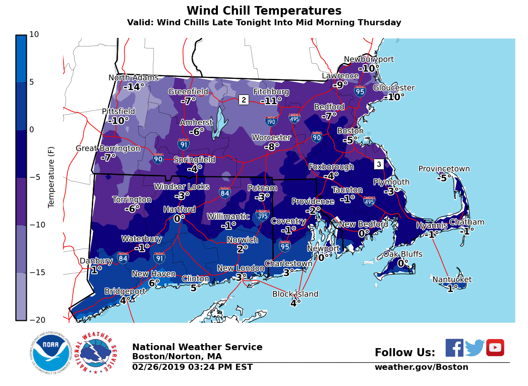
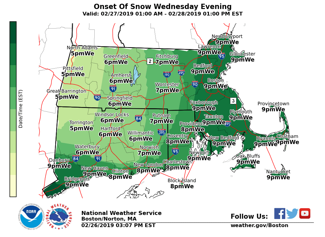
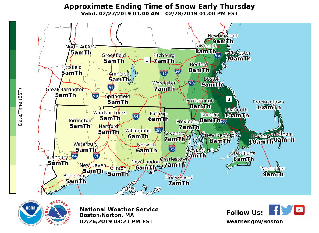
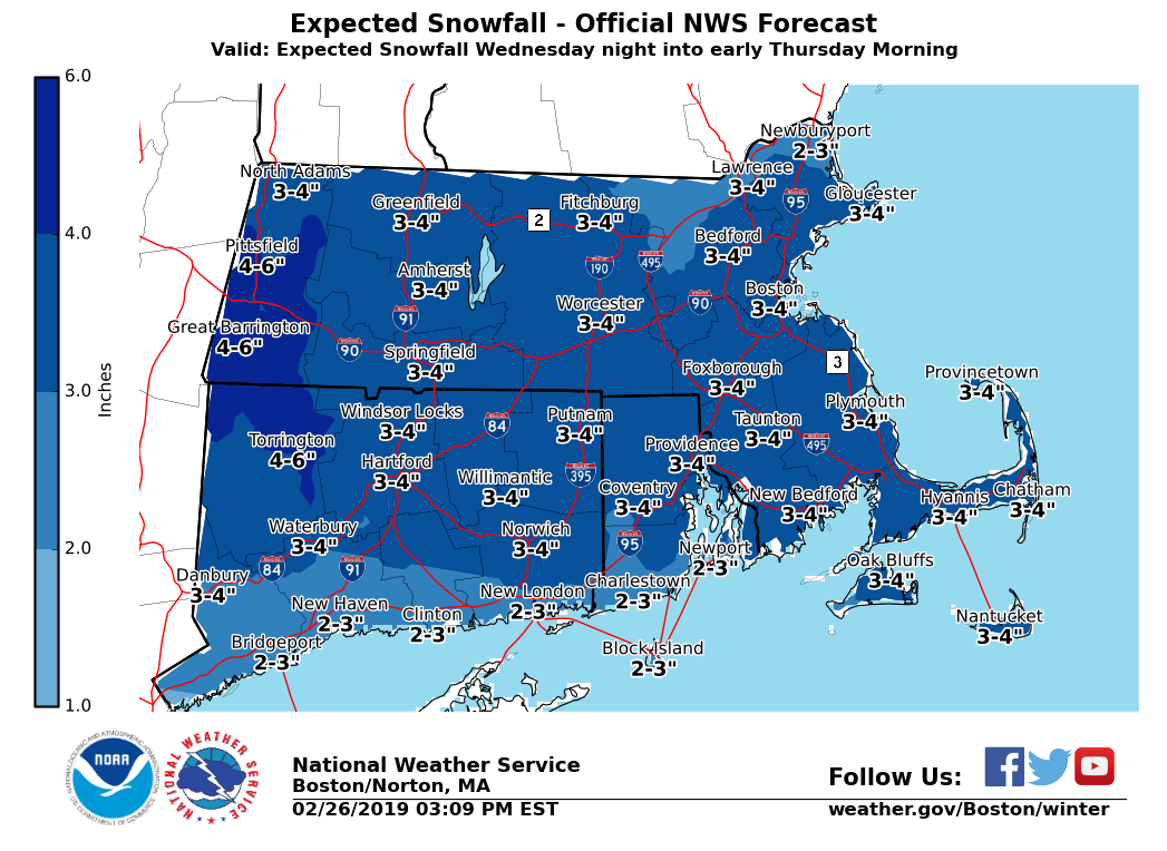
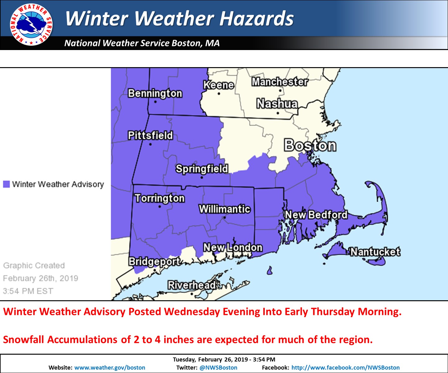
Good afternoon everyone A Winter Weather Advisory has been issued for western MA as well as areas along and south of the MA turnpike Wednesday evening into early Thursday morning. A briefing has been attached to this email along with a few graphics. These include late tonight into mid morning Wednesday Wind Chills, approximate start/stop times of the snow, current winter weather headlines, as well as expected snowfall amounts. *Wind Chills:* - A Wind Chill Advisory remains in effect for the East Slopes of the Berkshires and Northern Worcester County late tonight into mid morning Wednesday. - Wind Chills overnight into Wednesday morning will drop to between 10 and 15 below zero. *Accumulating Snow Wednesday Evening into early Thursday morning:* *What/Where:* - Total snow accumulations of 2 to 4 inches expected across most of southern New England. - A Winter Weather Advisory has been issued for western MA and areas along and south of the MA turnpike, where the greatest potential exists for reaching the higher amounts exists. *When:* *- *Light snow will overspread western MA/northern CT including the Hartford and Springfield Metro areas between 5 and 7 pm Wednesday evening. Some slippery spots possible for the latter half of the evening commute, but snowfall rates will be rather light. - Light snow overspreads eastern MA and RI between 7 and 10 pm. - Bulk of the accumulating snow occurs between 11 pm and 4 am Thursday morning, but snowfall rates should generally remain less than 1 inch per hour. - Snow should pretty much end between 4 and 7 am Thursday morning from west to east. Light snow may linger through late Wednesday morning across eastern MA. - Despite heaviest snow being over by the Thursday morning rush hour, temperatures in the upper teens and lower 20s may result in untreated roads remaining snow covered and slippery. *Uncertainty/When We Will Know More:* *- *A general 2 to 4 inches of snow is expected across the region. Confidence in the higher amounts is across western MA and areas along and south of the MA Turnpike, but given this is 24 to 36 hours out this axis may shift. - Snowfall amounts are still subject to change. A weaker system would result in many areas receiving only an inch or two of snow, but on the flip side of the coin a stronger system would result in the potential for 3 to 6 inch amounts. - Confidence will increase in the forecast by early Wednesday morning. Please let us know if you have any questions or concerns. Thank You Meteorologist: Hayden Frank If you have any questions or would like more information, don't hesitate to contact us via this email address, on NWSChat <https://nwschat.weather.gov/>, or at the following: National Weather Service Boston/Norton, MA 46 Commerce Way Norton, MA 02766 508.622.3280 Website <http://www.weather.gov/boston> | Facebook <http://www.facebook.com/NWSBoston> | Twitter <http://www.twitter.com/NWSBoston>