
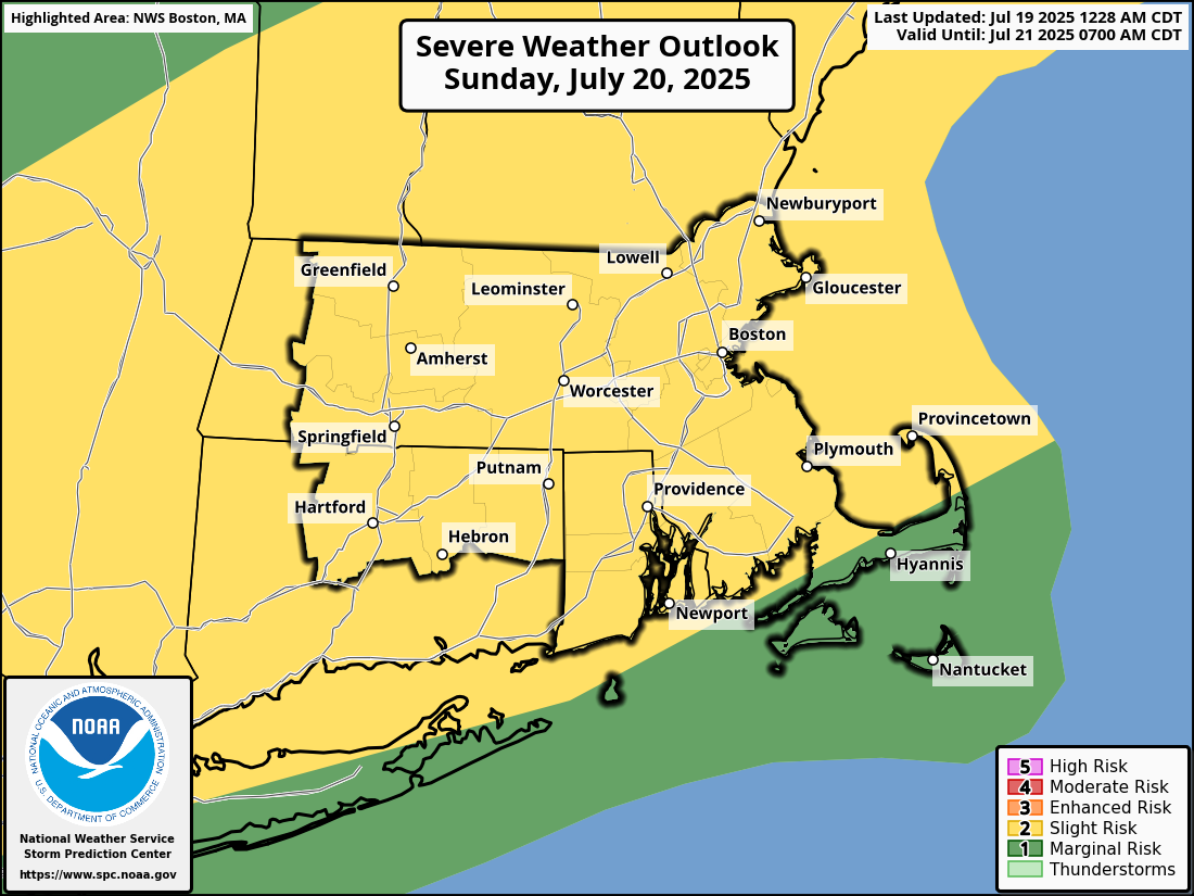
Good morning, We wanted to give you all a heads up on the potential for two rounds of storms on Sunday. A few showers and thunderstorms are possible late tonight into Sunday morning, especially across CT, RI and southeast MA. Heavy rainfall and localized street flooding may accompany this activity, but the location of the heavy rainfall is uncertain so confidence is low. Latest indications are that the south coast has the greatest risk, but the heaviest rainfall could end up to the south. A second round of scattered severe storms is possible Sunday afternoon and evening. The Storm Prediction Center has upgraded to a Slight (Level 2) Risk for southern New England on Sunday. Damaging wind gusts are the primary threat with these storms. Thanks. Kevin Cadima If you have any questions or would like more information, please don't hesitate to contact us. You can reach us via: email: box.operations@noaa.gov phone: 508.622.3280 Slack/NWSChat 2.0 <https://nwschatws.slack.com/> (for approved partners) social media: Website <http://www.weather.gov/boston> | Facebook <http://www.facebook.com/NWSBoston> | Twitter <http://www.twitter.com/NWSBoston>