
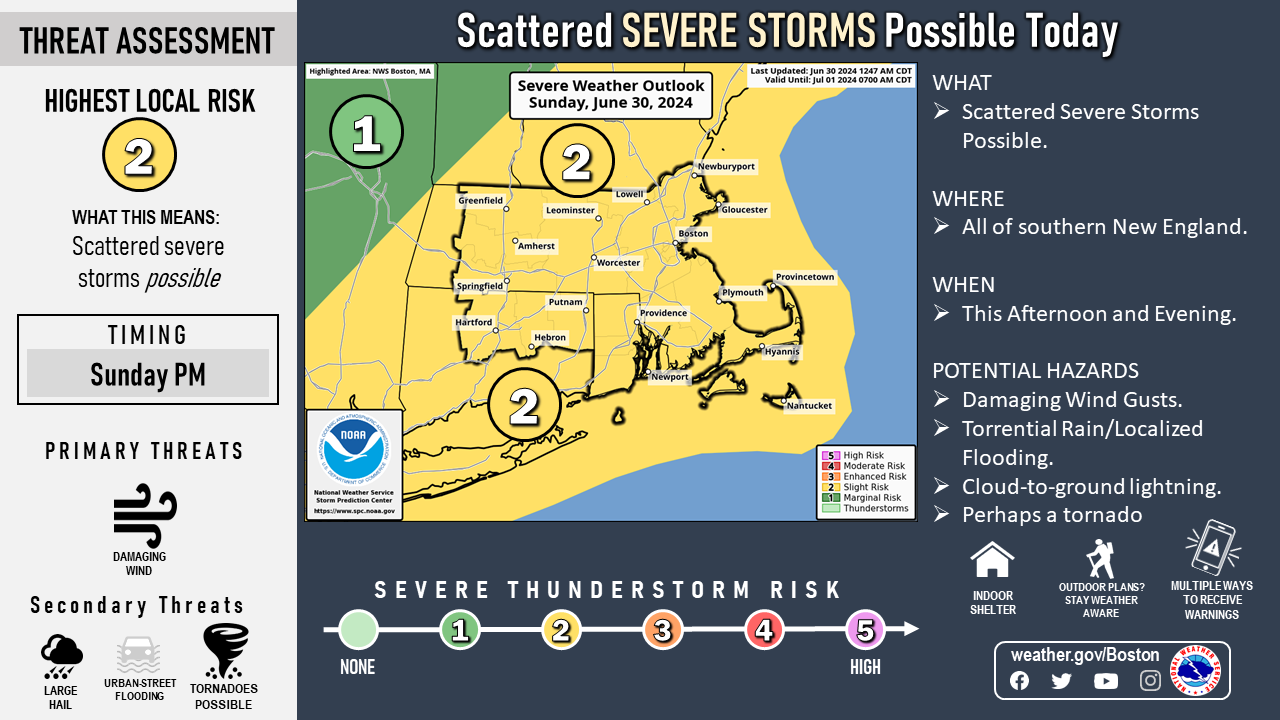
Good morning, Following is a weather update regarding the potential for strong to severe thunderstorms later today. We continue to monitor two potential rounds of thunderstorms for today, but the period we are most concerned about regarding strong to severe storms is this afternoon and evening, mainly north and west of I-95. Storms are expected to take on a line structure, meaning more locations could see thunderstorms, posing a primary risk for straight-line wind damage. There may also be some instances of large hail, torrential downpours capable of street flooding, frequent lightning and even a low risk for an isolated tornado. The main risk timing is between 2 PM and 10 PM. Some risk for strong to severe storms may exist from the Boston to Providence I-95 corridor southeastward, but it is uncertain if storms maintain their strength as they approach the coast. As alluded to above, a round of thunderstorms is also possible early this morning. These would be mainly for CT and south coastal RI and MA, and are not expected to become strong to severe. Thank You! Meteorologists: Bill Leatham and Matthew Belk If you have any questions or would like more information, please don't hesitate to contact us. You can reach us via: email: box.operations@noaa.gov phone: 508.622.3280 Slack/NWSChat 2.0 <https://nwschatws.slack.com/> (for approved partners) social media: Website <http://www.weather.gov/boston> | Facebook <http://www.facebook.com/NWSBoston> | Twitter <http://www.twitter.com/NWSBoston>