
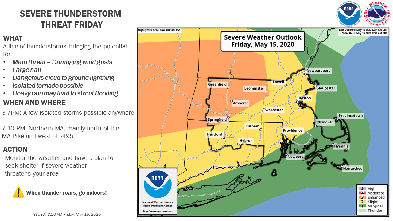
Good morning everyone, We are still expecting a round of strong to severe thunderstorms to move through southern New England this afternoon and evening. The main line of storms has trended a bit slower, decreasing the threat a bit. This would bring the main line of storms through after 7 PM, while there remains a threat for a few isolated storms out ahead of the main line during the afternoon. *Threats:* Main threat - Damaging winds In addition to damaging winds there is also a threat of large hail, dangerous cloud to ground lightning, an isolated tornado, and heavy rain may lead to street flooding. *Timing and Threat Area:* 3-7PM: A few Isolated storms possible anywhere (lesser sever threat) 7-10 PM: Northern MA, mainly north of the MA Pike and west of I-495 Thank You, Bryce Williams and Frank Nocera If you have any questions or would like more information, don't hesitate to contact us via this email address, on NWSChat <https://nwschat.weather.gov/>, or at the following: National Weather Service Boston/Norton, MA 46 Commerce Way Norton, MA 02766 508.622.3280 Website <http://www.weather.gov/boston> | Facebook <http://www.facebook.com/NWSBoston> | Twitter <http://www.twitter.com/NWSBoston>