
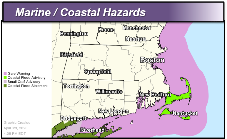
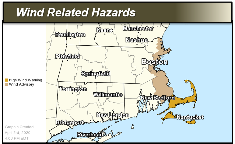
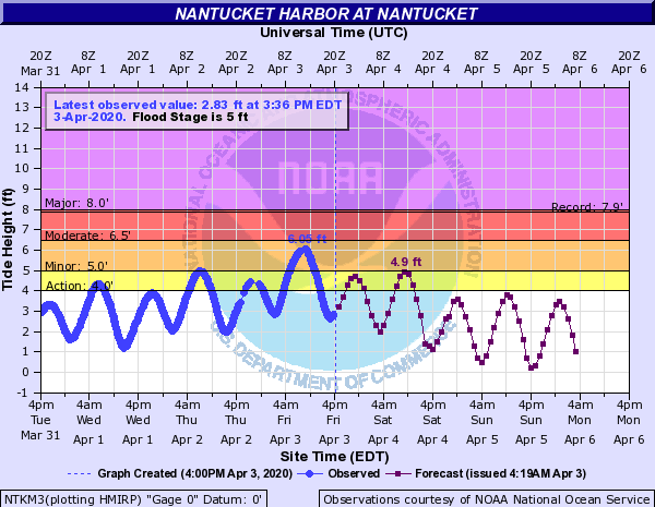
Good afternoon, We've passed the peak of the storm in terms of both coastal flooding and high winds. Below is an update on what remains for tonight into tomorrow morning. *Headlines:* - High Wind Warning*: *Through this evening for Cape Cod, Nantucket, Martha's Vineyard - *Wind Advisory*: Through this evening for the east coast of MA north of Cape Cod - *Coastal Flood Advisory*: In effect for this evening's high tide for Cape Cod, Nantucket, and Martha's Vineyard - *Gale Warning*: Through this evening on all waters. *Details:* *Strong to Damaging Winds:* Winds will slowly diminish through the evening and overnight. Downed trees and power lines will continue to be possible into the evening. *Coastal Flooding: *Minor coastal flooding is possible during high tide this evening for Cape Cod and the Islands. Additionally, Nantucket may still have minor flooding issues with Saturday morning's high tide. *COASTAL FLOOD DEFINITIONS ...* Minor Coastal Flooding - Flooding of the most vulnerable shore roads and/or basements due to height of storm tide or wave splash over. - Majority of roads remain passable with only isolated closures due to nuisance flooding or rip rap. - Isolated inundation up to a foot is possible. - There is no significant threat to life and any impact on property is minimal. - This type of event is covered by a Coastal Flood Advisory. The link below provides Coastal Flood Threat and Inundation Mapping ... https://www.weather.gov/box/coastal Thank you, Bryce Williams, Bill Babcock, and Bill Leatham If you have any questions or would like more information, don't hesitate to contact us via this email address, on NWSChat <https://nwschat.weather.gov/>, or at the following: National Weather Service Boston/Norton, MA 46 Commerce Way Norton, MA 02766 508.622.3280 Website <http://www.weather.gov/boston> | Facebook <http://www.facebook.com/NWSBoston> | Twitter <http://www.twitter.com/NWSBoston>