
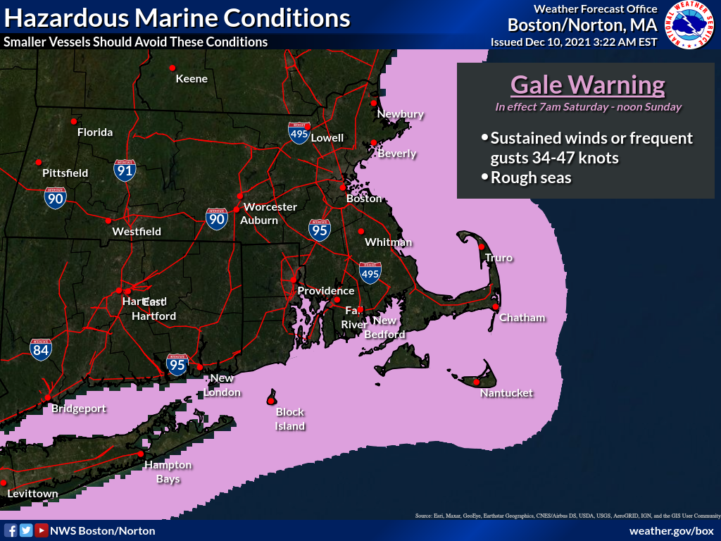
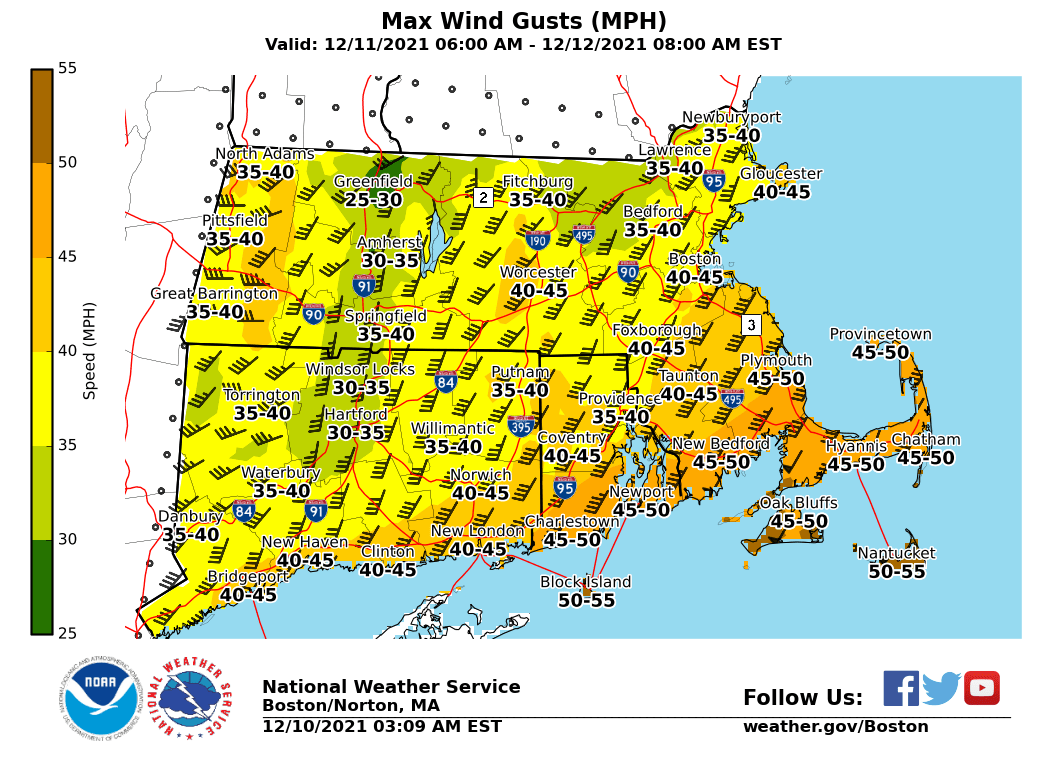
Good morning, Attached is an updated one-page briefing regarding the potential for strong winds tomorrow into tomorrow night. We've also attached a graphic of the maximum wind gusts in MPH based on the latest forecast update. Since the last briefing we have raised a gale warning for the coastal waters that will go into effect at 7am Saturday morning. Confidence is increasing that we will need to raise wind headlines over land. This would likely happen in the next 12 to 24 hours as we iron out the fine details on the timing and areal extent of potentially damaging wind gusts. Expect our next briefing to you no later than 6 PM this afternoon Thank You! Meteorologists: Rob Megnia and Hayden Frank If you have any questions or would like more information, don't hesitate to contact us via this email address, on NWSChat <https://nwschat.weather.gov/>, or at the following: National Weather Service Boston/Norton, MA 46 Commerce Way Norton, MA 02766 508.622.3280 Website <http://www.weather.gov/boston> | Facebook <http://www.facebook.com/NWSBoston> | Twitter <http://www.twitter.com/NWSBoston>