
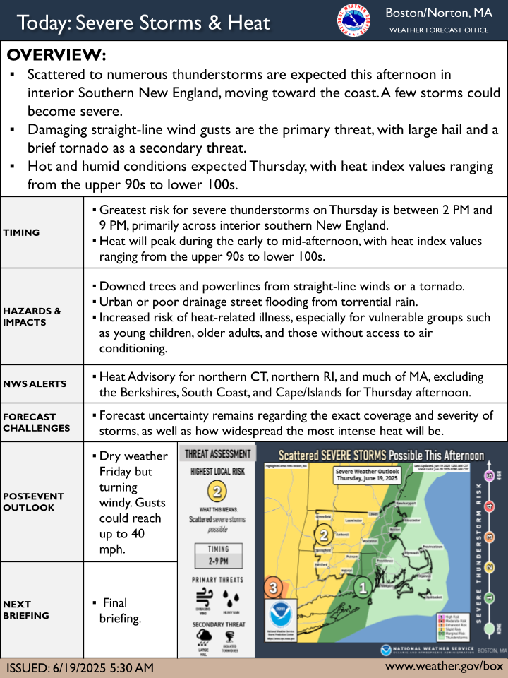
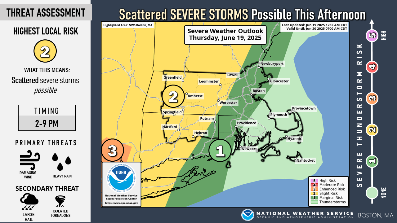
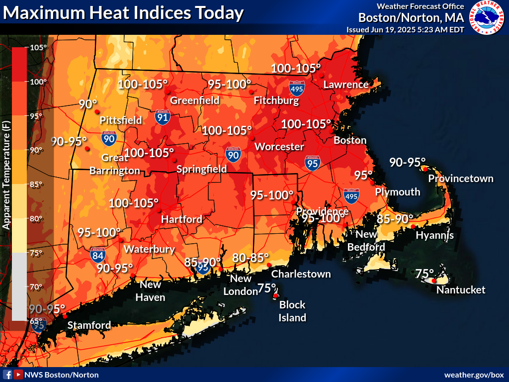
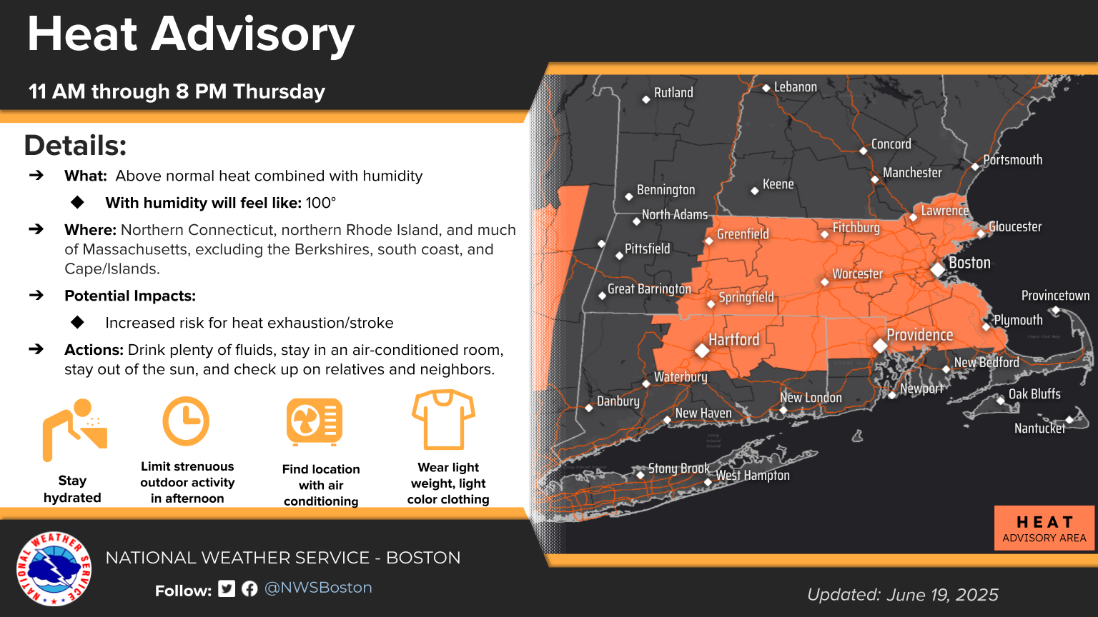
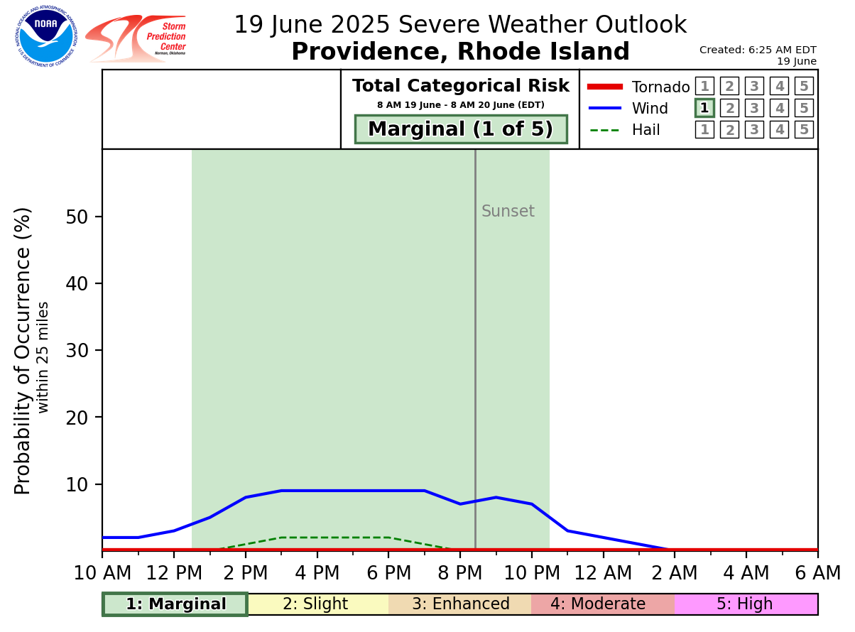
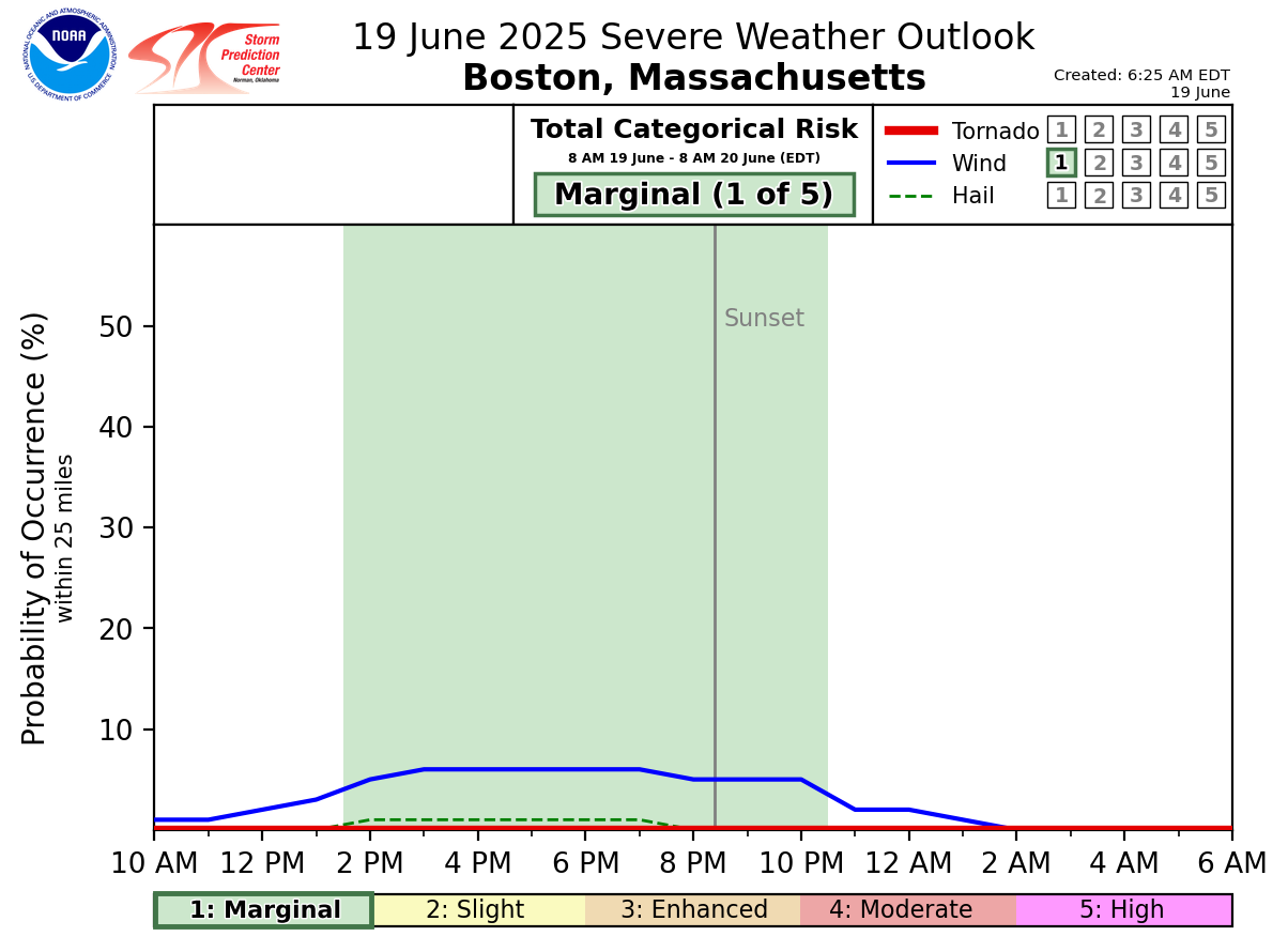
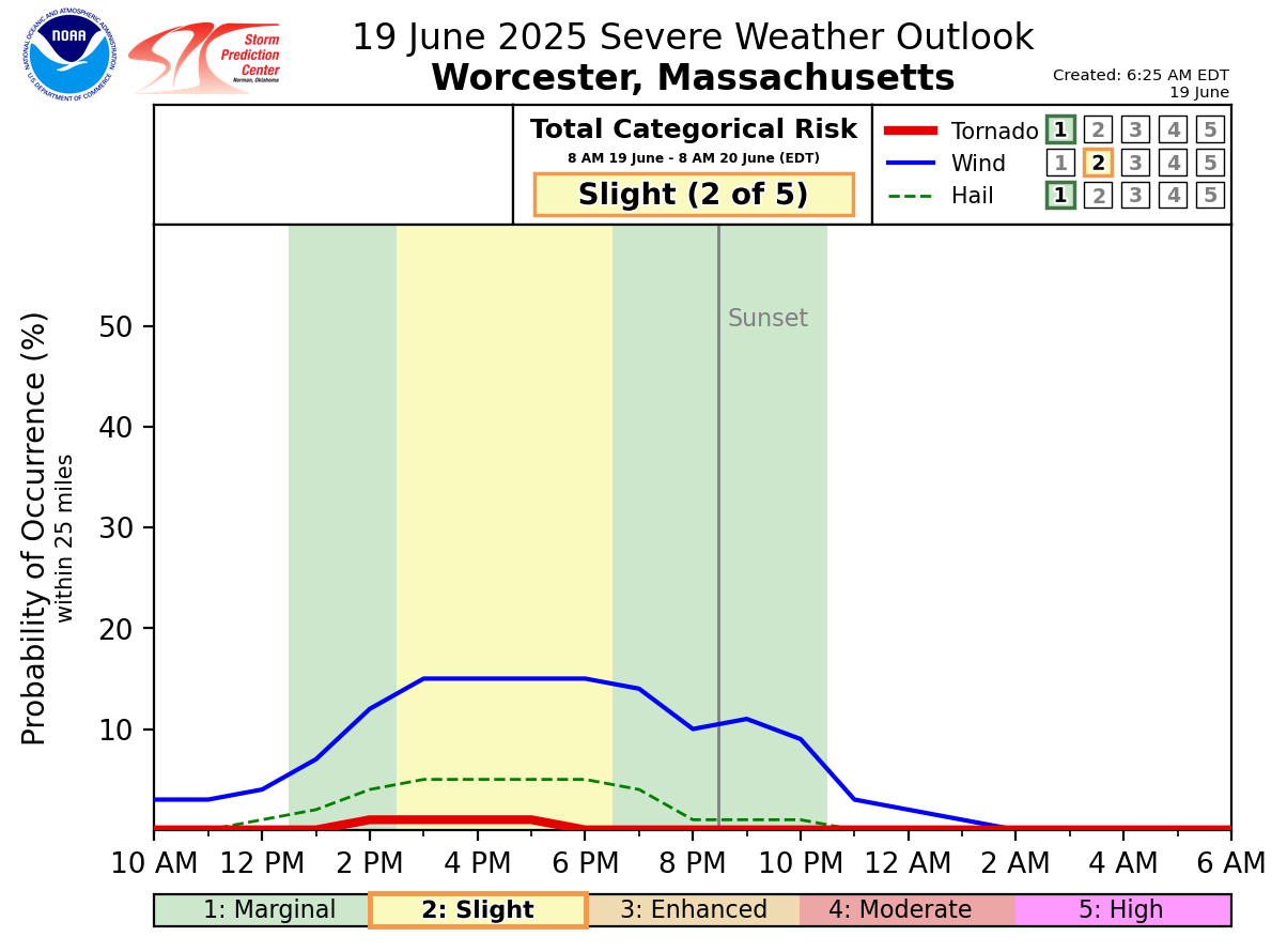
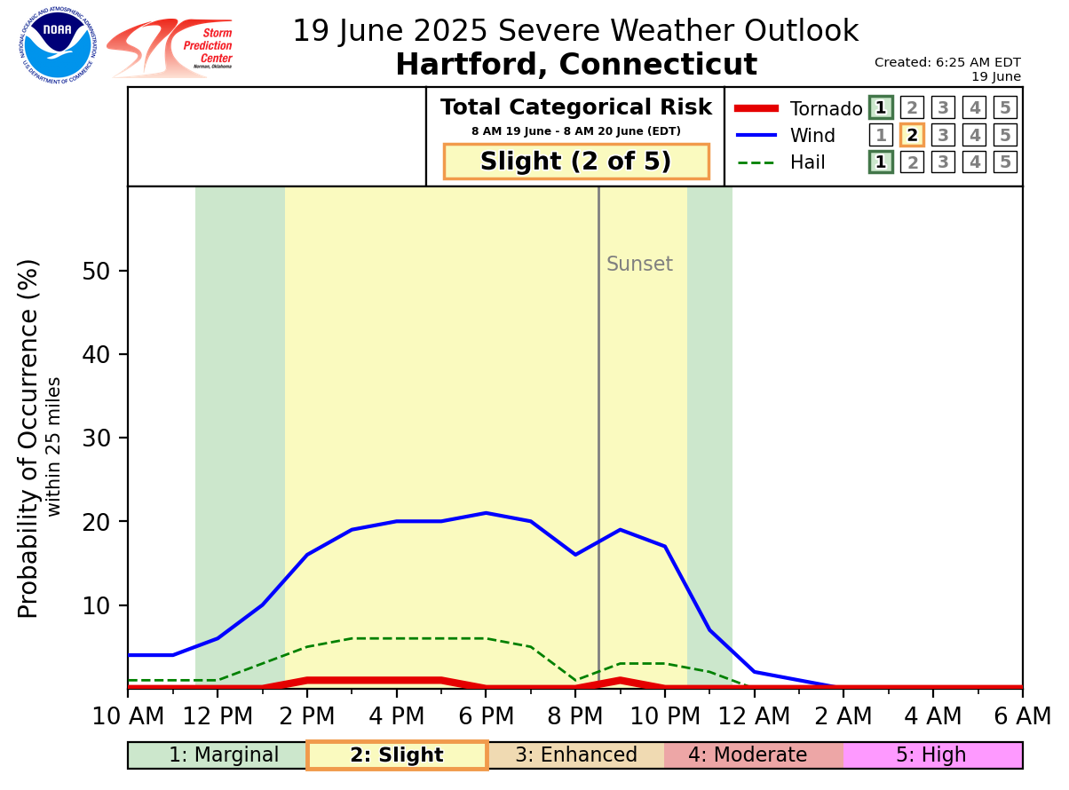
Good Morning, There are no significant changes to the forecast this morning. We are still expecting very hot and humid conditions today as well as scattered severe thunderstorms this afternoon. Attached are the one-page briefing, heat graphics, and experimental timing graphics for the thunderstorms this afternoon in Boston, Hartford, Worcester, and Providence. *Severe Thunderstorms:* The greatest risk for severe storms is between 3 PM and 10 PM, primarily across interior southern New England. The threat diminishes farther east. The main hazard continues to be damaging straight-line wind gusts, with large hail and a brief tornado as secondary threats. Localized torrential downpours may also result in street flooding, particularly in urban areas. *Heat and Humidity:* Heat and humidity will peak during the early to mid-afternoon, with heat index values in the upper 90s to lower 100s. A Heat Advisory will go into effect at 11 AM for northern Connecticut, northern Rhode Island, and much of Massachusetts—excluding the Berkshires, south coast, and Cape/Islands. This will be the last briefing for this event. Meteorologists: Emily McMinn and Andrew Loconto If you have any questions or would like more information, please don't hesitate to contact us. You can reach us via: email: box.operations@noaa.gov phone: 508.622.3280 Slack/NWSChat 2.0 <https://nwschatws.slack.com/> (for approved partners) social media: Website <http://www.weather.gov/boston> | Facebook <http://www.facebook.com/NWSBoston> | Twitter <http://www.twitter.com/NWSBoston>