
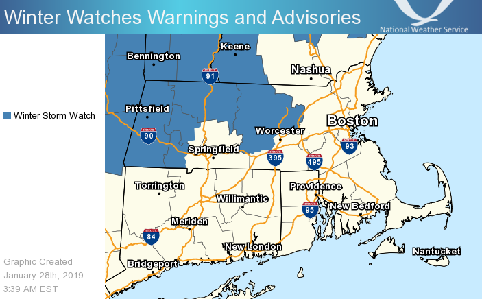
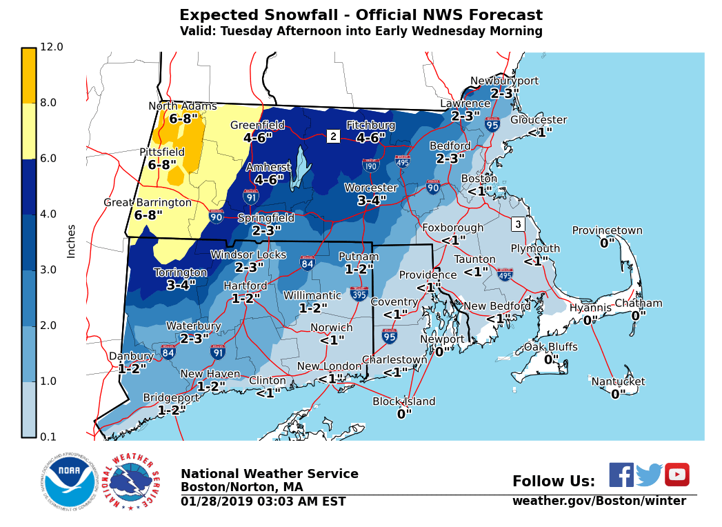
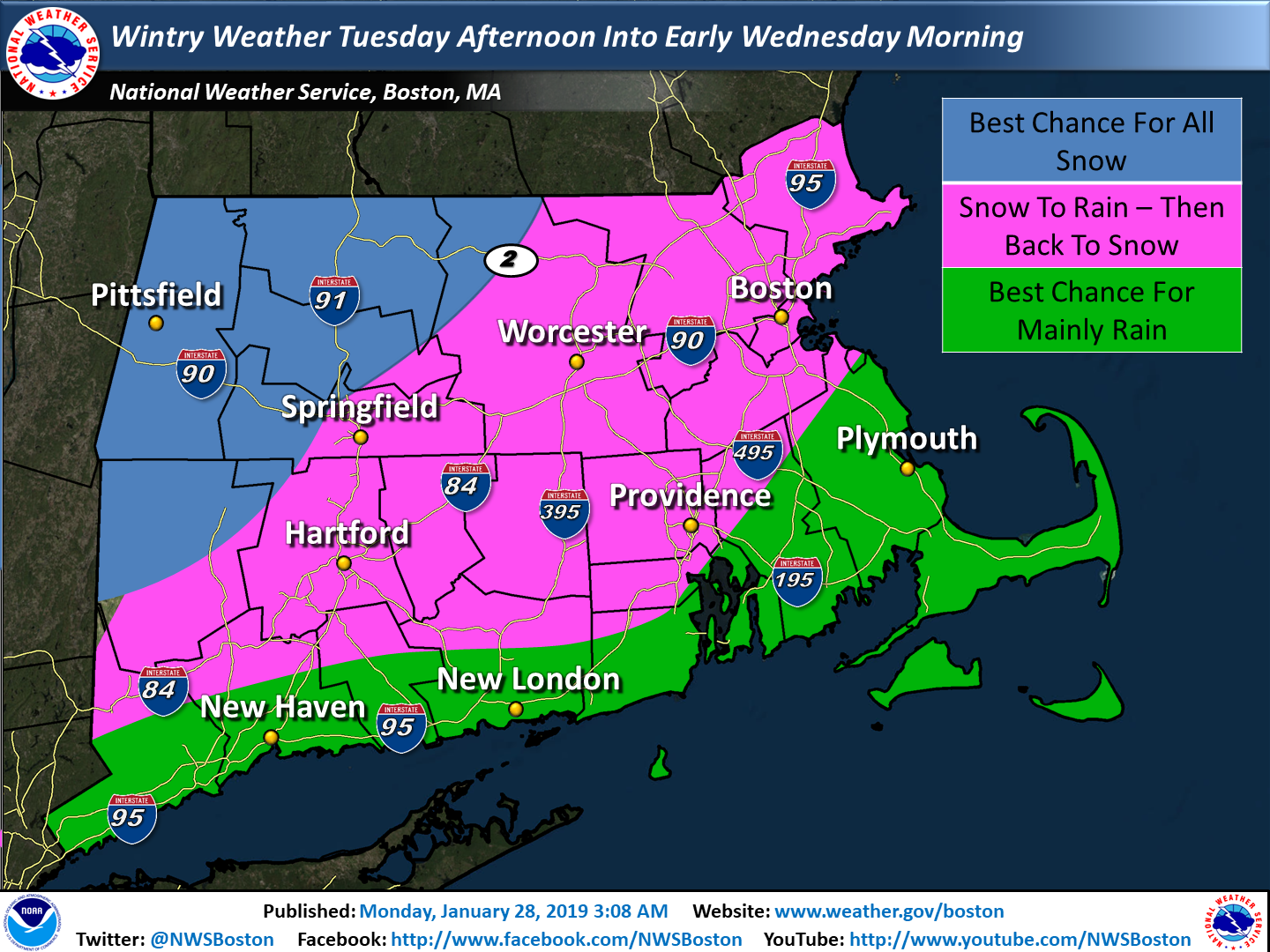
Good Morning, We have attached our latest snowfall and precipitation type forecasts for Tuesday afternoon into Wednesday. *Changes:* - Winter Storm Watch issued from the east slopes of the Berkshires into northern Worcester County for the possibility of 4 to 8 inches of snow. *Timeline:* - Snow begins Tuesday afternoon in western New England and reaches the coast early Tuesday evening. - Snow may be heavy at times from the Berkshires to northern Worcester County Tuesday night. - Snow quickly changes to rain Tuesday night in Providence and Boston with little accumulation. - Snow should mix with, or possibly change to rain as far inland as Hartford, Springfield, Worcester, and Lawrence Tuesday night where a few inches of snow should accumulate. - Colder air arrives before daybreak Wednesday morning, resulting in a change back to snow for most of southern New England before ending. - Gale force NW winds and light to moderate freezing spray on the MA/RI waters Wednesday through Thursday morning. *Uncertainty:* - How far inland the rain/snow line gets Tuesday night. - We should know more in time for the next update (by 5 PM today) If you have any questions or would like more information, don't hesitate to contact us via this email address, on NWSChat <https://nwschat.weather.gov/>, or at the following: National Weather Service Boston/Norton, MA 46 Commerce Way Norton, MA 02766 508.622.3280 Website <http://www.weather.gov/boston> | Facebook <http://www.facebook.com/NWSBoston> | Twitter <http://www.twitter.com/NWSBoston> Thanks, Joe DelliCarpini and Bill Babcock