
14 Dec
2022
14 Dec
'22
4:32 a.m.
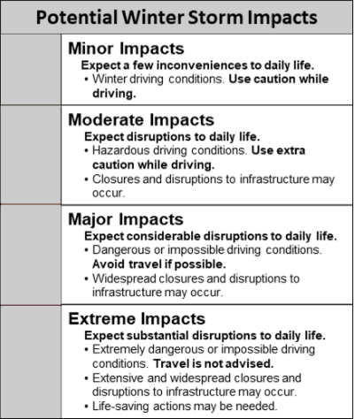
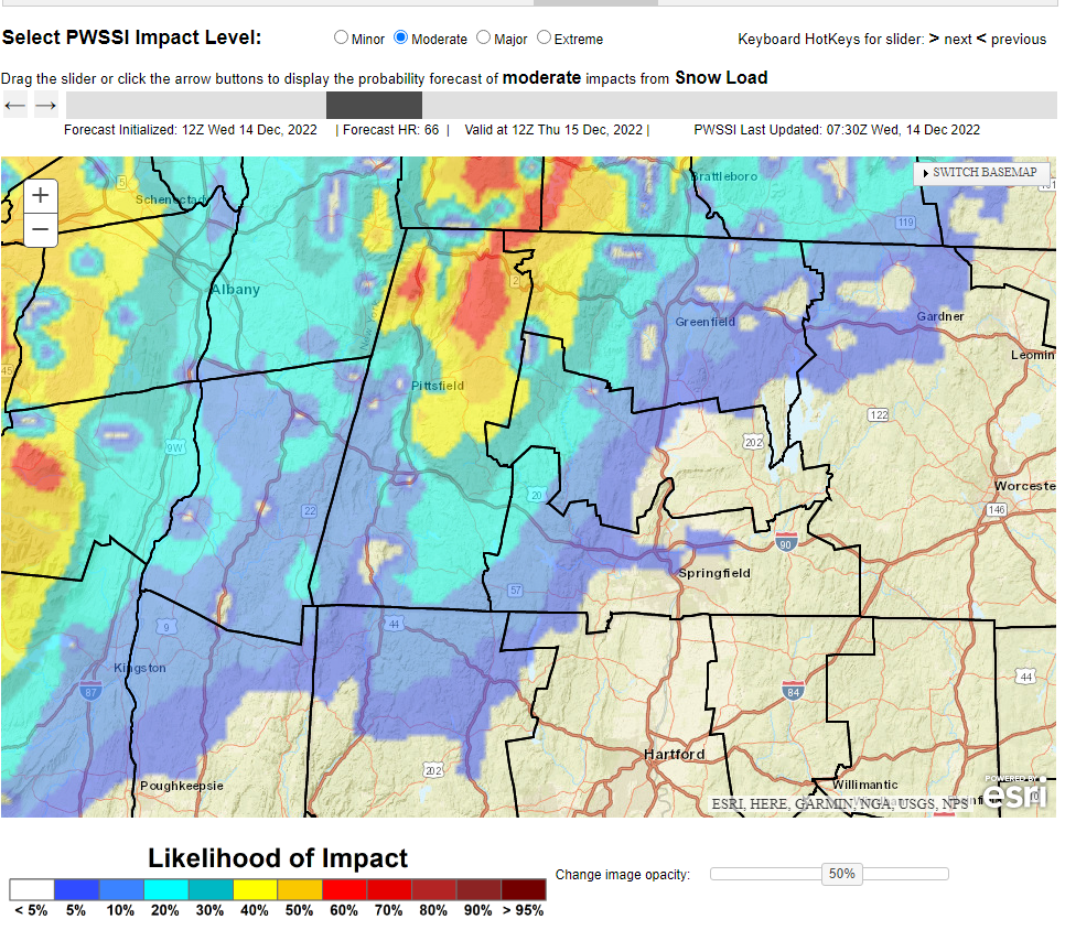
Good morning everyone, Attached is a one pager and graphic highlighting the potential for heavy wet snow across the high terrain of western MA & CT, beginning Thursday night and continuing into Friday, possibly lingering into Friday night. Frank Nocera & Bill Leatham If you have any questions or would like more information, don't hesitate to contact us via this email address, on NWSChat <https://nwschat.weather.gov/>, or at the following: National Weather Service Boston/Norton, MA 46 Commerce Way Norton, MA 02766 508.622.3280 Website <http://www.weather.gov/boston> | Facebook <http://www.facebook.com/NWSBoston> | Twitter <http://www.twitter.com/NWSBoston>