
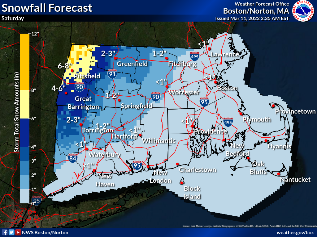
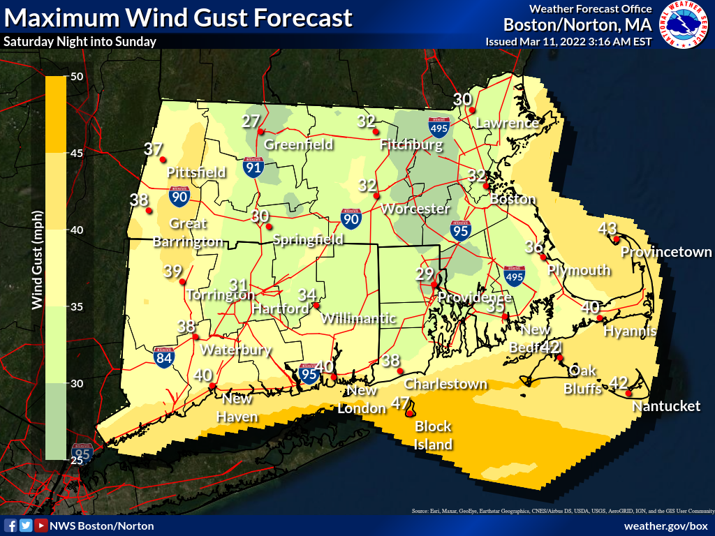
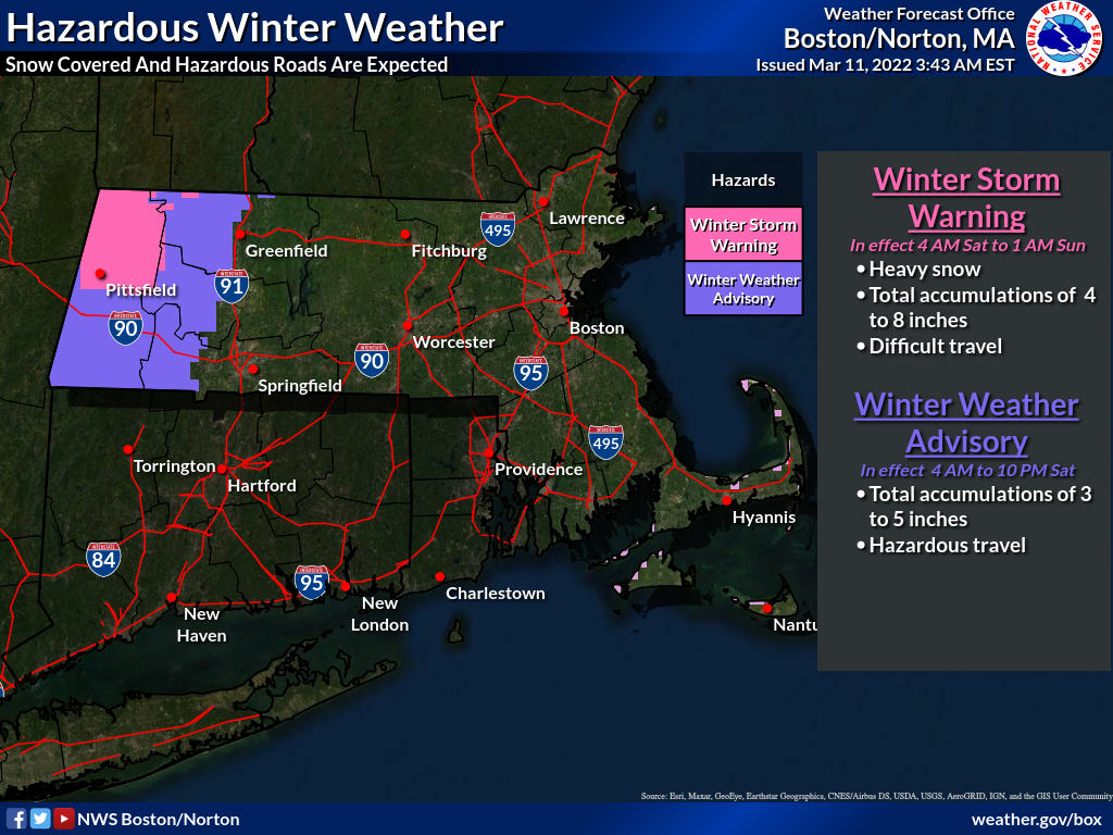
Good Morning Everyone, Attached is this morning's one-page briefing and graphics on wintry weather Saturday and the possibility of strong northwest winds Saturday night into Sunday. *What Has Changed:* - Winter Storm Warning for northern Berkshire County - Winter Weather Advisory for the east slopes of the Berkshires and southern Berkshire County *Key Points:* - Rain changes to snow from northwest to southeast Saturday, starting late in the morning near the Berkshires but not until later in the afternoon in Rhode Island and southeast Massachusetts. - Most of the accumulating snow will occur in western portions of Connecticut and Massachusetts, especially in the higher elevations. Initially, the snow may be heavy and wet when it changes over, but should transition to a lighter and fluffier snow Saturday afternoon. - Strong northwest winds are possible Saturday night into Sunday, especially near the coast and in the higher elevations, which could result in minor wind damage such as some downed branches/tree limbs and wires. Wind Advisories may be issued in later forecasts if confidence of gusts over 45 mph increases. If you have any questions or would like more information, don't hesitate to contact us via this email address, on NWSChat <https://nwschat.weather.gov/>, or at the following: National Weather Service Boston/Norton, MA 46 Commerce Way Norton, MA 02766 508.622.3280 Website <http://www.weather.gov/boston> | Facebook <http://www.facebook.com/NWSBoston> | Twitter <http://www.twitter.com/NWSBoston> Thanks, Joe DelliCarpini and Rob Megnia