
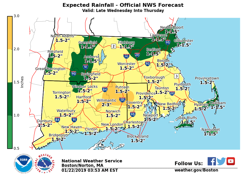
Good morning everyone, Temperatures will gradually warm through the day today, such that the wind chills will diminish and risk for freezing spray offshore diminishes as well. We continue to monitor the risk for heavy rain, which may bring about some urban and poor drainage, as well as a risk for river flooding late Wednesday into Thursday. There is also the risk for strong wind gusts especially across the Cape and Islands during the day on Thursday. *What / Where / When ...* - Heavy Rainfall and Possible Flooding - Greatest risk across eastern Connecticut, Rhode Island and southeast Massachusetts for late Wednesday night into Thursday - Rainfall of 1-2 inches across southern New England with locally up to 3 inches for RI and SE Massachusetts - Areas of urban and poor drainage flooding possible - Strong winds, with gusts to around 50 mph possible Thursday, especially on the Cape and Islands. We will continue to update you on this risk as we approach. If you have any questions or would like more information, don't hesitate to contact us via this email address, on NWSChat <https://nwschat.weather.gov/>, or at the following: National Weather Service Boston/Norton, MA 46 Commerce Way Norton, MA 02766 508.622.3280 Website <http://www.weather.gov/boston> | Facebook <http://www.facebook.com/NWSBoston> | Twitter <http://www.twitter.com/NWSBoston>