
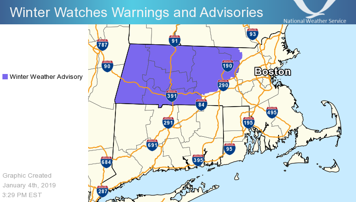
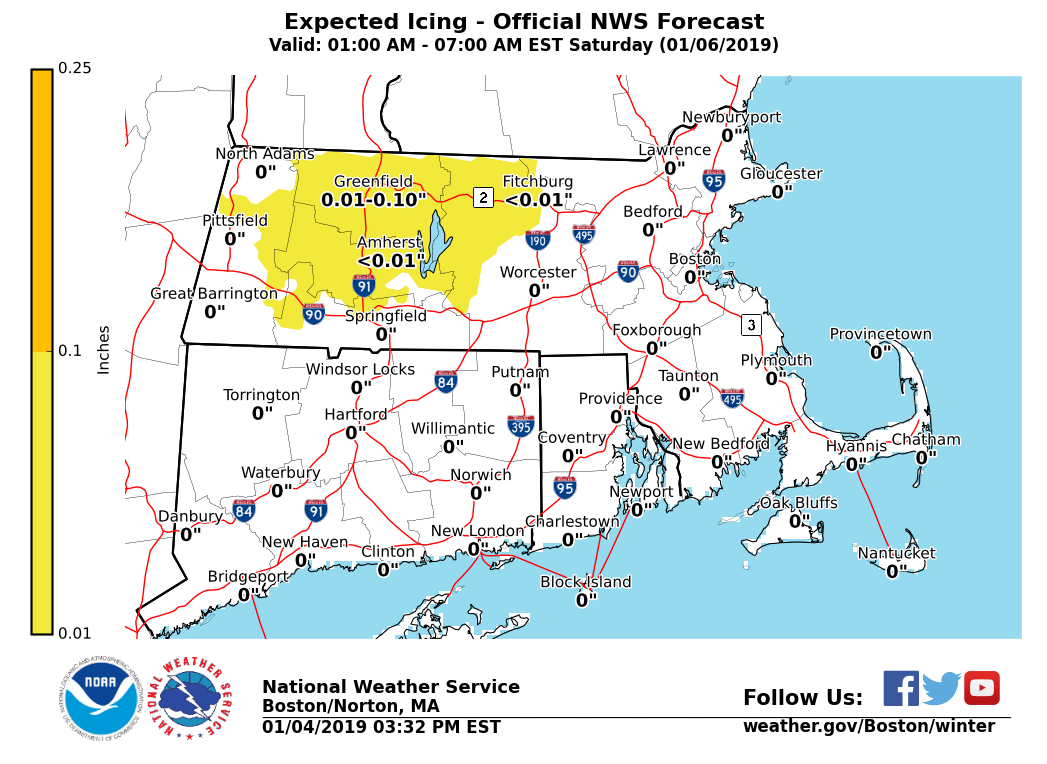
Good afternoon, We continue to forecast freezing rain late tonight into Saturday morning, which will make for hazardous travel conditions on untreated surfaces. Winter Weather Advisories have been issued for central and western Massachusetts. More details below. *What / Where / When ... * - Freezing rain will begin to overspread northern and western areas of Massachusetts and Connecticut, especially along the higher terrain of the Berkshires, Litchfield and Worcester Hills, beginning prior to daybreak Saturday. - Impacts to major travel routes ... along I-91 at and north of Springfield, MA and along the Massachusetts Route 2 corridor immediately west of Fitchburg, MA. - A gradual transition to rain S to N through the morning. Will see the last remnants of freezing rain along the Berkshires as late as 12 PM Saturday before any and all precipitation is plain rain. - A glaze of ice, up to a tenth of an inch, is possible on untreated surfaces. - Also, Saturday night into Sunday morning, especially north and west of the I-95 corridor, any remaining wet surfaces are expected to freeze. If left untreated, there is the threat of additional ice developing along area roadways. *Uncertainty ... * - Surface temperatures are critical with respect to freezing rain and ice accretion outcomes. Any measure of ice accretion will make surfaces slick. - However the greatest uncertainty is the exact timing of freezing rain to rain transition as outlined above. As alluded by the prior email, any small change can make a big difference in outcomes. Matthew and Nicole Belk If you have any questions or would like more information, don't hesitate to contact us via this email address, on NWSChat <https://nwschat.weather.gov/>, or at the following: National Weather Service Boston/Norton, MA 46 Commerce Way Norton, MA 02766 508.622.3280 Website <http://www.weather.gov/boston> | Facebook <http://www.facebook.com/NWSBoston> | Twitter <http://www.twitter.com/NWSBoston>