
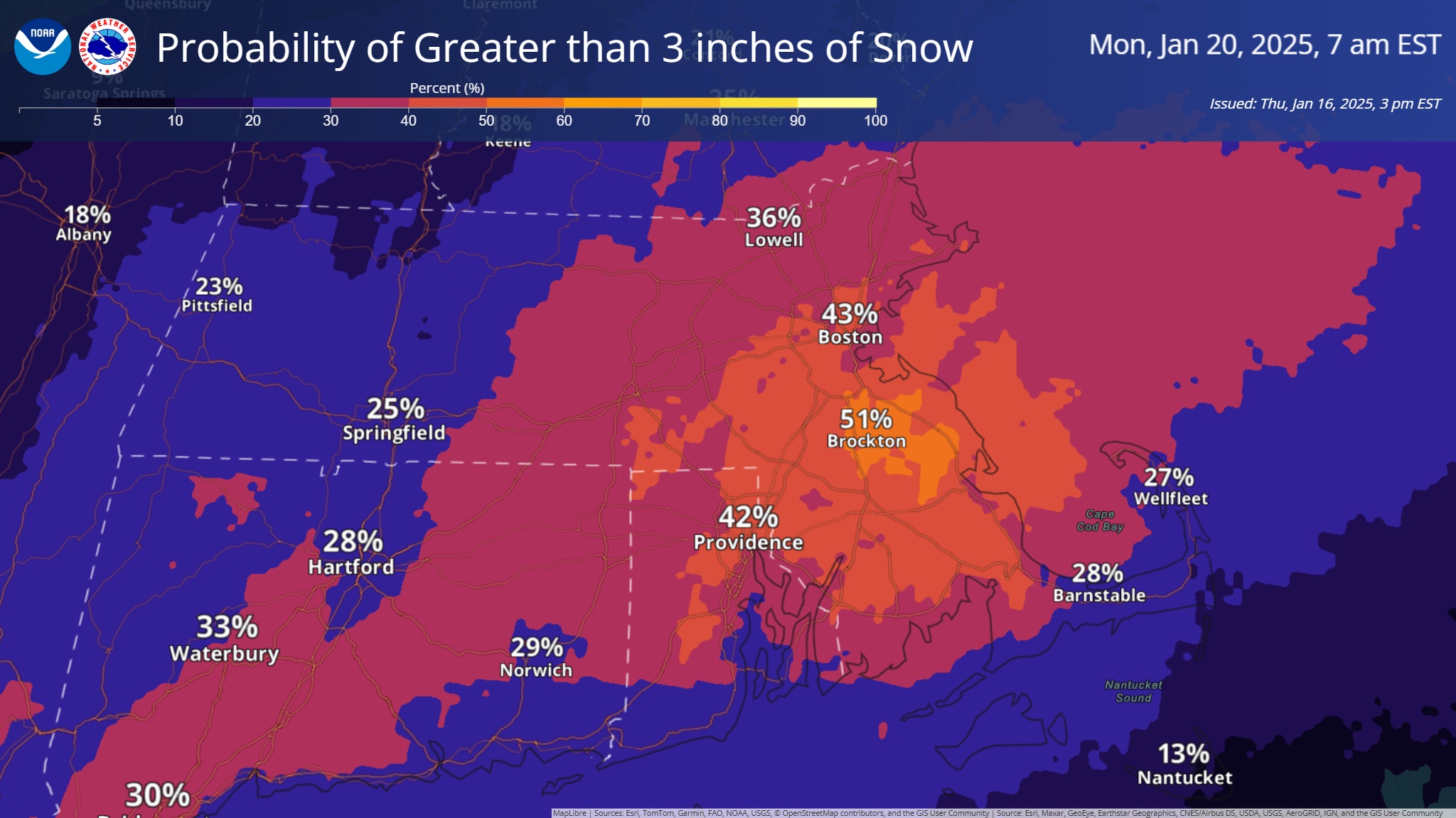
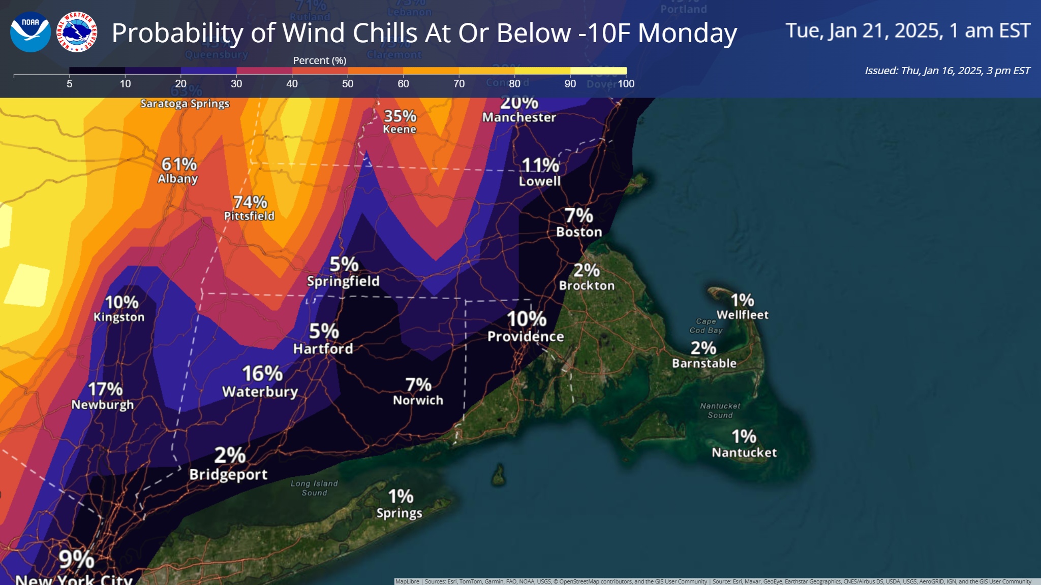
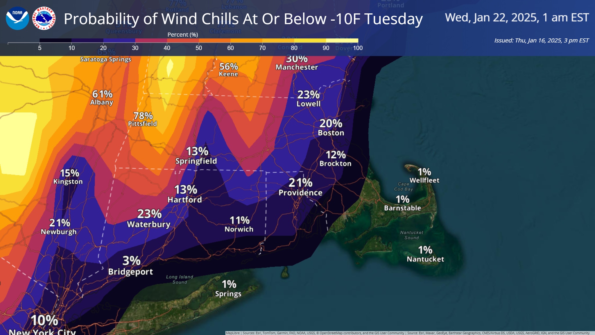
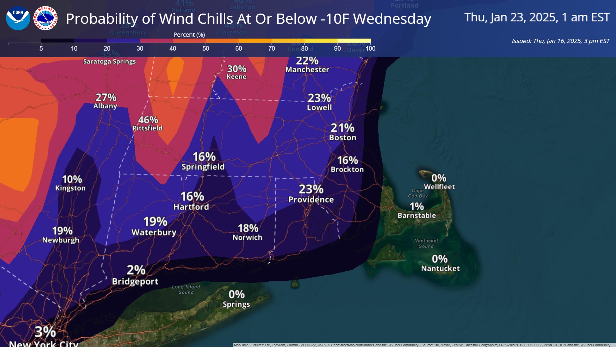
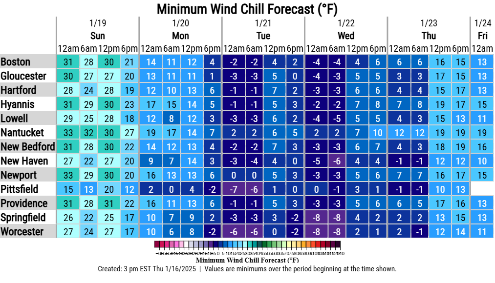
Good afternoon everyone, Here is your updated briefing on a few upcoming bouts of winter weather. While we are still several days away and confidence is on the lower side, there is increasing confidence that southern New England will experience a round of snowfall Sunday evening into Monday. Attached is the current probability of exceeding 3 inches of snow. This will be refined in the coming days. As for next week's arctic outbreak, bitter cold temperatures are still expected early to mid week. We have attached a timeline of expected minimum apparent temperatures as well as probabilities of experiencing apparent temperatures below -10F. Please let us know if you have any questions! Thanks, Bryce Williams and Matthew Belk If you have any questions or would like more information, please don't hesitate to contact us. You can reach us via: email: box.operations@noaa.gov phone: 508.622.3280 Slack/NWSChat 2.0 <https://nwschatws.slack.com/> (for approved partners) social media: Website <http://www.weather.gov/boston> | Facebook <http://www.facebook.com/NWSBoston> | Twitter <http://www.twitter.com/NWSBoston>