
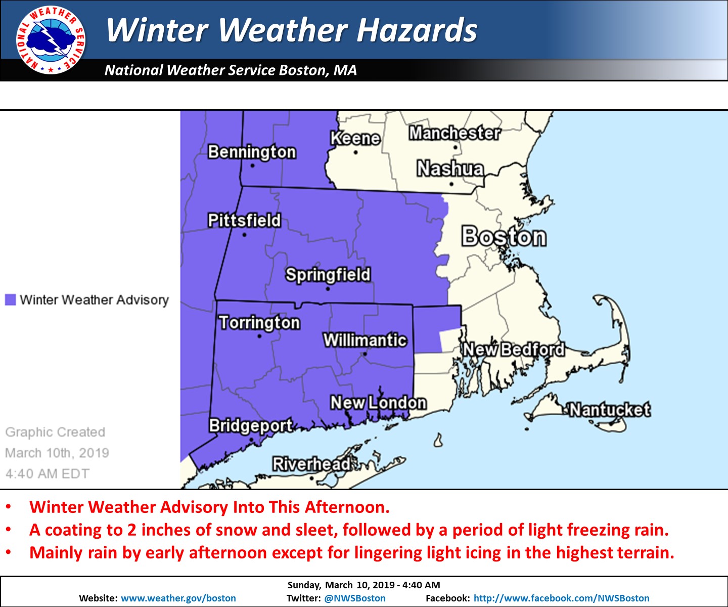
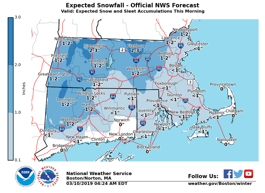
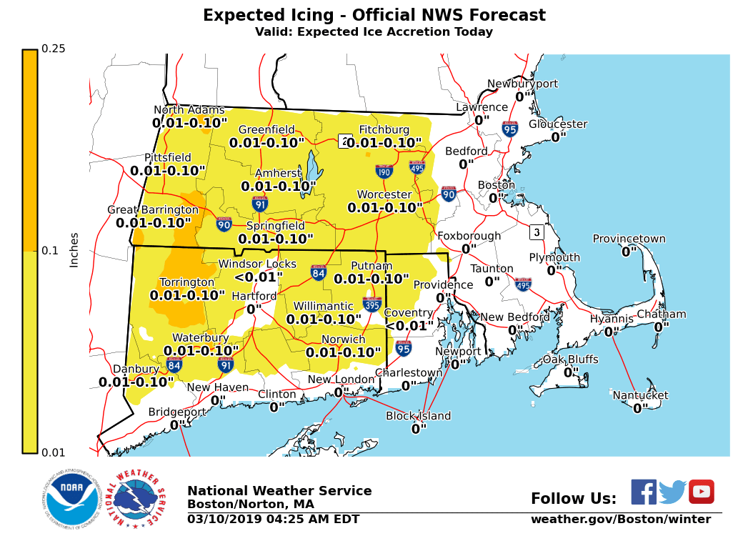
Good morning everyone A Winter Weather Advisory continues for western and central MA, as well as northern CT and into northwest RI through 2 pm today. The advisory has been extended until 5 pm for the northern Worcester Hills and East Slopes of the Berkshires. Attached to this email is our expected snow and sleet accumulations along with ice accretion forecast. *WHAT/WHERE/WHEN: * - A burst of snow and sleet overspread most of the region between 6 and 9 am. - Snow and sleet accumulations of a coating to 2 inches are anticipated with the higher amounts more likely across interior MA. There is a low risk for a few 3 inch amounts in northwest MA. - Snow and sleet will change to rain by afternoon in most locations, but a period of light freezing rain is anticipated before the transition across interior MA/CT and northwest RI. - Light freezing rain may persist through late afternoon along the high terrain of the east slopes of the Berkshires and northern Worcester Hills. - Ice accretion should be a trace to up to one tenth of an inch with the higher amounts expected in the northern Worcester Hills and the east slopes of the Berkshires. *IMPACTS:* - Snow and sleet will result in roads becoming slippery for a few hours this morning. - Most roadways will just be wet by early this afternoon, although some icy conditions may persist in the higher terrain of the Worcester Hills and east slopes of the Berkshires. Please let us know if you have any questions or concerns. Meteorologist: Hayden Frank If you have any questions or would like more information, don't hesitate to contact us via this email address, on NWSChat <https://nwschat.weather.gov/>, or at the following: National Weather Service Boston/Norton, MA 46 Commerce Way Norton, MA 02766 508.622.3280 Website <http://www.weather.gov/boston> | Facebook <http://www.facebook.com/NWSBoston> | Twitter <http://www.twitter.com/NWSBoston>