
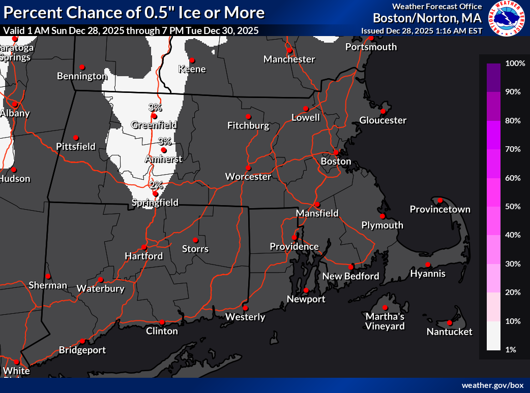
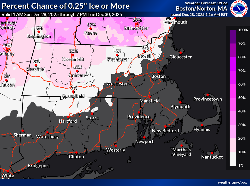
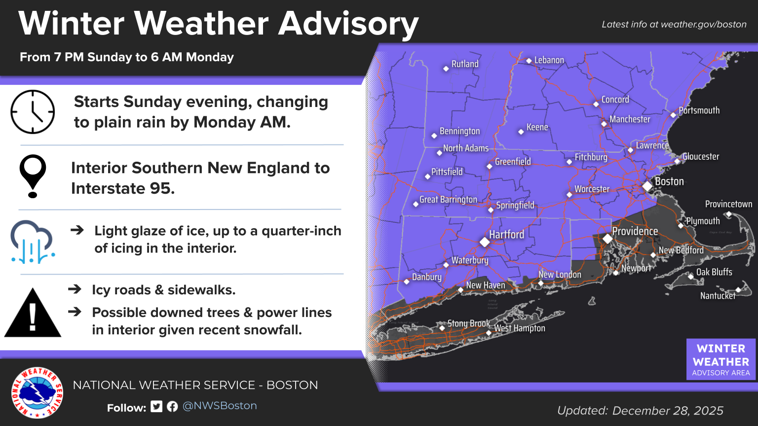
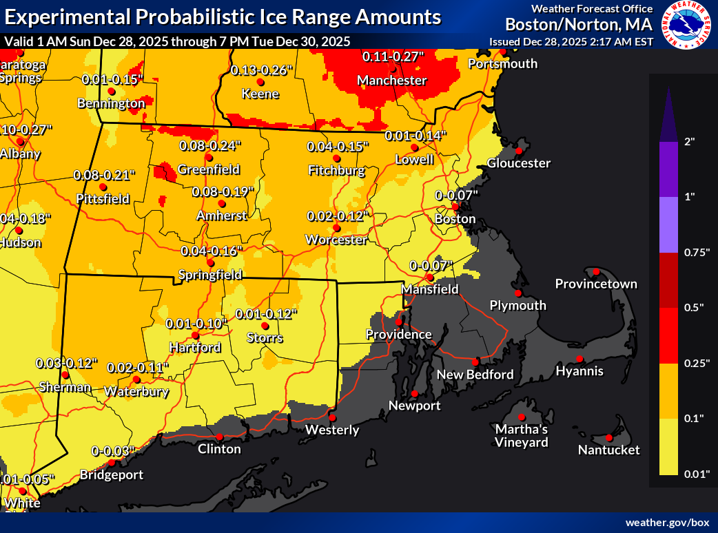
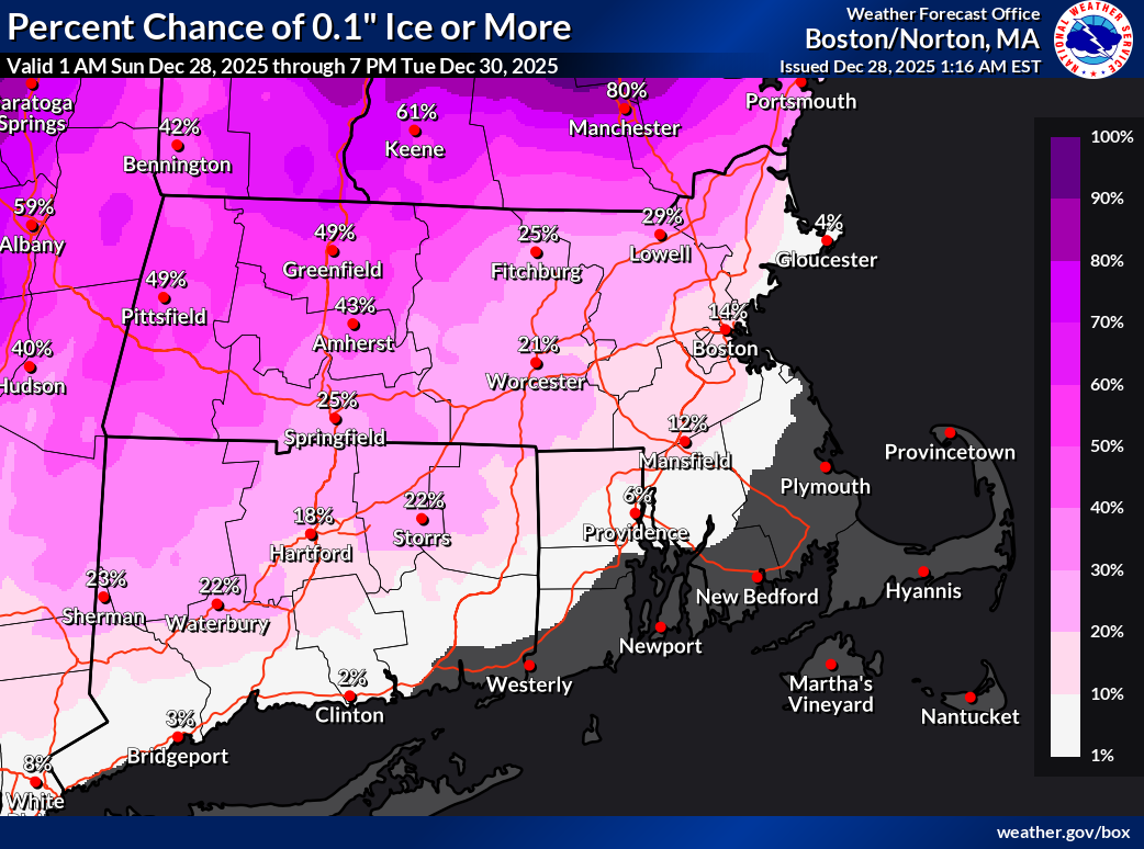
Good Morning. Confidence continues to grow in a period of freezing rain tonight, moving into southern New England between 7-10pm, and changing over to rain from south to north between midnight and 4am. Ice accretion will be highest in the northern CT river valley with up to a quarter inch of ice is possible. Elsewhere, we are generally expecting anywhere from a trace to a tenth of an inch of ice. A Winter Weather Advisory has been expanded to include the Northshore, Boston, and western Kent County RI. There is still uncertainty on if temperatures will be sub-freezing around the south shore tonight when precip arrives. Advisories could be expanded south this afternoon if confidence in freezing rain increases today. Icy roads and sidewalks will be the main hazard, with impacts to the Monday morning commute possible. However the potential for tree and powerline damage will also exist in portions of the CT River and Merrimack Valleys, where ice accretions look to be more significant and coinciding with where leftover snow from the recent snowstorm is still clinging to trees and powerlines. Following supporting attachments include: - One-page briefing sheet. - Winter Weather Advisory area. - Official NWS Storm Total Flat Ice Accretion Forecast***. - Exceedance Probabilities for 0.1", 0.25", and 0.5" or more of flat ice accretion*. * *Note*: NWS forecasts horizontal or flat ice accretions. If interested in radial icing (such as icing accretion occurring around powerline wires or tree branches), multiply the flat ice forecast values by 0.4. Expect the next briefing to be sent* by 6pm this afternoon. * Thank You! Meteorologist: Kyle Pederso If you have any questions or would like more information, please don't hesitate to contact us. You can reach us via: email: box.operations@noaa.gov phone: 508.622.3280 Slack/NWSChat 2.0 <https://nwschatws.slack.com/> (for approved partners) social media: Website <http://www.weather.gov/boston> | Facebook <http://www.facebook.com/NWSBoston> | Twitter <http://www.twitter.com/NWSBoston>