
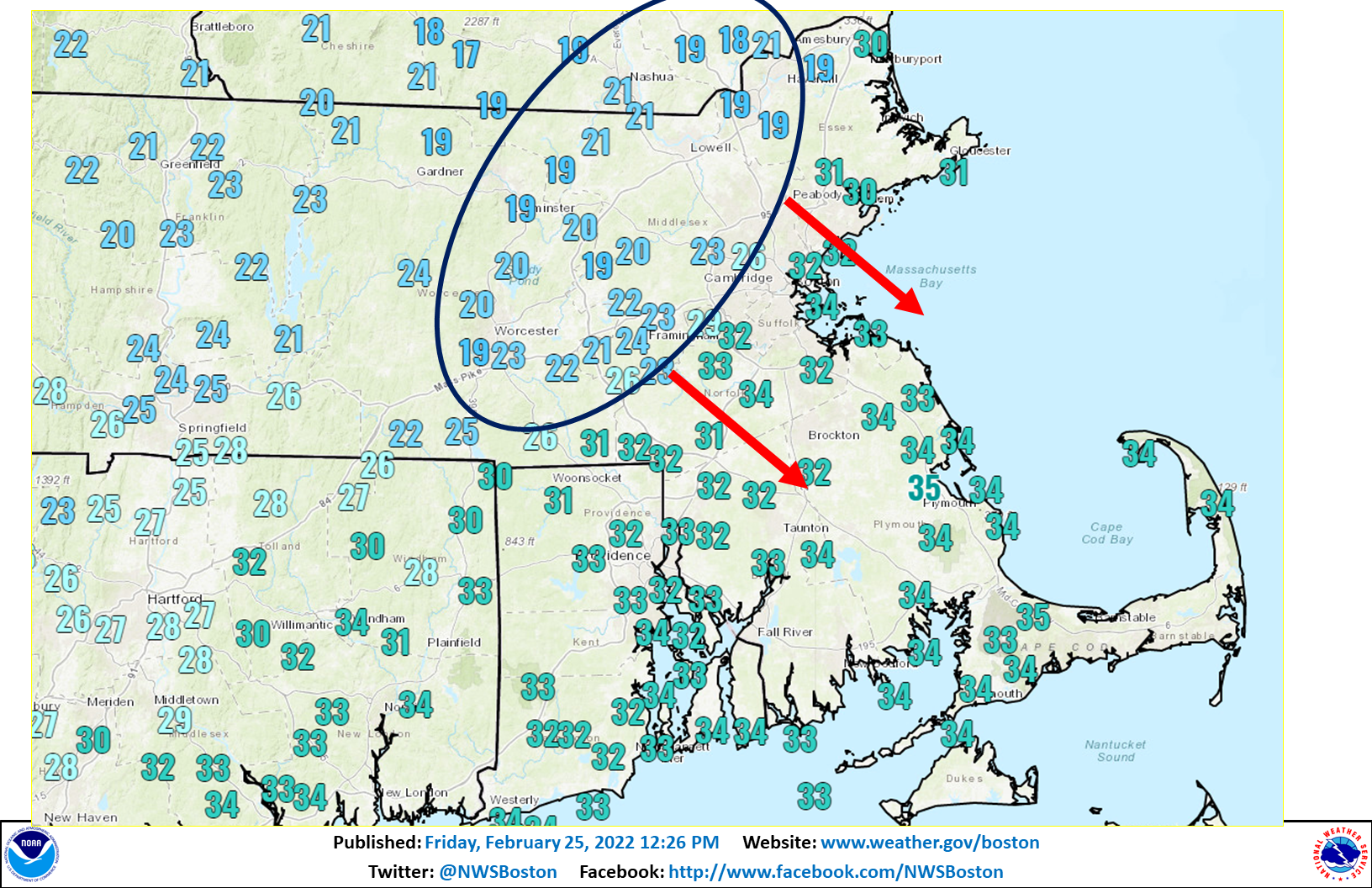
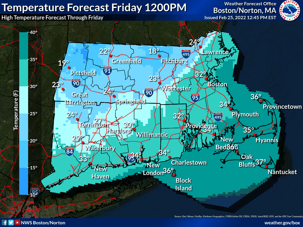
Good afternoon everyone, Just wanted to send out a quick update regarding the flash freeze potential across eastern MA and Rhode Island during the mid/late afternoon period. Current temps are in the upper teens and lower 20s across central and interior NE MA and this colder air will begin to move south across eastern MA and RI from north to south between 3 and 6 pm. Temps will quickly fall into and through the 20s resulting in a rapid freeze up and icy roads which will impact the evening commute. The colder air will be accompanied by a period of light snow with additional accumulation of a coating to 2 inches through this evening. We've attached a current temperature map and also a forecast temperature loop showing the timing of the colder air. Thanks. Kevin Cadima If you have any questions or would like more information, don't hesitate to contact us via this email address, on NWSChat <https://nwschat.weather.gov/>, or at the following: National Weather Service Boston/Norton, MA 46 Commerce Way Norton, MA 02766 508.622.3280 Website <http://www.weather.gov/boston> | Facebook <http://www.facebook.com/NWSBoston> | Twitter <http://www.twitter.com/NWSBoston>